contact
contact
ForYou Club
19 °C
Webcam
10 / 13 Open facilites
Current info

The Ramsauer Via Ferrata
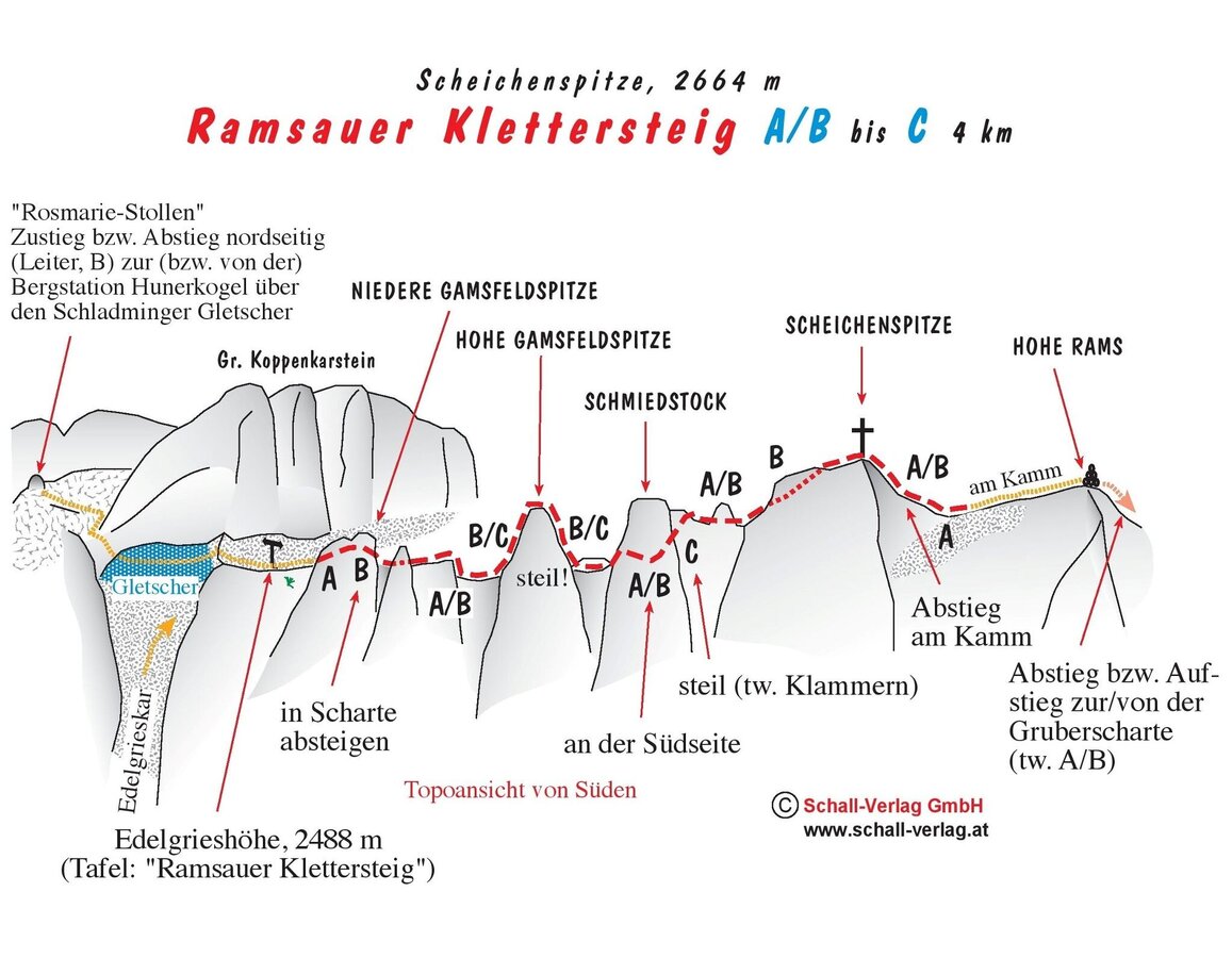
Mountain tour on the Ramsauer Klettersteig | © Hans-Peter Steiner
Preparation on the Ramsauer Klettersteig | © Hans-Peter Steiner
Hiking on the Ramsauer Klettersteig | © Hans-Peter Steiner
Ramsauer Klettersteig with mountain station | © Hans-Peter Steiner
Ascent on the Ramsauer Klettersteig | © Hans-Peter Steiner
Ramsauer Klettersteig | © Hans-Peter Steiner
Climbing on the Ramsauer Klettersteig | © Hans-Peter Steiner
Mountaineer on the Ramsauer Klettersteig | © Hans-Peter Steiner
Traversing the Ramsauer Klettersteig | © Hans-Peter Steiner
Mountain tour on the Ramsauer Klettersteig | © Hans-Peter Steiner
View from the Ramsauer Klettersteig | © Hans-Peter Steiner
Traversing the Ramsauer Klettersteig | © Hans-Peter Steiner
Mountain tour on the Ramsauer Klettersteig | © Hans-Peter Steiner
Hiking on the Ramsauer Klettersteig | © Hans-Peter Steiner
Ascent on the Ramsauer Klettersteig | © Hans-Peter Steiner

Tour description

For the approach from the Dachstein Mountain station, through the Rosmarie Stollen over the Edelgries Glacier, we recommend crampons in the morning (in hard snow conditions).

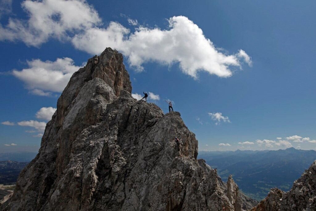
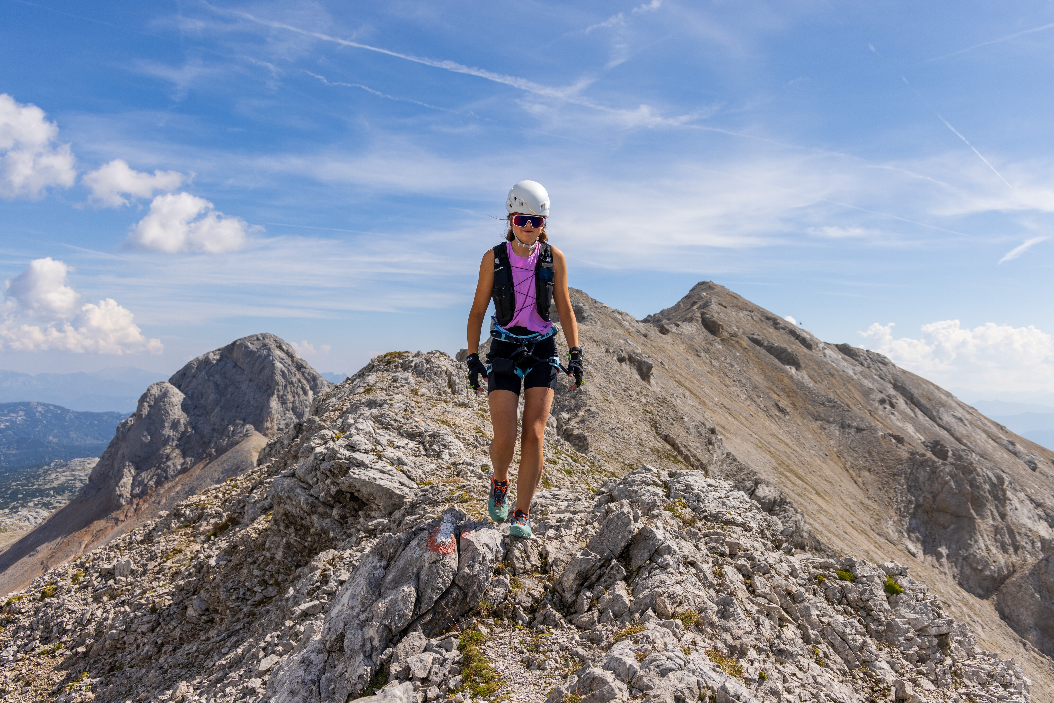
Usually, the route starts at the Edelgrießhöhe, but you can start at either end. This impressively scenic Via Ferrata crosses summits and rock towers to the Gruberscharte in a breathtaking experience.

Remark:

Due to the length, high alpine location and the sporty route, this climb is only recommended for fit and experienced via ferrata climbers.

Times:

  • Via Ferrata - 2:30 h
  • Time to Base - 1:30 h
  • Time from Top - 3:00 h
  • Total - 7:00 h

The tour

C
Tour characteristics
Exposition:
Distance: 1900 m Climbing time: 2 h 30 min
Information
Elevation at the starting point: 2687 m
Hiking time to the starting point: 1 h 30 min
Elevation at the entrance: 2570 m
Elevation gain on the via ferrata: 350 m
Elevation at the exit: 2500 m
Walking time (descent): 3 h
highest point: 2687 m
Best season
Jan
Feb
Mar
Apr
May
Jun
Jul
Aug
Sep
Oct
Nov
Dec

Map, elevation profile & further information

From the Dachstein Glacier Cable Car mountain station, follow the marked trail, ascend a ladder to the entrance of the Rosmarie Tunnel, and then continue through to the south side. From there, cross the upper section of the Edelgrieß cirque to the Edelgrießhöhe. Continue on the marked trail to the start of the safety barriers near the Gamsfeldspitze.
Over the Hohe Rams to the Gruberscharte ridge and from there towards the Guttenberghaus. From Styria's highest mountain hut, descend to the Feisterer trailhead (parking lot) or walk another 15 minutes to the Rössinger Landesstraße junction and the Stierer bus stop.

Arriving from the west: From the west you can take the Munich-Salzburg motorway, continuing on the Tauern motorway (A 10) until the Ennstal junction. From here take the Ennstal A-road (the B 320) for around 30 km into the Schladming-Dachstein region, then take the Ramsau am Dachstein turn-off. 

Arriving from the north: From the south-east take the Pyhrnautobahn motorway (A 9) to the Liezen junction and then the Ennstal A-road (B 320) into the Schladming-Dachstein region. Then take the Ramsau am Dachstein turn-off.

Parking lot at Gasthof Edelbrunn or at the bottom station of the Dachstein cable car (Tollroad)

Take bus line 960 from Schladming Rathausplatz (city center) or train station to Ramsau am Dachstein and get off at the final stop at the Dachstein Glacier Cable Car.

Schedule of the Ramsauer Verkehrsbetriebe

Bus schedules

Wheather predicition

Tours nearby