contact
contact
ForYou Club
13 °C
Webcam
9 / 13 Open facilites
Current info
Ramsau am Dachstein

Dachstein Westridge (Westgrat)
Tour description

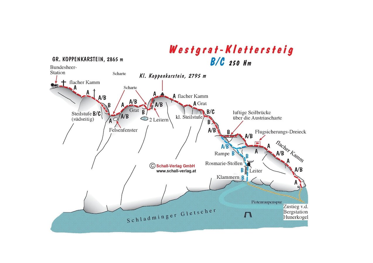
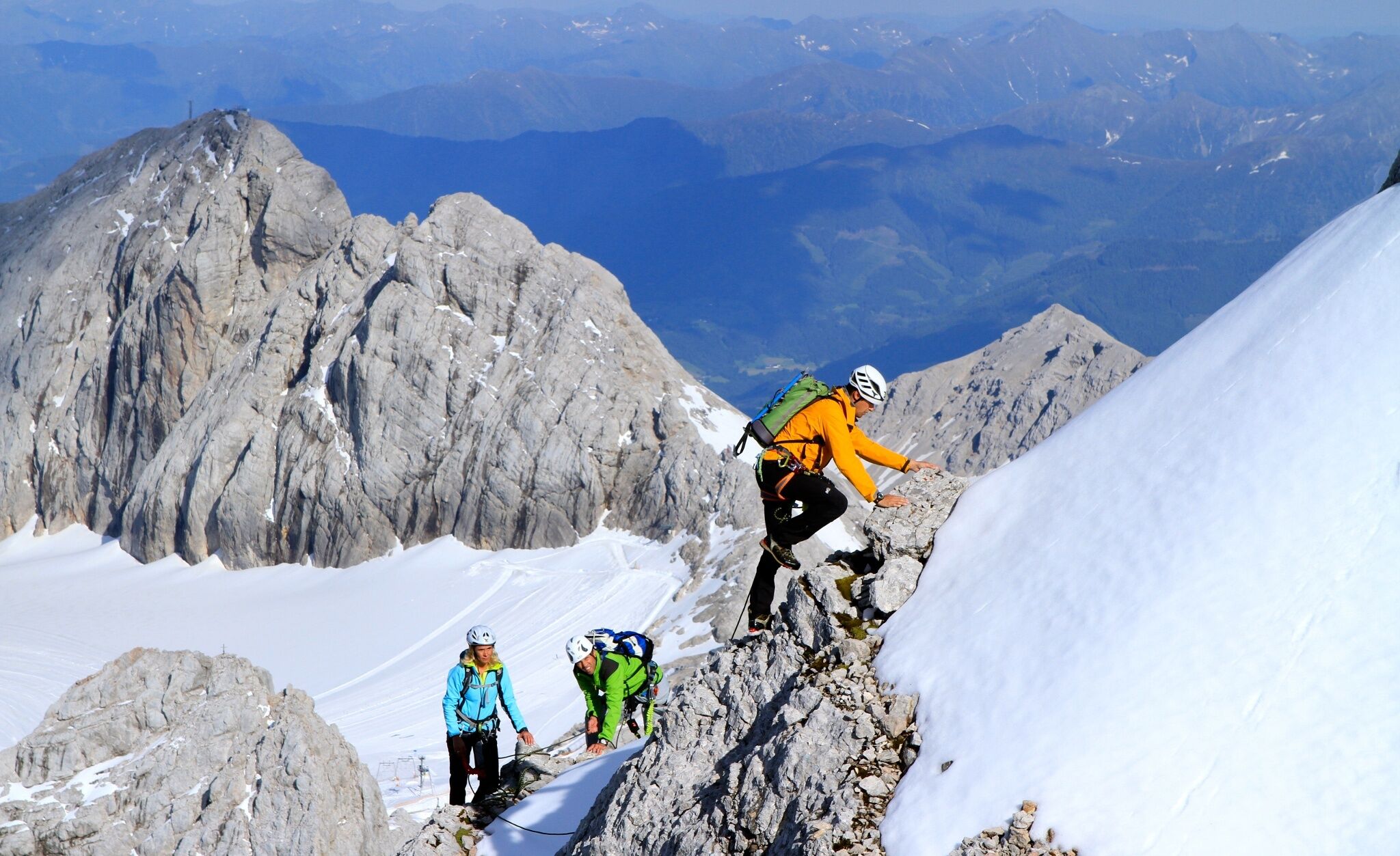
The Dachstein Westgrat Klettersteig up the Hoher Dachstein is often attemptedin combination with a crossing of the summit and descent via the Randkluftsteig or Schulter Klettersteig. A moderately difficult via ferrata in high-alpine terrain surrounded by extraordinarily beautiful landscapes, with access and descent across the glacier.

Comments:

Vital when crossing the glacier - dangerous crevasses - crampons and ropes are essential.

Times:

  • Via Ferrata - 1:00 h
  • Time to Base - 2:00 h
  • Time from Top - 2:15 h
  • Total - 5:15 h

The tour

B
Tour characteristics
Exposition:
Via ferrata length: 550 m Climbing time: 2 h
Information
Elevation at the starting point: 2687 m
Hiking time to the starting point: 2 h
Elevation at the entrance: 2775 m
Elevation gain on the via ferrata: 210 m
Elevation at the exit: 2985 m
Walking time (descent): 1 h 30 min
highest point: 2995 m
Best season
Jan
Feb
Mar
Apr
May
Jun
Jul
Aug
Sep
Oct
Nov
Dec

Map, elevation profile & further information

From the Dachstein Glacier Cable Car mountain station, the groomed trail leads toward the Seethaler Hut. At the bend toward the Seethaler Hut, continue straight ahead to the Steinerscharte (partially secured with steel cable up to grade B) and from there descend again on the west side to the Gosau Glacier. Crampons and a rope safety device are required here! From there, ascend southward to the Obere Windluke (upper wind hatch), and before that, turn left to reach the foot of the west ridge, where the safety device begins.
The shortest descent leads down the Randkluftsteig (edge ​​gap) to the foot of the ridge. This is possible as long as the crevasse situation allows. From around the beginning of August, the descent must be made via a shoulder via ferrata. From the end of the via ferrata, cross the glacier to the groomed trail, then follow the groomed trail to the Hunerkogel mountain station.

Arriving from the west: From the west you can take the Munich-Salzburg motorway, continuing on the Tauern motorway (A 10) until the Ennstal junction. From here take the Ennstal A-road (the B 320) for around 30 km into the Schladming-Dachstein region, then take the Ramsau am Dachstein turn-off. Drive through the Ramsau Village and then turn left to Dachstein toll road. Continue up to the parking lot at Dachstein glacier cable-car.

Arriving from the north: From the south-east take the Pyhrnautobahn motorway (A 9) to the Liezen junction and then the Ennstal A-road (B 320) into the Schladming-Dachstein region. Then take the Ramsau am Dachstein turn-off. Drive through the Ramsau Village and then turn left to Dachstein toll road. Continue up to the parking lot at Dachstein glacier cable-car.

Parking lot at the bottom station of the Dachstein glacier cable car

From Schladming Rathausplatz (town center) or the train station, take the Ramsau public transport bus line 960 to the final stop at the valley station of the Dachstein Glacier Cable Car.

Schedule of the Ramsau transportaition (Ramsauer Verkehrsbetriebe)

Trip Planner  Bus Stop: Türlwandhütte

Wheather predicition

today
01.06.2026
Mountain 1 °C
Valley 15 °C
Precipitation
Probability
85 %
Amount
3.7 l/m²
Wind speed
Nordwest
45 km / h
Sun
Sun hours
4.8 h
Sunrise
05:13 o clock
Sunset
20:54 o clock

Repeated snow showers and some sunshine in between.

tomorrow
02.06.2026
Mountain 3 °C
Valley 22 °C
Precipitation
Probability
85 %
Amount
21.7 l/m²
Wind speed
West
20 km / h
Sun
Sun hours
7.1 h
Sunrise
05:12 o clock
Sunset
20:55 o clock

Quite sunny with scattered clouds during the day, but a chance of thunderstorms towards evening.

day after tomorrow
03.06.2026
Mountain -1 °C
Valley 12 °C
Precipitation
Probability
85 %
Amount
5.1 l/m²
Wind speed
Nordwest
40 km / h
Sun
Sun hours
0.3 h
Sunrise
05:12 o clock
Sunset
20:56 o clock

Constant snowfall through the day. Slow-down towards evening.

Tours nearby