Preintalerhütte - Putzentalalm via Kaiserscharte | Schladminger Tauern Trail Alternative
easy Mountain Hike
This route gives you time to linger at the beautiful mountain lakes around the Klafferkessel. The hike in the morning through the Lämmerkar cirques is spectacular, and the clear Kapuzinersee is beautiful. In the Lungauer Klaffer, the Angersee and Zwerfenbergsee with the spectacular surrounding mountain panorama invite you to take a long break. On the Kaiserscharte you then enter the Sölktäler Nature Park.
For mountain enthusiasts, the Waldhorntörl offers the opportunity to climb the Waldhorn. This means an additional 420 meters in altitude, 3 hours of walking time and, above all, the requirement of good fitness, sure-footedness and a head for heights.
Gallery
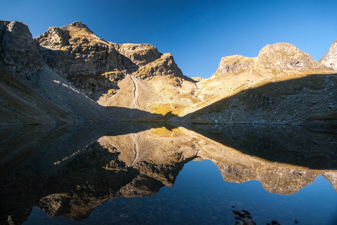
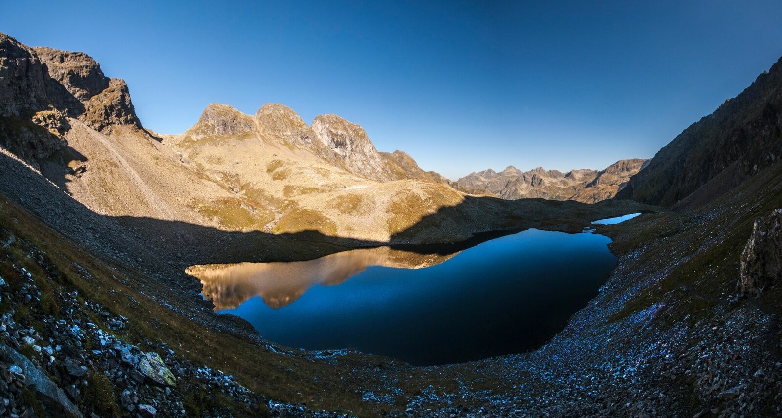


From the Preintalerhütte and Waldhornalm you first follow path #777/#702 (Schladminger Tauern Höhenweg and long-distance hiking trail 02) towards Klafferkessel into the outer Lämmerkar cirque. Here you turn left and continue to follow path #777 uphill through the Innere Lämmerkar. You climb over stony ground and partly loose boulders over a steep step to Lake Kapuzinersee - an impressive summit scenery all around you.
Past the Kapuzinersee you climb south of it to the Waldhorntörl, which enables the transition to Lungau. Directly on the gap, the path branches off to the left to the summit of the Waldhorn (2,702 m). Mountain enthusiasts with good stamina and sure-footedness can integrate the summit into the tour: At the beginning there are easy climbing passages (UIAA I) to the west ridge of the Waldhorn, where the path now winds up to the highest point. The view on the climb and from the summit is magnificent.
From Waldhorntörl you now descend towards Lungauer Klafferseen. First you reach the Angersee and shortly afterwards the Zwerfenbergsee. On its southern bank, path #793 branches off towards Kleinsölktal. Now it goes uphill again, but without any major difficulties. You will soon reach the Kaiserscharte, which at 2,298 m above sea level is the highest point on the tour.
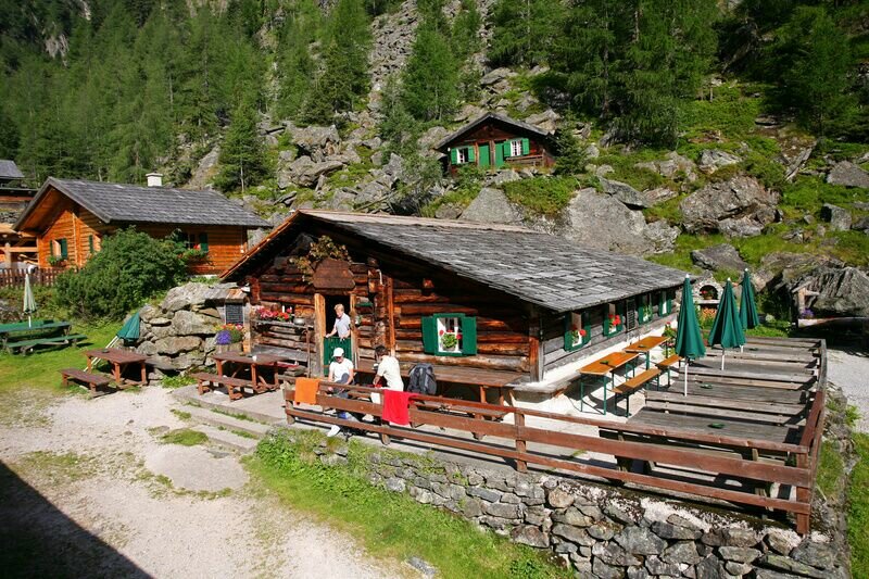
From now on it's all downhill along a well-maintained hiking trail. Past a small hunting lodge and through extensive mountain pine fields you descend into the Kaisergraben until you finally reach the Putzentalalm.
From Schladming take provincial highway L722 (Rohrmoosstraße road) to Rohrmoos and at the roundabout continue on provincial highway L723 (Tälerstraße road) to Untertal village. At the end of the village keep left on "Untertalstraße" road and follow it to the valley head of Untertal valley at Seeleiten car park.
The starting point at the Preintalerhütte can only be reached by hiking. You can reach the Preintalerhütte in a hike of approx. 2 hours from the Seeleiten car park in Untertal. This can be reached with the valley bus number 974 of the Planai buses: www.planaibus.at
Seeleiten car park at the valley head of Untertal.
There is a parking fee on the public parking spaces in Untertal valley.
Changes in weather patterns, quick falls in temperature, thunderstorms, wind, fog and snow are some of the dangers that can be encountered on a hiking tour. Hosts of alpine huts and mountain refuges have a lot of experience in the mountains and can give good advice about weather and the trails. Poor equipment, overestimation of one's own capabilities, carelessness, poor personal constitution and/or wrong judgement can lead to critical situations. In case of thunderstorms: avoid summits, ridges and steel ropes.
- Plan your tour in advance, taking into account walking time, route length, altitude difference, danger spots and weather forecast.
- Together is much more beautiful and at the same time safer in the mountains. Do not go alone, if possible, and adapt the tour to the ability of your group.
- Let them know where you are going and when you want to be back. Also sign hut or summit books.
GPS data and orienteering
Available GPS data - just like hiking maps - is only a guidance for orientation and can never depict a trail exactly with all its details. Especially at dangerous spots it is essential to judge on site how to proceed.
In an emergency please call:
- 140 - for Alpine emergencies (all over Austria)
- 112 - European GSM emergency number
A well-packed backpack is helpful and especially when touring Alpine terrain a tuque, gloves, a windproof jacket and pants are standard equipment. Good, waterproof shoes, sun glasses, sun cream and sufficient beverages are essential too. Torch light, a map of the area, knie and a small first-aid kit should also be in the backpack.
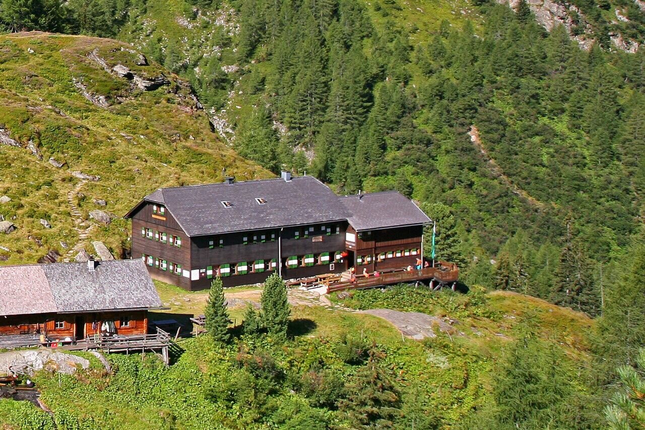
Depending on where you stay overnight - Breitlahnhütte or Putzentalalm - there are alternative transition options from the Preintalerhütte to Kleinsölktal.
Hiking map 1:50,000 Schladming-Dachstein, available from the Schladming-Dachstein Tourism Association and its information offices.


