
Preintalerhütte - Schwarzensee | Schladminger Tauern Trail: Stage 05

Tour description
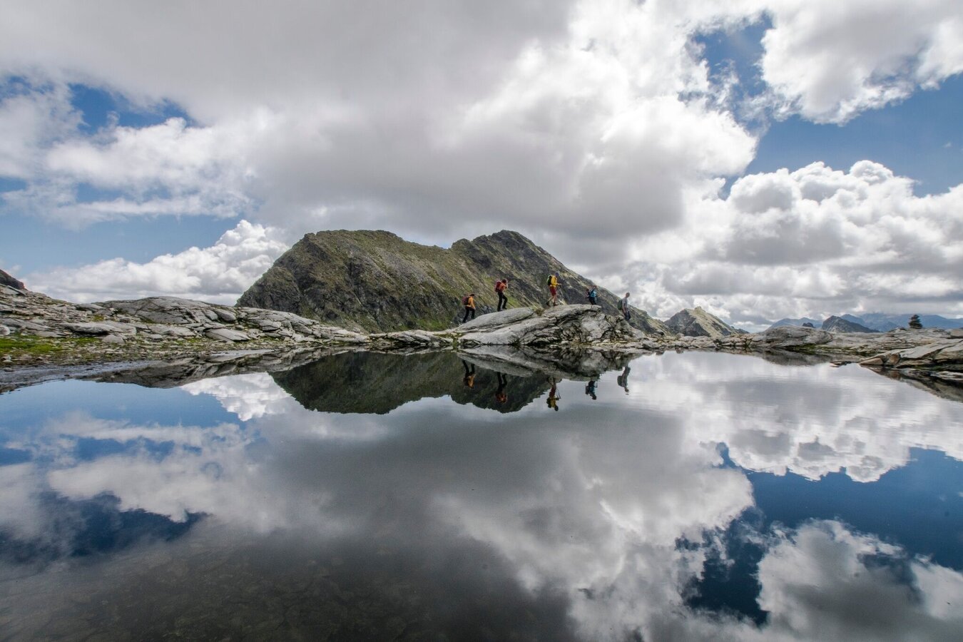
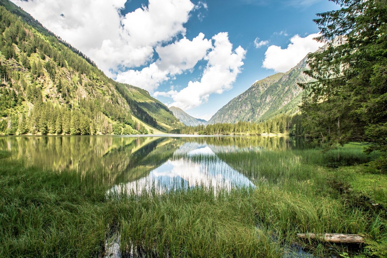
This tour is the start of the "2nd half" on the Schladminger Tauern Höhenweg, in case you have chosen the longer 7-day version. On this day tour you hike into high alpine terrain. With the Trattensee, the Goldlacken and the Schwarzensee there are also some beautiful water experiences along this route. Those who are fit, have a head for heights and have experience in alpine terrain can also plan a “side trip” to the Hochwildstelle at 2 747 m.
The tour
Map, elevation profile & further information
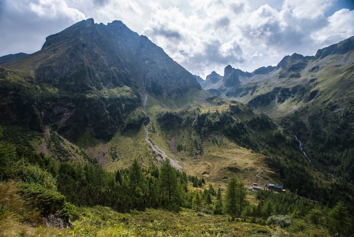
Shortly after the Preintalerhütte and Waldhornalm you cross the Sonntagskarbach and climb the Höfertsteig at a medium incline. After a short while you reach a trail fork, where you turn right onto path #702. The path winds in short serpentines towards Trattenkar cirque, where you then hike along the eastern flank of the Schneider and below the "Himmelreich" past the Trattensee lake. Soon you will reach the highest point of this tour at the Wildlochscharte (2,486 m). To the north, a high alpine path leads to the Hochwildstelle - the highest mountain within Styria at an altitude of 2 747 m. Mountain enthusiasts who are free from giddiness, sure-footed and experienced in alpine climbing can take a "side trip" to the summit. It will take you about 1.5 hours there and back.
At the Wildlochscharte crossroads you continue east to the Trattenscharte at 2,408 m. You reach it after just a few minutes. A little further downhill you reach the small lakes of the “Goldlacken”. At the crossroads there, you continue hiking to the southeast on the right - along the flanks of the Schareck and above the Stummer Almen - until you reach "Karlkirchen", a small dome of the rock. It's all downhill from here on out. First to the Lassachalm and from there either along the hiking trail or following the forest road through a high forest until you reach the Breitlahnhütte.
Depending on your tour planning, you have the following options:
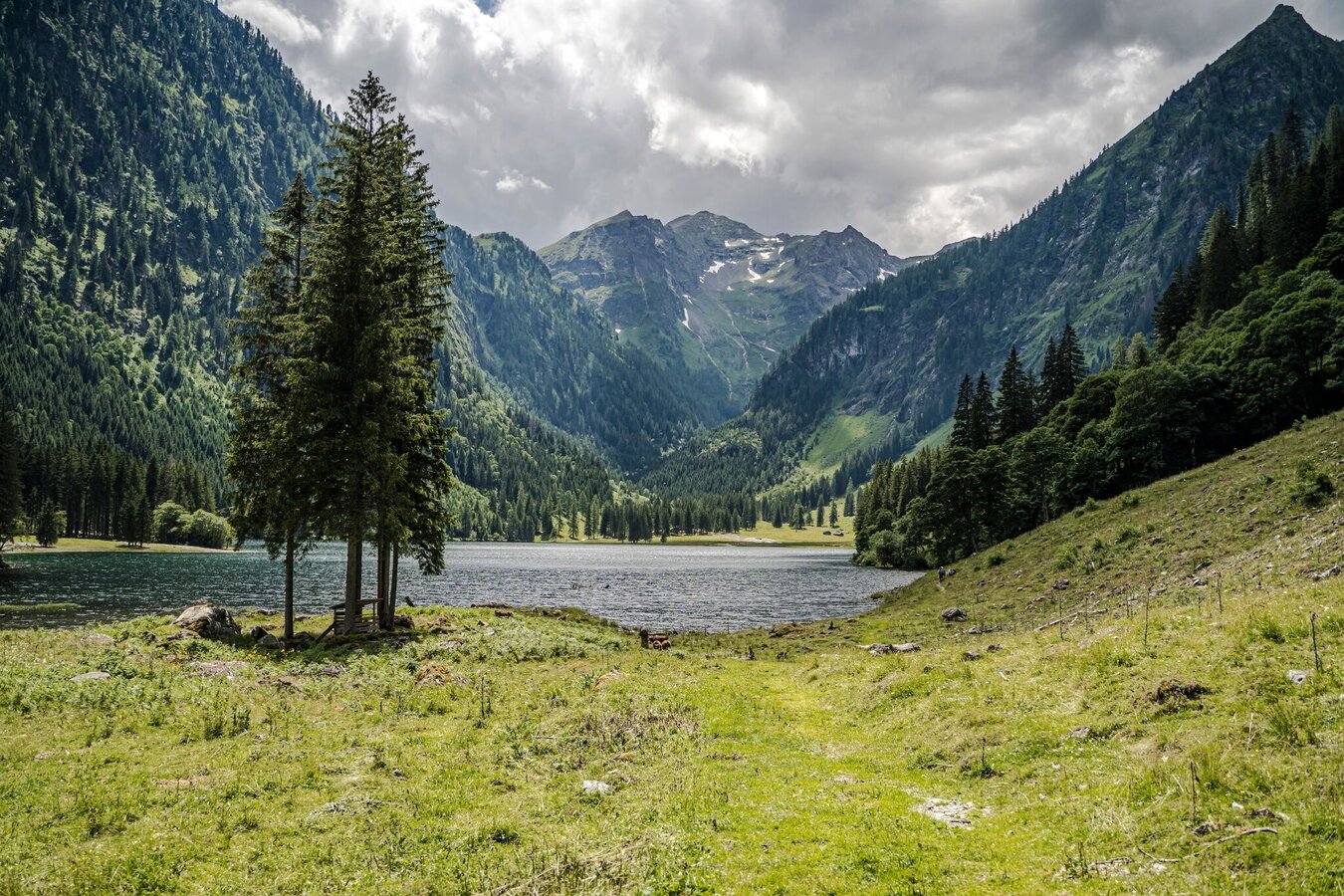
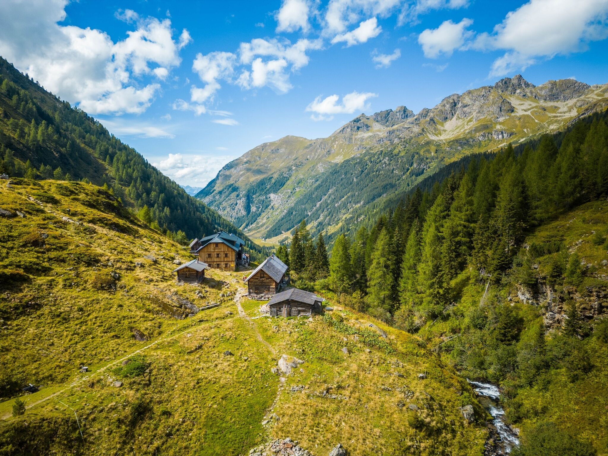
- Overnight stay at the Breitlahnhütte and afternoon trip to Schwarzensee (approx. 1.5 hours there and back)
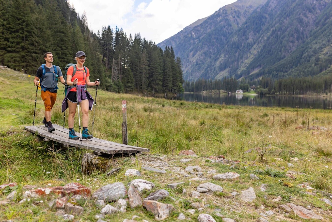
- Continue the hike past the Schwarzensee to the Putzentalalm and spend the night there - see further description below
- Trip with the Sölker Tälerbus to Gröbming (please note the timetable validity!)
If you stay overnight at the Putzentalalm, follow path #786 into the valley to the Schwarzensee. You continue past the largest - and one of the most beautiful - mountain lakes in the Schladminger Tauern to the Putzentalalm. If you stay overnight there, you can also choose alternative routes for the stage from the Preintalerhütte to the Putzentalalm:
- the path #784 via the Sonntagskarseen and the Rettingscharte to the Schwarzensee and the Putzentalalm
- the path #777 to the Lämmerkar and to the Waldhorntörl and from Angersee via path #793 over the Kaiserscharte to the Putzentalalm.
From Schladming take provincial highway L722 (Rohrmoosstraße road) to Rohrmoos and at the roundabout continue on provincial highway L723 (Tälerstraße road) to Untertal village. At the end of the village keep left on "Untertalstraße" road and follow it to the valley head of Untertal valley at Seeleiten car park.
Seeleiten car park at the valley head of Untertal.
There is a parking fee on the public parking spaces in Untertal valley.
The starting point at the Preintalerhütte can only be reached by hiking. You can reach the Preintalerhütte in a hike of approx. 2 hours from the Seeleiten car park in Untertal. This can be reached with the valley bus number 974 of the Planai buses: www.planaibus.at
Changes in weather patterns, quick falls in temperature, thunderstorms, wind, fog and snow are some of the dangers that can be encountered on a hiking tour. Hosts of alpine huts and mountain refuges have a lot of experience in the mountains and can give good advice about weather and the trails. Poor equipment, overestimation of one's own capabilities, carelessness, poor personal constitution and/or wrong judgement can lead to critical situations. In case of thunderstorms: avoid summits, ridges and steel ropes.
- Plan your tour in advance, taking into account walking time, route length, altitude difference, danger spots and weather forecast.
- Together is much more beautiful and at the same time safer in the mountains. Do not go alone, if possible, and adapt the tour to the ability of your group.
- Let them know where you are going and when you want to be back. Also sign hut or summit books.
GPS data and orienteering
Available GPS data - just like hiking maps - is only a guidance for orientation and can never depict a trail exactly with all its details. Especially at dangerous spots it is essential to judge on site how to proceed.
In an emergency please call:
- 140 - for Alpine emergencies (all over Austria)
- 112 - European GSM emergency number
A well-packed backpack is helpful and especially when touring Alpine terrain a tuque, gloves, a windproof jacket and pants are standard equipment. Good, waterproof shoes, sun glasses, sun cream and sufficient beverages are essential too. Torch light, a map of the area, knie and a small first-aid kit should also be in the backpack.
Depending on where you stay overnight - Breitlahnhütte or Putzentalalm - there are alternative transition options from the Preintalerhütte to Kleinsölktal.
Sölker Tälerbus: https://www.soelktaeler.com/taelerbus
Hiking map 1:50,000 Schladming-Dachstein, available from the Schladming-Dachstein Tourism Association and its information offices.


