


Gröbminger Land
Niederöblarn Pond Loop
Hiking
Data:

copyright: Christoph Lukas

copyright: Christoph Lukas
Tour description
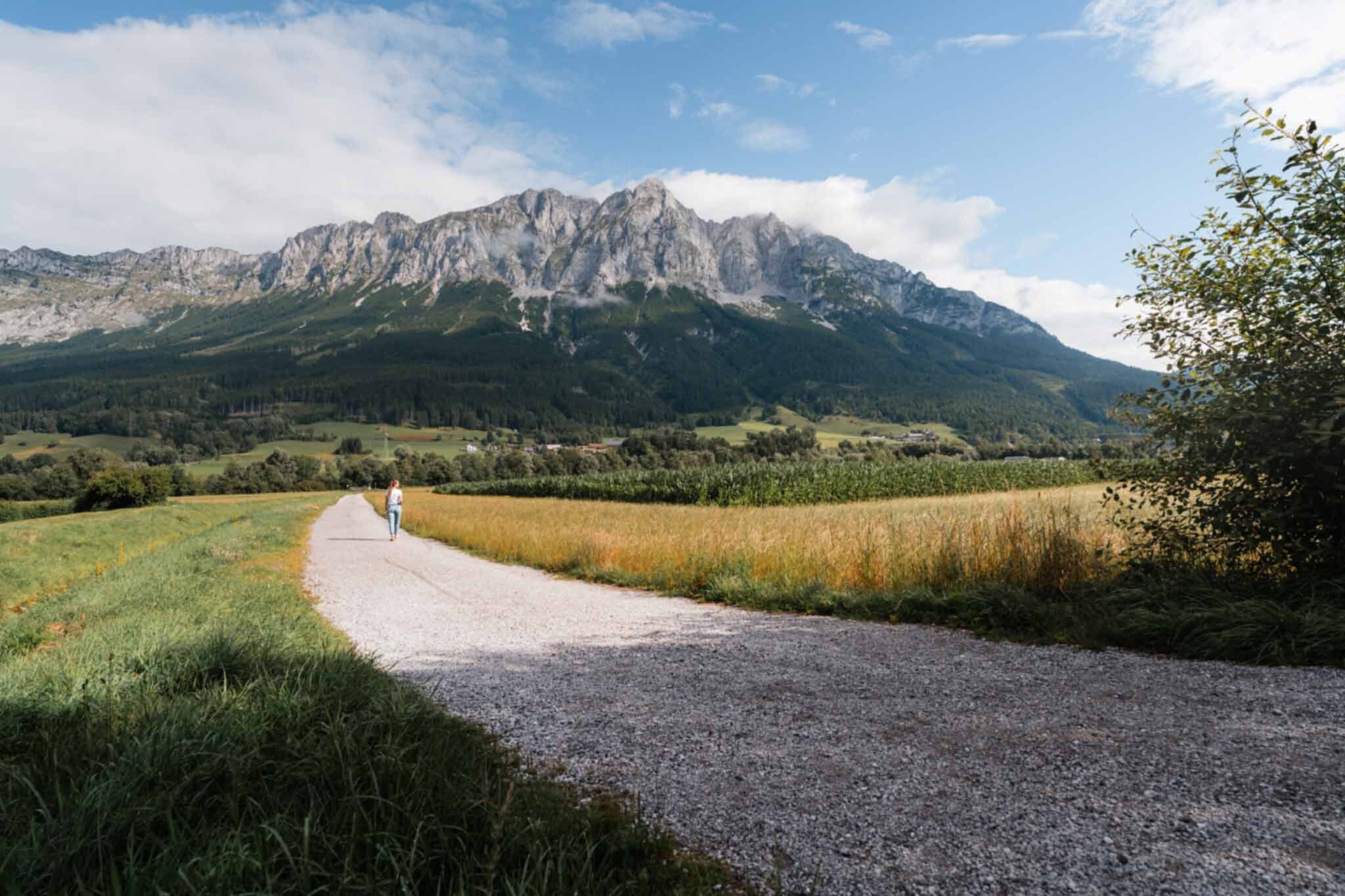
In just half an hour, this leisurely walk takes you from the Grimming Sports Area to the peaceful village of Ennsau near Niederöblarn. There, you can enjoy a leisurely stroll along a flat trail around Niederöblarn Pond.
The tour
Tour characteristics
Distance: 2.1 km
Information
Distance: 2.1 km
Duration:
30 min
Ascent: 10 m
Descent: 10 m
Best season
Jan
Feb
Mar
Apr
May
Jun
Jul
Aug
Sep
Oct
Nov
Dec
Map, elevation profile & further information
Starting at the Sportsarea Grimming in Niederöblarn, walk toward Niederöblarner Teich. Take a leisurely stroll along the flat trail around the pond, then follow the dirt path alongside the railroad tracks back to the entrance of the Sportsarea Grimming.
From the A10: At Altenmarkt (Exit 63), turn toward Graz. Follow the B99 to Radstadt. From there, take the B320 toward Graz. At Pruggern, follow the sign for Öblarn—continue on to Niederöblarn and, as you enter the town, turn left toward the Sportsarea.
From the A9: At Selzthal (Exit 69), turn toward Liezen/Radstadt. From Liezen, take the B320 to Espang. There, turn toward Öblarn. At the entrance to Niederöblarn, turn right toward the Sportsarea.Sportsarea Grimming
From the A9: At Selzthal (Exit 69), turn toward Liezen/Radstadt. From Liezen, take the B320 to Espang. There, turn toward Öblarn. At the entrance to Niederöblarn, turn right toward the Sportsarea.Sportsarea Grimming
Niederöblarn can be reached with the ÖBB regional trains (www.oebb.at).
Weather changes, rapid drop in temperature, thunderstorms, wind, fog and snow fields are objective dangers and require the right behavior on the way. Hut keepers are experienced mountain connoisseurs, they can give good tips on the weather and the course of the trail. Lack of equipment, overestimation of one's own abilities, carelessness, poor physical condition and a wrong assessment can lead to critical situations. During thunderstorms: avoid peaks, ridges and rope belays at all costs.
GPS data and orientation aids: Available GPS data - as well as hiking maps - are only an orientation aid, since they can never represent an exact image or the richness of detail of a path in reality. Especially in the case of danger spots, it must therefore always be decided in the end on the basis of the conditions on site whether and how the further course of the path looks like.
In case of emergency, please dial the following emergency numbers:
No. 140 - for alpine emergencies - Austria-wide
No. 112 - Euro emergency call GSM emergency call service
Take rainproof and warm clothes and enough water, possibly also a snack, wear shoes with non-slip profile soles. A first aid kit should also be in your backpack.
SummitLynx- Your digital summit and hut book - available worldwide and always with you!For more information, please contact the Schladming Dachstein Tourist Office:
Phone: +43 3687 23310
mailto:info@schladming-dachstein.at
The brochure “Schladming-Dachstein Hiking” is available in all information offices in the region.
Phone: +43 3687 23310
mailto:info@schladming-dachstein.at
The brochure “Schladming-Dachstein Hiking” is available in all information offices in the region.
