


Gröbminger Land
Hike to Walchental
Hiking
Data:

copyright: Gerhard Pilz - gpic.at
Important Information
Tour description
From Öblarn, you walk along the Walchentalbach stream into the secluded Walchental valley. Thanks to its
peaceful location, the Augelände in Öblarn is the ideal summer retreat for young and old alike. Along the way, you will not only find the Schrabach Chapel, which is well worth seeing, but also the Copper Trail with its many stations. If you are interested in a guided tour of the “Öblarner Wassererlebnis” (Öblarn Water Experience), you can find detailed information at wassererlebnis-oeblarn.at
peaceful location, the Augelände in Öblarn is the ideal summer retreat for young and old alike. Along the way, you will not only find the Schrabach Chapel, which is well worth seeing, but also the Copper Trail with its many stations. If you are interested in a guided tour of the “Öblarner Wassererlebnis” (Öblarn Water Experience), you can find detailed information at wassererlebnis-oeblarn.at
The tour
easy
Starting point
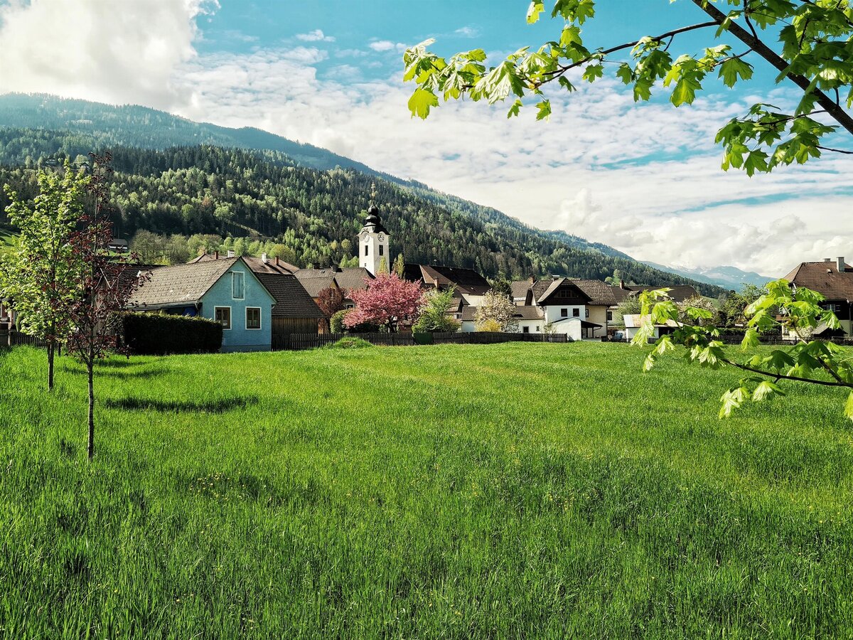
Main square in Öblarn
Destination
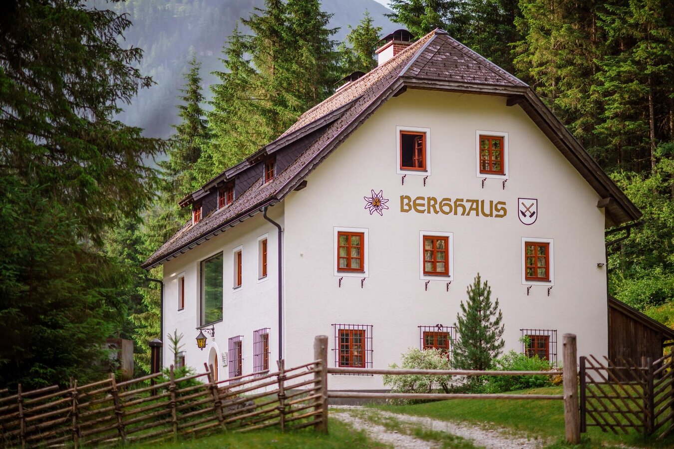
Berghaus in Walchen
Tour characteristics
Distance: 13.2 km
Fitness (2/6)
Information
Distance: 13.2 km
Duration:
4:00 h
Ascent: 300 m
Descent: 300 m
highest point: 979 m
Best season
Jan
Feb
Mar
Apr
May
Jun
Jul
Aug
Sep
Oct
Nov
Dec
Map, elevation profile & further information
Follow the signs from Öblarn towards Walchental until you reach the mountain lodge. The route there and back is the same.
Trail conditions
There are no places to stop for refreshments along the way, so please bring your own drinks and snacks.
From the west: By car, take the B320 Ennstal federal highway at Sankt Martin and turn off towards Öblarn, continuing on to Öblarn.
From the east: By car, take the B320 Ennstal federal highway at Espang and turn off towards Öblarn, continuing on to Öblarn.Main square in Öblarn
From the east: By car, take the B320 Ennstal federal highway at Espang and turn off towards Öblarn, continuing on to Öblarn.Main square in Öblarn
Arrival at Öblarn train station with ÖBB.
Weather changes, rapid drop in temperature, thunderstorms, wind, fog and snow fields are objective dangers and require the right behavior on the way. Lack of equipment, overestimation of one's own abilities, carelessness, poor physical condition and a wrong assessment can lead to critical situations. During thunderstorms: avoid peaks, ridges and rope belays at all costs.
GPS data and orientation aids: Available GPS data - as well as hiking maps - are only an orientation aid, since they can never represent an exact image or the richness of detail of a path in reality. Especially in the case of danger spots, it must therefore always be decided in the end on the basis of the conditions on site whether and how the further course of the path looks like.
In case of emergency, please dial the following emergency numbers:
No. 140 - for alpine emergencies - Austria-wide
No. 112 - Euro emergency call GSM emergency call service
Take rainproof and warm clothes and enough water, possibly also a snack, wear shoes with non-slip profile soles. A first aid kit should also be in your backpack.
SummitLynx- Your digital summit and hut book - available worldwide and always with you!For more information, please contact the Schladming Dachstein Tourist Office - Sölktäler Nature Park Information Center:
Phone: +43 3687 23310 501
mailto:info@schladming-dachstein.at
Stein an der Enns 107
8961 Sölk
The brochure “Schladming-Dachstein Hiking” is available in all information offices in the region.
Phone: +43 3687 23310 501
mailto:info@schladming-dachstein.at
Stein an der Enns 107
8961 Sölk
The brochure “Schladming-Dachstein Hiking” is available in all information offices in the region.
