
Stage 04 From Glacier to Wine North Route Bad Mitterndorf - Tauplitzalm
Tour description
The tour
Map, elevation profile & further information
This stage of the hiking route "From Glacier to Wine" is one of the few where it really is almost entirely uphill, but from Bad Mitterndorf (Tourist Information Tel. +43 3623 2444) initially quite comfortable. Only at the end, from the beautiful Öderntal to the Tauplitzalm, the climb becomes a bit more strenuous. We leave Bad Mitterndorf in a northerly direction and march along a small stream until we reach a fork in the path, where we keep left to enter Öderntal. On the right, at this fork in the road, you can also reach the Tauplitzalm (a somewhat shorter variant), but the path across the Öderntal is much more scenic. Always along the valley past the Kochalmbauer homestead, we reach a crossroads just after the Albrechtshütte (hunting lodge of the Federal Forests), where we keep to the right to continue hiking quite comfortably along the Öderntal. Next stop is the rustic Steinbrecherhütte of the Sonnleitner family (Tel. +43 664 5195516) at 1,200 m above sea level.
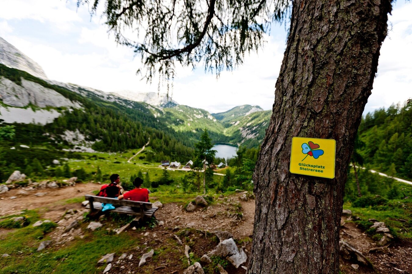
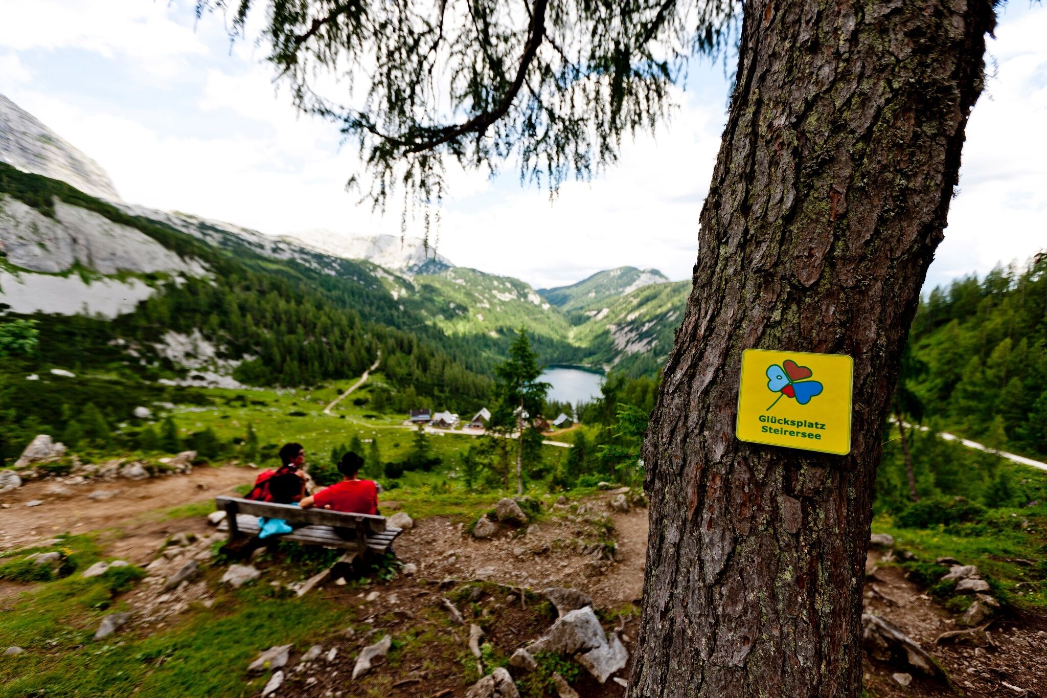
From here begins the ascent to the Tauplitzalm, which leads us on this tour around the Lawinenstein, a beautiful lookout mountain on the Tauplitzalm. The path climbs steadily up to the alpine pasture, sometimes in serpentines. On the mountain pasture we are greeted by the Großsee, one of the numerous lakes on this beautiful high plateau. To the right is the imposing Lawinenstein, a balcony-like lookout mountain with a beautiful view over the Ausseerland-Salzkammergut region with Bad Mitterndorf on one side and the area of Lake Grundlsee on the other. But a special moment for us is certainly the view from the Lawinenstein back to the Dachstein with its glacier, our starting point of the hiking route "From Glacier to Wine". On the mountain slope of the Lawinenstein, which can be reached from the Tauplitzalm in about 1.5 hours, there are several gorges and a weather hole that leads almost vertically down into the earth. It is said that if someone throws a stone in there, a heavy thunderstorm will break out on the same day.
The range of accommodation on the Tauplitzalm, our stage destination, extends from the romantic alpine hut to the best-run hotel (Tourist Information Tel. +43 3688 2446). And all of them have one thing in common besides their coziness: here we will also get the best advice about our next stage to the Hochmölbinghütte.
Detaillierte Informationen zur Anreise finden Sie hier.
There are numerous parking spaces available in Bad Mitterndorf.Accessible by train and bus.
Detailed information about arriving by ÖBB (Austrian Federal Railways) can be found at www.oebb.at or on the Verbundlinie Steiermark website www.busbahnbim.at
With Verbundlinie’s BusBahnBim route planner app, planning your journey has never been easier: simply enter towns and/or addresses, stop names or points of interest to check all bus, train and tram connections in Austria. The app is available free of charge for smartphones – on Google Play and in the App Store
Emergency call mountain rescue: 140
Tips when reporting an emergency – Answer these six WH questions: What happened? How many people are injured? Where did the accident happen (are there GPS coordinates)? Who is reporting the incident (callback number)? When did the accident happen? What is the weather like at the site of the incident?
Proper backpack packing makes many things easier: Pack heavy things first. The water bottle should always be within reach in a side pocket. All the things that are often needed, such as sunglasses, camera or hiking map, belong on top. An emergency kit, including blister plasters, belongs in every rucksack and it is always advisable to dress in layers.Steiermark Tourismus
Tel. +43 316 4003
If you would like to hire a tour operator, simply book with Steiermark Touristik, the official travel agency of Steiermark Tourismus:
Tel. +43 316 4003 450,
The Steiermark Touren app, available free of charge on Google Play and the App Store (Android, iOS), offers detailed first-hand information: brief facts (length, duration, difficulty, ascent and descent/elevation gain, ratings), map, route descriptions, altimeter, compass, peak finder, navigation along the tour. You can also create your own personal lists of favourite tours and sites, store tours and destinations offline, use social media channels, and much more.
Gratis Pocket Card Wanderroute "Vom Gletscher zum Wein" finden Sie auf www.steiermark.com
Naturerlebniskarte Ausseerland-Salzkammergut, 1:50.000 www.ausseerland.at
Kompass WK 68 Ausseerland, Ennstal, Tauplitz www.kompass.at
Freytag & Berndt WK082 Bad Aussee · Totes Gebirge · Bad Mitterndorf · Tauplitz www.freytagberndt.at
Rother Wanderführer "Vom Gletscher zum Wein": auf 160 Seiten mit 80 Farbabbildungen 60 Höhenprofile, 60 Wanderkärtchen im Maßstab 1:75.000, zwei Übersichtskarten, GPS-Tracks zum Download, Format 11,5 x 16,5 cm, kartoniert mit Polytex-Laminierung, ISBN 978-3-7633-4550-2, www.rother.de


