


Grimming-Donnersbachtal
Planner-Almway
Hiking trail
Data:
Tour description
THE WAY IS THE GOAL. You can say that here. As beautiful as the path is, it is also far. Through the Donnersbachklamm over the old Plannerstraße to the Schrabachalm and over the Kasweg to the Planneralm.
The tour
moderate
Starting and end point
Gasthof Leitner
Tour characteristics
Distance: 12.9 km
Fitness (3/6)
Information
Distance: 12.9 km
Duration:
4:30 h
Ascent: 950 m
Descent: 45 m
highest point: 1592 m
Best season
Jan
Feb
Mar
Apr
May
Jun
Jul
Aug
Sep
Oct
Nov
Dec
Map, elevation profile & further information
Follow the signs and hike through the Donnersbachklamm gorge. Shortly after the rock passage and over the steps uphill you come to the signpost. Turn left and follow the markings up to the Ertlschweigerhaus. After about 100 meters uphill along the road, you cross to the left in the direction of the old Plannerstraße. This leads you first on asphalt and later on a forest path to the Schrabachalm. Here at the latest you should treat yourself to a (palate) break before you continue hiking along the Kasweg up to the Planneralm. You can return along the same path, or you can organize a ride back to Donnersbach in advance.
Way number: 8
At Trautenfels or Wörschach turn off the B320 towards Irdning and then on to Donnersbach.Pakingplace Gasthof Leitner
With the bus 941 to the bus stop ,,Bonnersbach Corner Ilgenberg''. Opposite the Gasthof Leitner is the start from the tour. Attetion! No bus during summer holidays.
- Turn back in good time if the weather deteriorates. If you get caught in a thunderstorm, stay away from individual trees. Wait out the storm, if possible in a crouching position.
- Stay on marked trails and remember to close pasture fences.In case of emergency, keep calm and call the mountain rescue on 140. If you have no reception, take out the sim card and dial 112.
- If you encounter cows: It is best to pass above the herd with at least 50 meters distance. Stay calm, don't make any frantic movements and don't run away. Do not imitate cow sounds and do not try to pet the animals. A stick and loud shouting can often make the animals turn back in an emergency.
- If you are a dog owner: Clarify before the hike if you have to cross a pasture. Keep your dog on a leash and make sure he stays calm. If a cow attacks, let the dog off the leash immediately. Never pick him up to defend him.
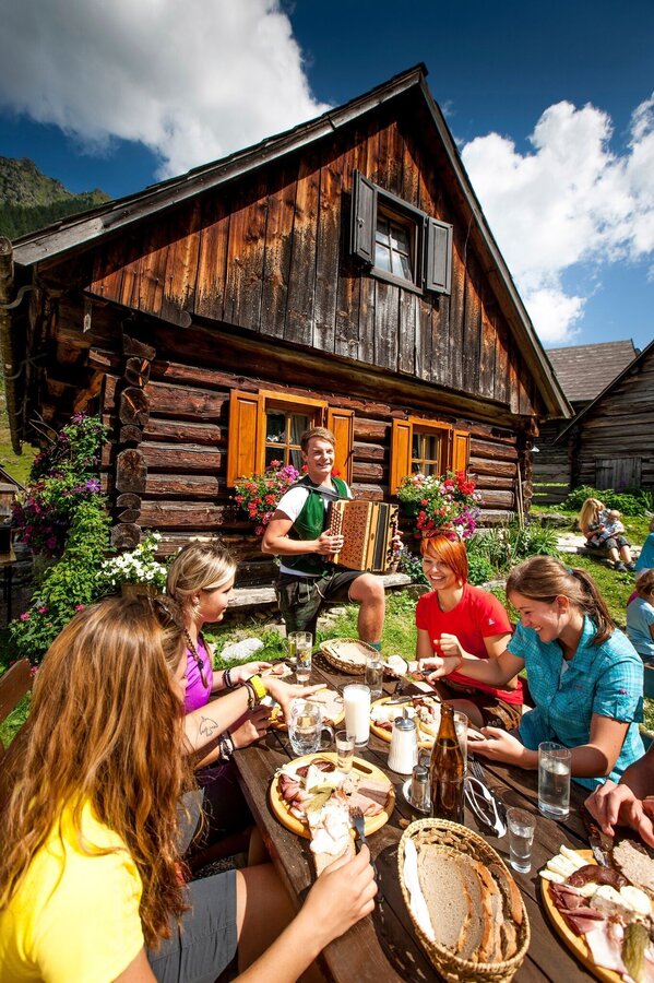
Get new power from a break at the Schrabachalm.Tourism information: www.schladming-dachstein.at
Tourist Office Schladming-Dachstein
Ramsauerstrasse 756
8970 Schladming
T: +43 3687 23310
info@schladming-dachstein.at
- SCHLADMING-DACHSTEIN Hiking EAST. Available free of charge at tourist offices and lodging establishments.
- SCHLADMING-DACHSTEIN Hiking Map (1:50.000)


