


Hochrettelstein - The most beautiful in the Donnersbacher Tauern
Tour description
The tour
Map, elevation profile & further information
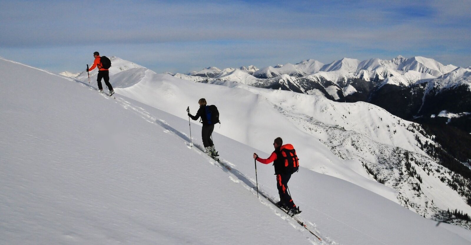
At the beginning, we follow the mostly cleared forest road to the Jagdhaus Gulling, where we keep right to head westward on the right-hand forest road into the Plienten valley. After about 3 km at an altitude of just under 1,300 m, we keep right and ascend via steep meadows to the ruined huts at Saubichl on the alpine pasture of the same name.
Now continue to the right across a clearing, which we leave to the left where it becomes steeper to reach an open slope via a narrow strip of forest. First, head north uphill and then cross the steep avalanche slope in a left-hand loop. This brings us to the large cirque embedded in the landscape southwest of the Hochrettelstein. Now the path leads us once more somewhat steeper and across a wide flank up to the summit. The descent follows the ascent route.
ÖBB www.oebb.at or Verbundlinie Steiermark www.busbahnbim.at
With the BusBahnBim App from Verbundlinie, timetable information is easier than ever: all bus, train and tram connections in Austria can be queried by entering locations and/or addresses, stops or important points. The app is available as a free app for smartphones (Android, iOS) – on Google Play and in the App Store
The tour is undertaken at your own risk! No liability is assumed for any existing or occurring alpine hazards (avalanches, weather, etc.). Important note: Before every ski tour or snowshoe hike, it is essential to check the current avalanche report - available at www.lawine-steiermark.at .
Mountain sports and the assessment of the local situation are - especially in winter - primarily a matter of personal responsibility. Tourism associations or avalanche warning services can therefore not assume any liability based on information provided .
If you would like to entrust yourself to a tour operator, simply book with Steiermark Touristik, the official travel agency of Steiermark Tourism: Tel. +43 316 40030www.steiermark-touristik.com
Further information:Steiermark Tourism Tel. +43 316 40030www.steiermark.com
Urlaubsregion Schladming-Dachstein Ramsauerstraße 756 8970 Schladming Tel. +43 3687 23310www.schladming-dachstein.at
The Steiermark Touren App, available for free on Google Play and in the App Store (Android, iOS), offers detailed first-hand information: short facts (length, duration, difficulty, ascent and descent in vertical meters, ratings), map, route descriptions, altimeter, compass, peak finder, navigation along the tour. In addition, you can create your personal favorites list of preferred tours and points, save tours and excursion destinations offline, use social media channels and more.
Please also note the recommendations of the Alpine Club "Safe on ski tours: 10 recommendations"
Paul Sodamin, Peter Sodamin: Schitouren Steiermark www.steiermark.com/buecher


