
Stoderzinken Summit Tour
Tour description
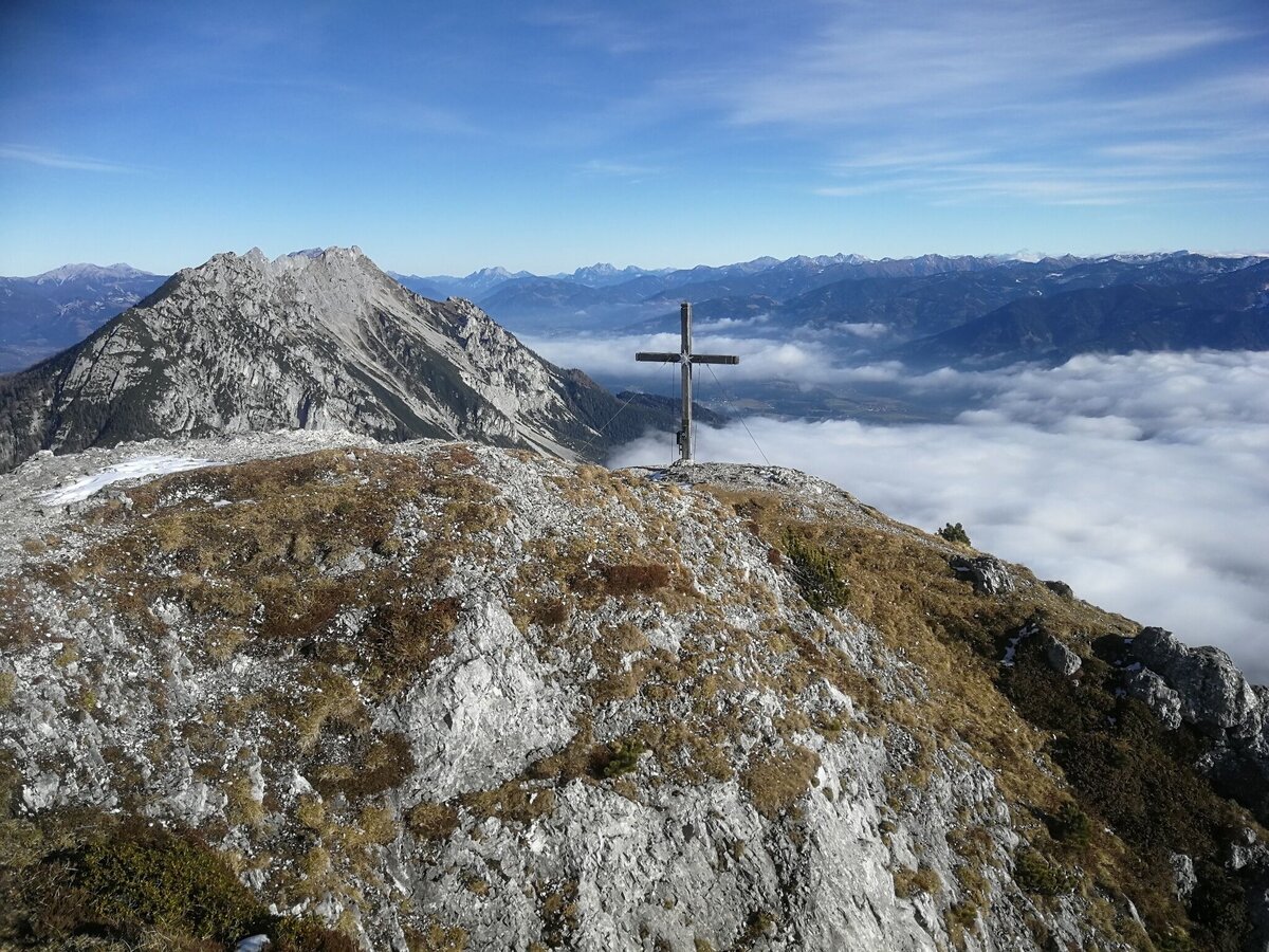
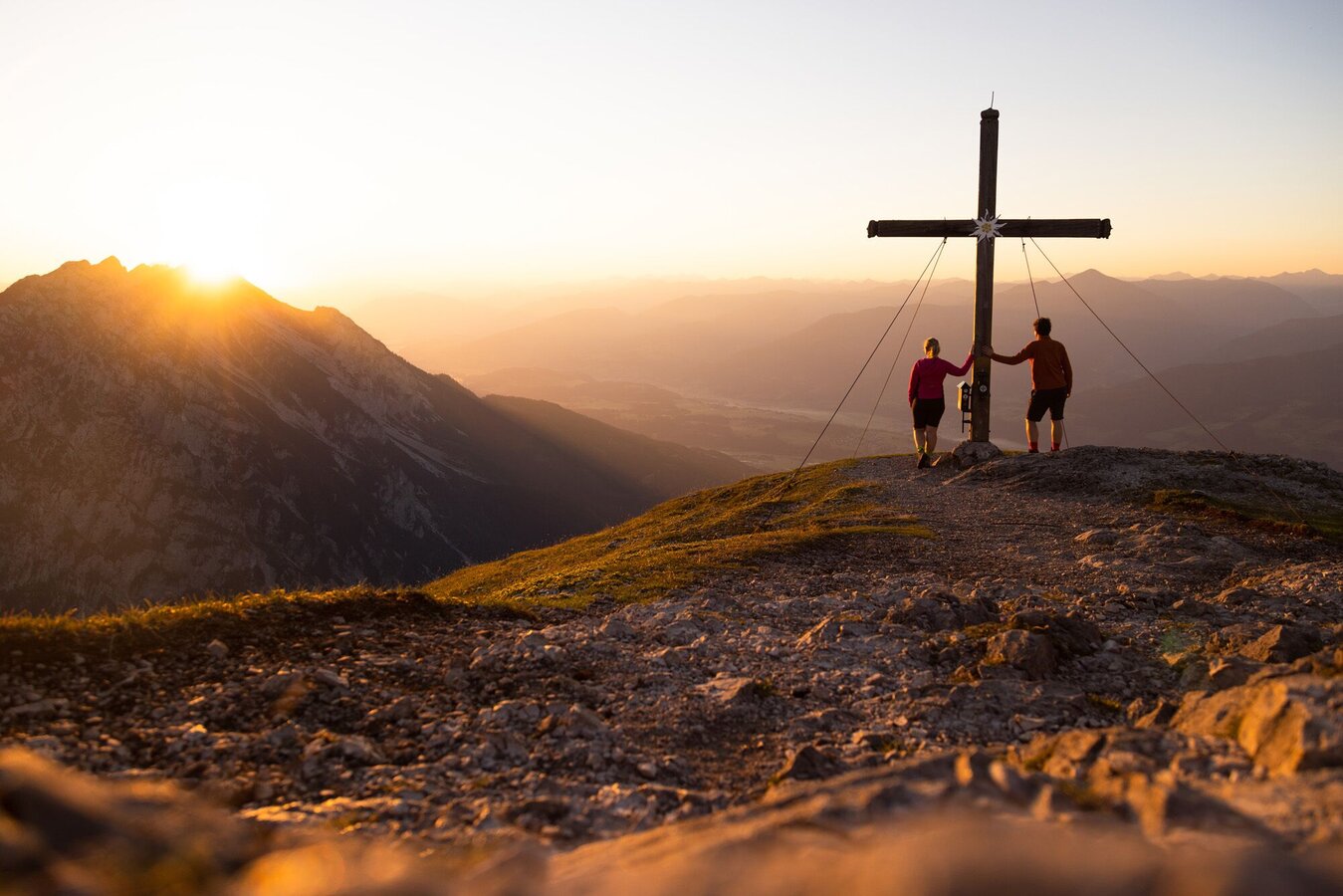
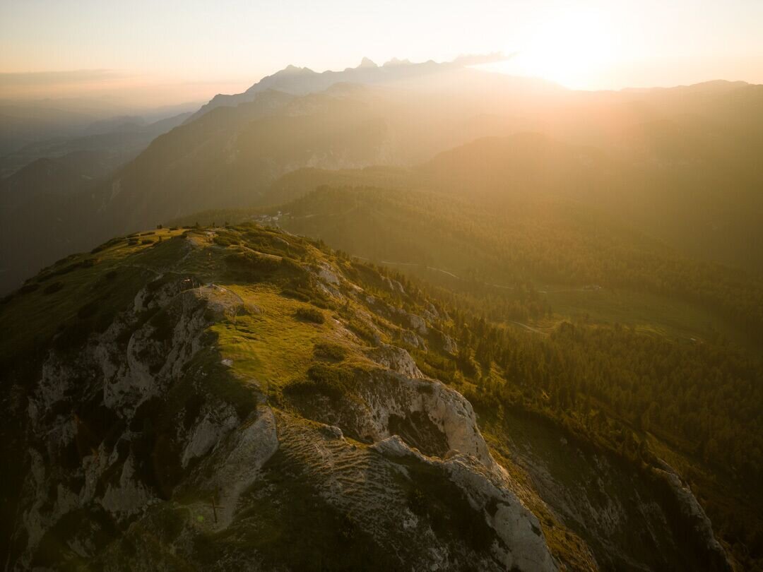
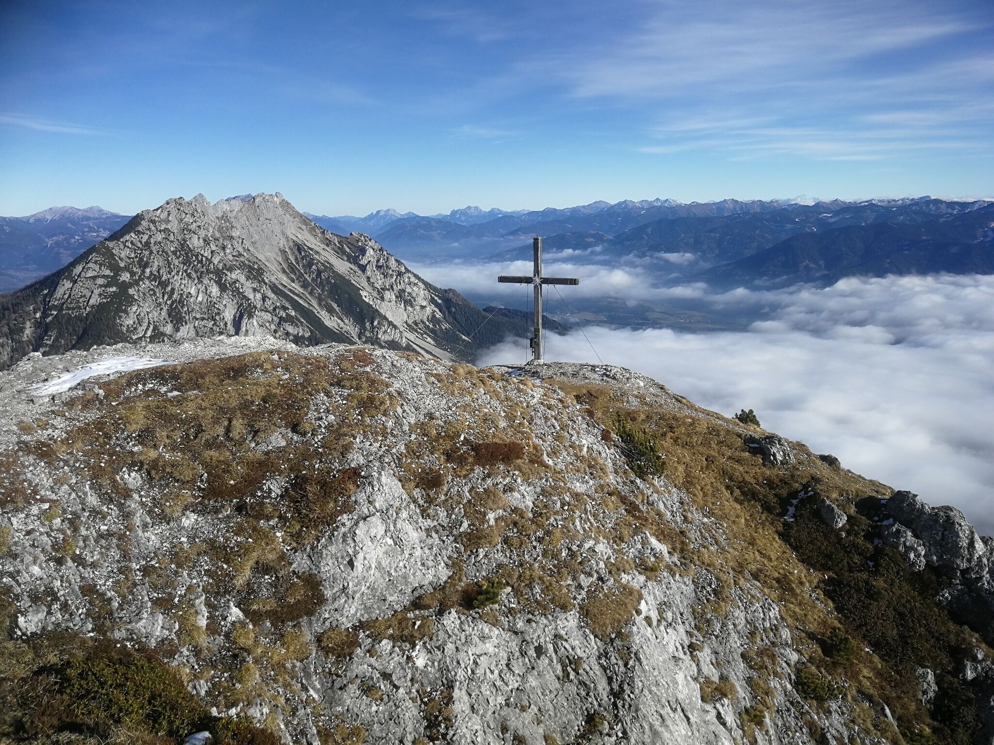
Hike to the summit of the Stoderzinken with a magnificent view of Gröbming, the Dachstein massif and the lower Ennstal. The hike to the summit of the Stoderzinken is a special experience. The ascent from the hiking trail heads at the huts, which leads through a beautiful larch, stone pine and mountain pine forest. Immerse yourself in the natural experience of the mountain forest at the tree line. From the summit there is a wonderful 360° all-round view and a spectacular view down into the Gröbming Basin and the market town of Gröbming. A special experience is a sunrise hike on the Stoderzinken.
The tour
Map, elevation profile & further information
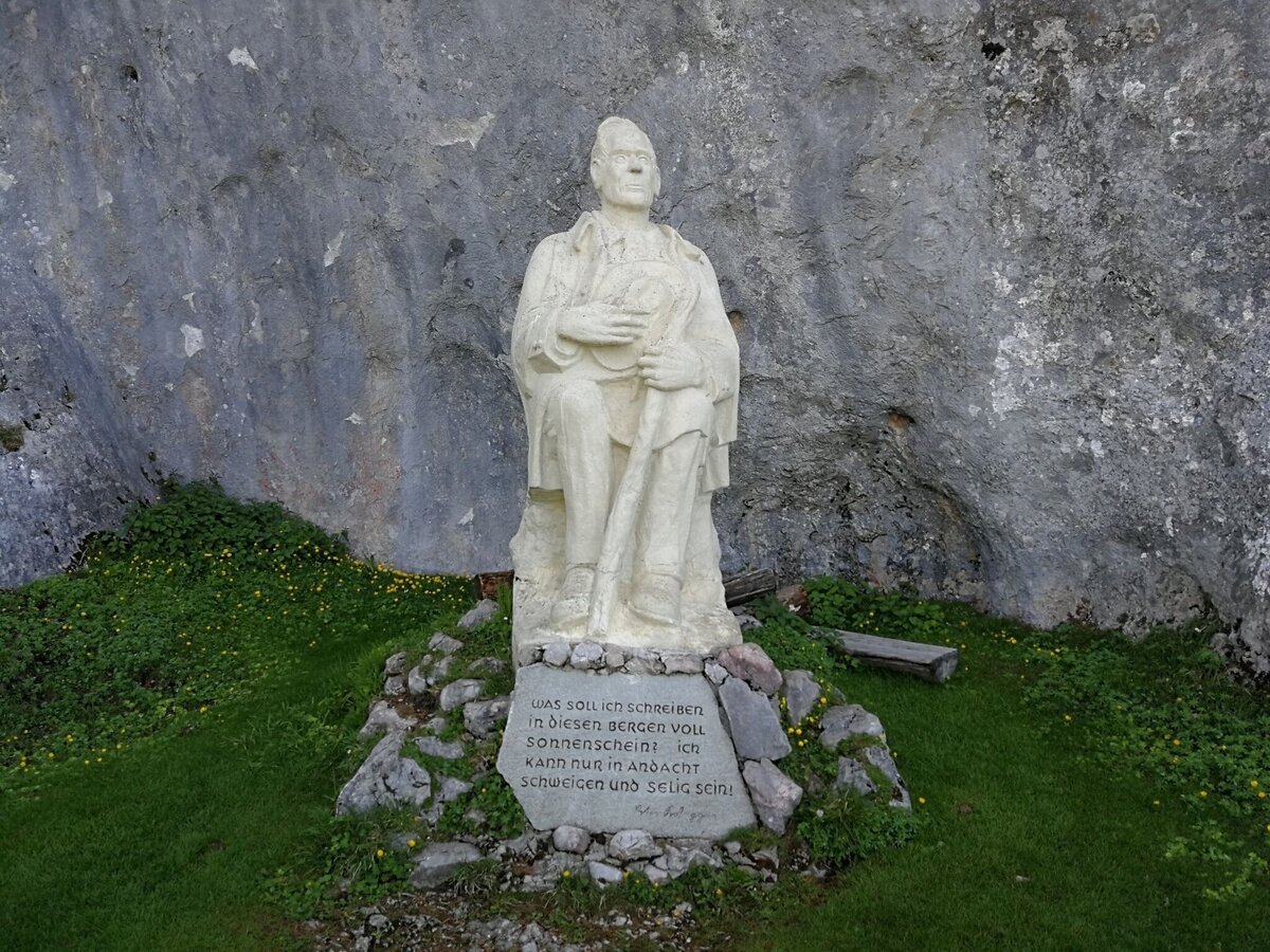
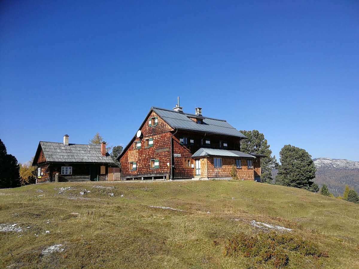
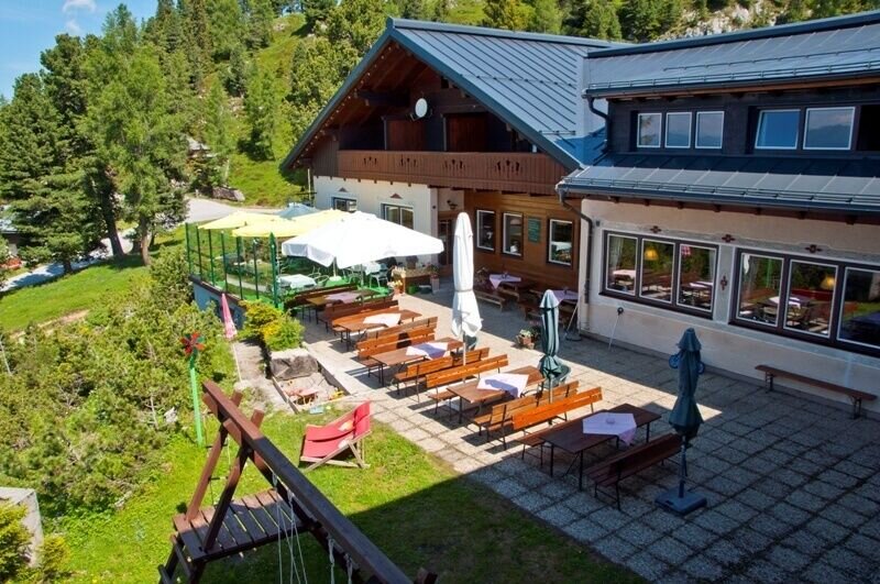
You start your hike at the hiking trail head Rosemi Alm/Roßfeld car park. You hike past the Rosemi Alm in a few minutes to the connection to the AV path #675. You now go uphill to the crossroads near the Stoderhütte, where you turn right onto path #676 in the direction of the Friedenskircherl and the Stoderzinken summit. You now hike a relatively wide, gravel path until you turn left below the Peter Rosegger monument in the direction of the Stoderzinken summit.
Through a mountain pine alley you now hike up over the tree line - from the right some exits of via ferrata routes connect to the hiking trail. Finally you hike comfortably over the tree-free heights to the summit, which invites you to linger and enjoy. A 360° panorama with a particularly attractive view of the Dachstein glacier and the karst plateau "Am Stein". To the east you can see the wide valley basin of Gröbming, which is impressively towered over by the rocky jagged ridge of the Kammspitze, which looks very close.
For the descent, hike back a little from the summit and then turn right onto trail #675, which takes you through the mountain pines and over a few switchbacks through the forest down to the Brünnerhütte (not serviced). From there you hike slightly uphill back to the Stoderhütte and the Steinerhaus and along the known path back to the starting point at the Rosemi Alm hiking portal.
Exit the B320 Ennstalbundesstraße in Gröbming. Follow the signs towards the Stoderzinken Alpenstrasse. From the Adventure Park/Gröbminger Alm, the Stoderzinkenstraße is a toll road.
Stoderzinken Alpenstrasse parking spaces:
- Roßfeld car park at the Rosemi Alm hiking trail head
- Christopherus car park at the Christopherus hiking trail head
With the Stoderzinken bus shuttle it is possible to drive up to the Rosemi Alm.
More information: Stoder bus shuttle | Information from A-Z | Schladming-Dachstein
Changes in weather patterns, quick falls in temperature, thunderstorms, wind, fog and snow are some of the dangers that can be encountered on a hiking tour. Hosts of alpine huts and mountain refuges have a lot of experience in the mountains and can give good advice about weather and the trails. Poor equipment, overestimation of one's own capabilities, carelessness, poor personal constitution and/or wrong judgement can lead to critical situations. In case of thunderstorms: avoid summits, ridges and steel ropes.
The path to the Friedenskircherl is not suitable for walking when there is snow.
GPS data and orienteering
Available GPS data - just like hiking maps - is only a guidance for orientation and can never depict a trail exactly with all its details. Especially at dangerous spots it is essential to judge on site how to proceed.
In an emergency please call:
- 140 - for Alpine emergencies (all over Austria)
- 112 - European GSM emergency number
A well-packed backpack is helpful and especially when touring Alpine terrain a tuque, gloves, a windproof jacket and pants are standard equipment. Good, waterproof shoes, sun glasses, sun cream and sufficient beverages are essential too. Torch light, a map of the area, knie and a small first-aid kit should also be in the backpack.
Well-trained mountaineers with a head for heights can also choose the variant via the Friedenskircherl and then via the "Florasteig".
During the summer holidays, a shuttle bus runs between Gröbming and the Rosemi Alm hiking trail head.
- Good footwear and free from dizziness.
- Mountain boots, rain protection.
- Here are all the hiking maps and important brochures to download.


