
Gröbminger Land
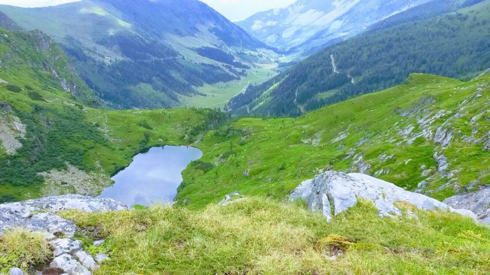
Stierkarsee
Hiking trail
Data:
01.11. - 01.05.2026
Tour description
From the car park you hike to the end of the valley, past original rustic alpine huts along the stream. At first there are gravel paths and alpine meadows, but soon the path leads over a large scree field to a small bridge where two mountain streams meet. In the middle the path continues, steeply up through the high forest until you reach the timberline and stand in front of a mountain basin. The path then continues steeply uphill on the right hand side and after a short time you reach the Stierkarsee. In a small valley basin, the lake and its alpine meadows around it invite you to stay. The Hohe Wildstelle is enthroned above it, and a hike further to the Goldlacken is highly recommended.
The tour
difficult
Starting and end point
Parkplatz Sattental
Tour characteristics
Fitness (5/6)
Information
Distance: 12.84 km
Duration:
5 h 7 min
Ascent: 1099 m
Descent: 1099 m
highest point: 2322 m
Best season
Jan
Feb
Mar
Apr
May
Jun
Jul
Aug
Sep
Oct
Nov
Dec
Map, elevation profile & further information
Vom Parkplatz wandert man zum Talschluss, vorbei an originellen urigen Almhütten den Bach entlang. Sind es zuerst noch Schotterwege und Almwiesen, führt der Weg bald über ein großes Geröllfeld bis zu einer kleinen Brücke wo sich zwei Gebirgsbäche treffen. In der Mitte geht der Weg weiter, steil hinauf durch den Hochwald bis man die Waldgrenze erreicht und vor einem Bergkessel steht. Es geht dann rechter Hand noch ein kurzes Stück steil bergauf und man erreicht nach kurzer Zeit den Stierkarsee. In einem kleinen Talkessel liegt der See und seine Almwiesen rund herum laden zum Verweilen ein. Von dort aus verlocken die Goldlacken, eine Ansammlung kleiner Seen und laden zum Weitergehen auf die Hochwildstelle, dem höchsten Berg der Steiermark ein.
Weather changes, rapid drop in temperature, thunderstorms, wind, fog and snowfields are objective dangers and require the right behaviour on the way. Hut hosts are experienced mountain experts, they can give good tips about the weather and the route. Lack of equipment, overestimation of one's own abilities, carelessness, poor physical condition and a wrong assessment can lead to critical situations.
In case of thunderstorms: Avoid summits, ridges and ropes at all costs
In an emergency, please dial the following emergency numbers:
140 - Mountain Rescue
112 - Euro emergency call
sturdy shoes, rain protection, hiking sticks if necessary
Tour at your own risk! No liability is assumed for any alpine dangers (weather, etc.) that may exist or occur.


