
Silberkarklamm's Water Experience
Tour description
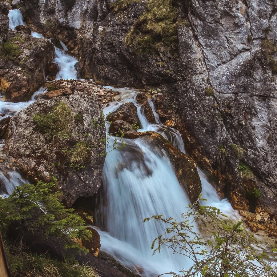
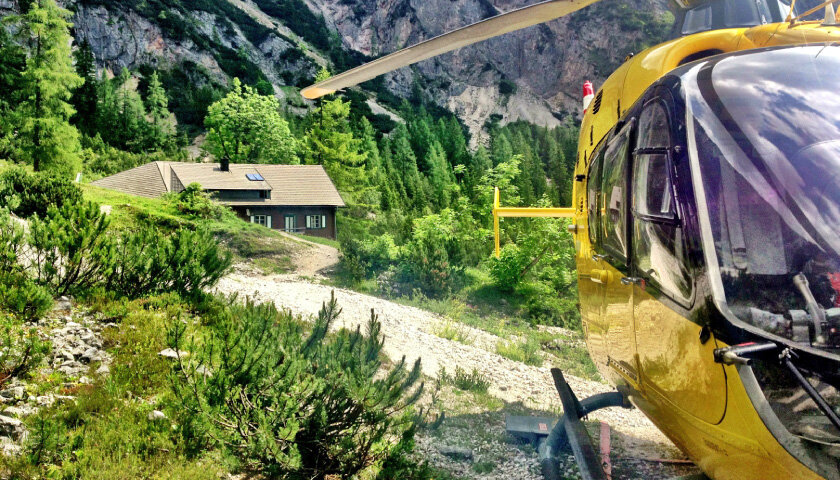
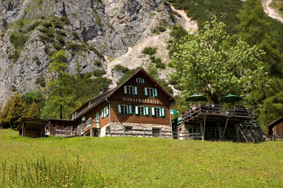
From the Silberkarklamm car park, an impressive ascent leads along the roaring forest stream. Easily accessible via steps. Waterfalls, vertical cliffs, flowers (especially many gold auricles in spring) and the wildly romantic scenery in the gorge and in the cirque make this hike very interesting for families. Also recommended when the weather is not very nice. The Silberkarhütte is located in the middle of the Kar. From the Silberkarhütte Höhenweg as the way back: to the left of the hut, a challenging and somewhat exposed path leads along the slope, reaches a great vantage point and then leads as a real "Wurzelsteig" narrow and steep downhill in the forest to the wayside cross, from there turn left back to the gorge entrance.
The tour
Map, elevation profile & further information
From the Silberkarklamm car park over steps through the impressive backdrop of the roaring torrent. Waterfalls, vertical cliffs and the wild and romantic scenery make this hike very interesting for families. Continue through the Silberkar to the Silberkarhütte. Return on the same path through the gorge or on the challenging high-altitude trail via a circular hiking trail via the forest and root trail back to the starting point.
From west:
Tauernautobahn A 10 to the Ennstal junction - exit in the direction of Graz/Schladming - around 20 km on the Ennstal federal road to Schladming - Ramsau junction. In Ramsau to the "Stierer-Kreisung" where you turn towards Rössing. Downhill to Rössing and left at the Lodenwalker up to the Silberkarklamm car park.
From North/East:
Pyhrn autobahn in the direction of Liezen and Ennstal federal road to Aich. At Höhenfeld, turn off in the direction of Ramsau am Dachstein. Through Weißenbach near Haus and along the state road to Ramsau Rössing. Turn right at the Lodenwalker and up to the Silberkarklamm car park.
Silberkarklamm car park. Attention: partly subject to a fee!
With the regular buses of the Ramsauer Verkehrsbetriebe to the Silberkarklamm stop in Ramsau Rössing.
Schedula available at: www.rvb.at
The Höhenweg from the Silberkarhütte in the direction of Gh. Fly agaric is a demanding hiking trail with exposed spots.
Changes in weather patterns, quick falls in temperature, thunderstorms, wind, fog and snow are some of the dangers that can be encountered on a hiking tour. Hosts of alpine huts and mountain refuges have a lot of experience in the mountains and can give good advice about weather and the trails. Poor equipment, overestimation of one's own capabilities, carelessness, poor personal constitution and/or wrong judgement can lead to critical situations. In case of thunderstorms: avoid summits, ridges and steel ropes.
GPS data and orienteering
Available GPS data - just like hiking maps - is only a guidance for orientation and can never depict a trail exactly with all its details. Especially at dangerous spots it is essential to judge on site how to proceed.
In an emergency please call:
- 140 - for Alpine emergencies (all over Austria)
- 112 - European GSM emergency number
A well-packed backpack is helpful and especially when touring Alpine terrain a tuque, gloves, a windproof jacket and pants are standard equipment. Good, waterproof shoes, sun glasses, sun cream and sufficient beverages are essential too. Torch light, a map of the area, knie and a small first-aid kit should also be in the backpack.
The parking lot on the left is chargeable!
Highlight: Via Ferratas "Hias", "Rosina" are located in the canyon, the ferrata "Siega" is located in the Silberkar cirque.
Entrance fee:
Silberkarklamm: € 4,90 for adults | € 2,90 for kids
Groups (from 15 people): € 4,50 for adults | € 2,50 for kids


