
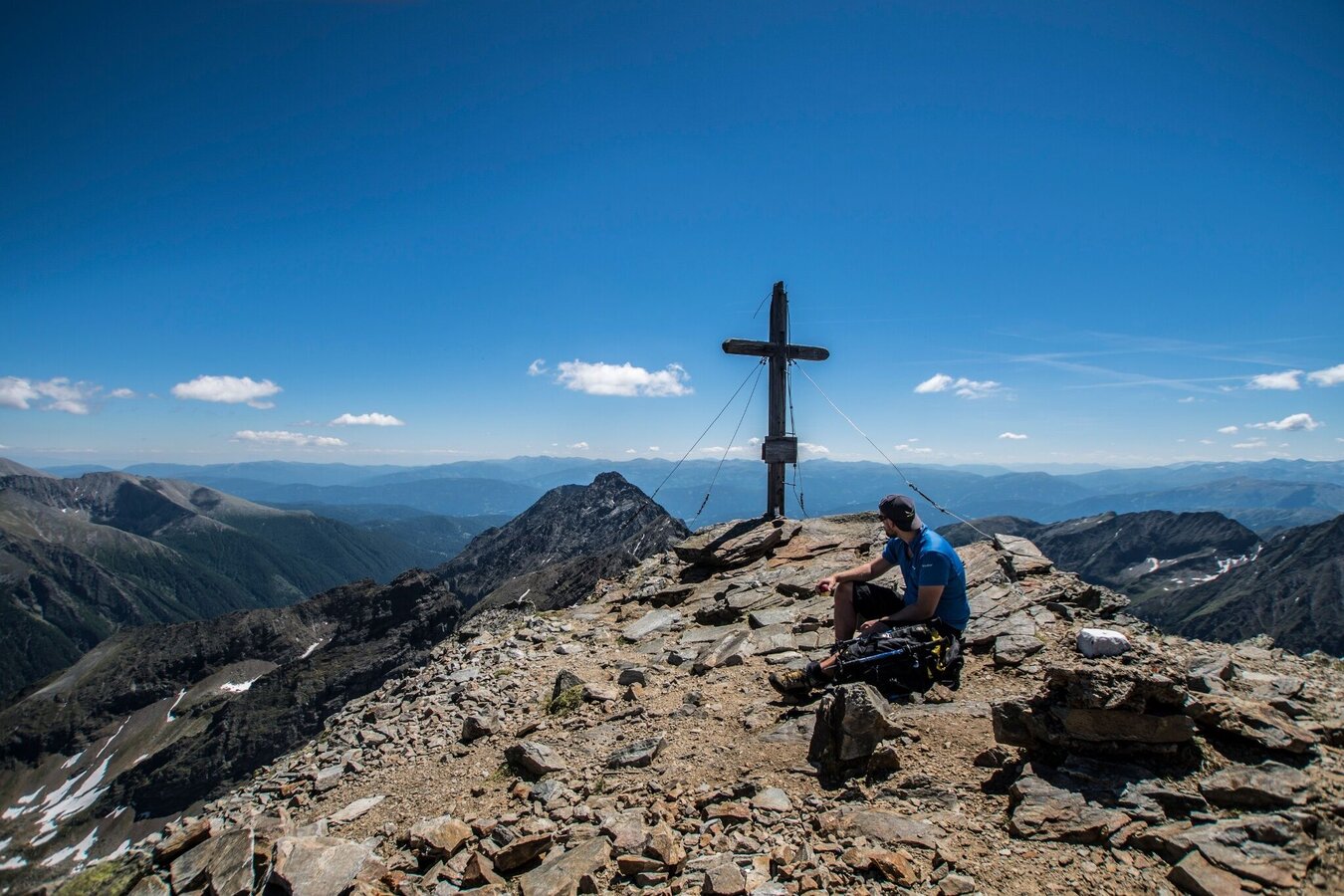
Hochgolling - 2,862 m
Tour description
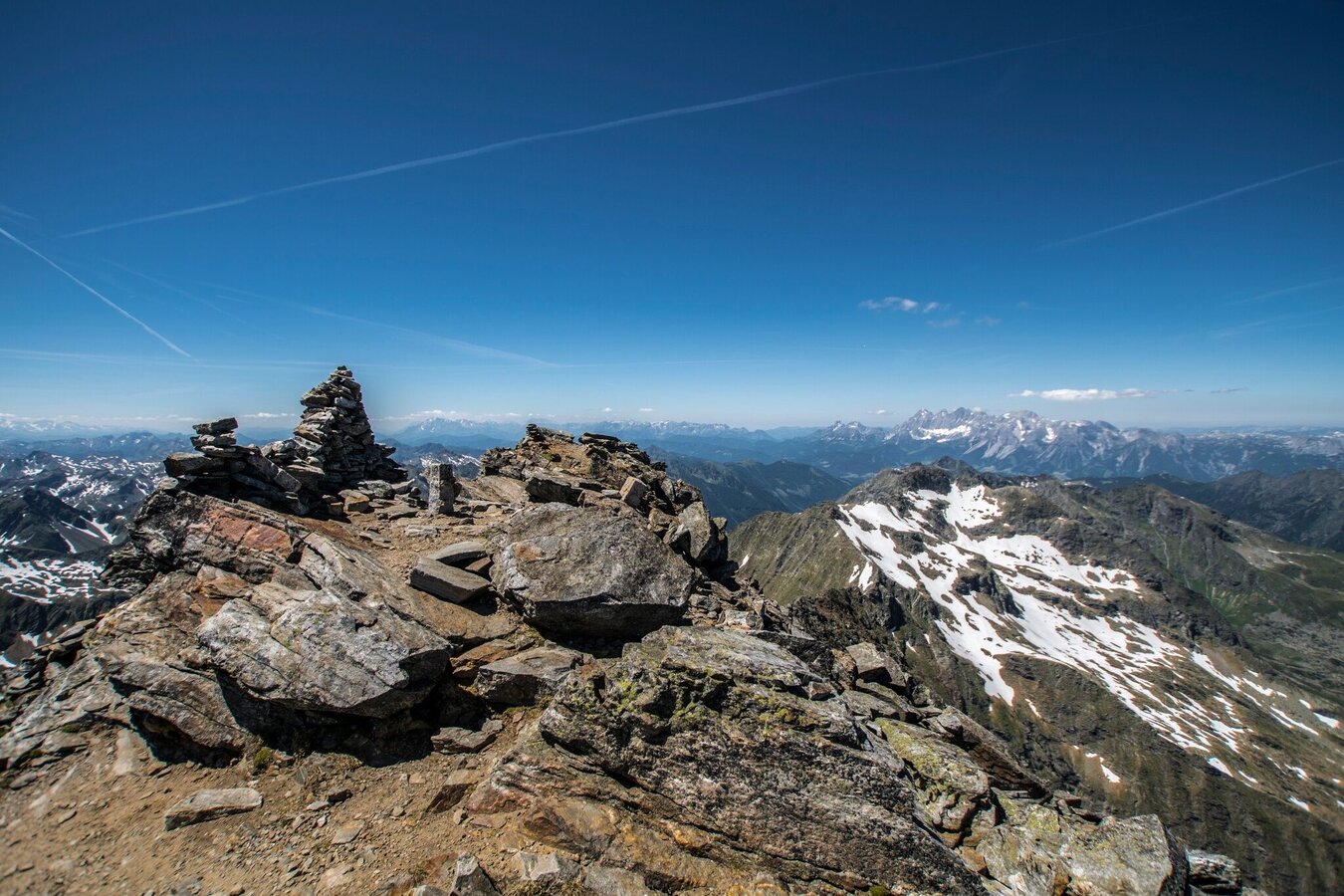
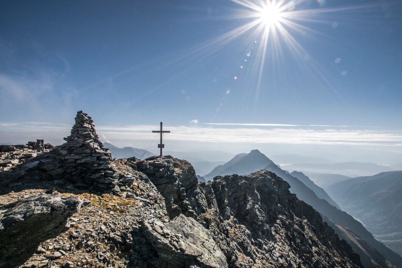
Archduke Johann, the Styrian prince, undertook this hike on 28 August 1817 and wrote enthusiastically about it in his notes. We are also mesmerised by the hike and the view from the Hochgolling, the highest peak in the Niedere Tauern. The panoramic view from the summit is something special and we can recommend an early tour as the morning moods are unique. For experienced hikers, the summit of the Hochgolling is a rewarding mountain tour. First of all, this mountain impresses with its almost 1,200 metre almost vertical north face, dark and threatening, with a small ice field in the middle of the wall. The view from the summit is magnificent - especially to the south to the beautifully shaped summit of the Kasereck and the Preber, but also to the Dachstein and to the east, where the mountains stretch to the horizon and the Tauern Queen - the Hochalmspitze - probably steals the show from all the other peaks in the morning light.
From the Seeleiten car park, initially a forest path, then a hiking trail to Gollingwinkel, followed by an alpine trail. Surefootedness and a head for heights required. Take care on snowfields, especially in the morning when they are still frozen. Take food and drink with you!
Refreshment stops:
- Almgasthaus Riesachfall
- Golling hut
Experience points:
- Steinriesental valley with the Gollinghütte hut
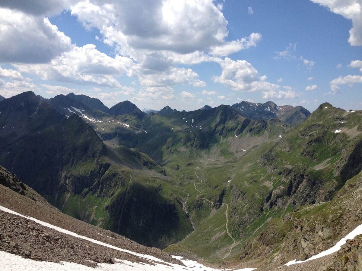
- Natural amphitheatre ‘Götterplatz’ Gollingwinkel
- Gollingscharte with a view of the Landawirsee lakes
- Summit of the Hochgolling
The tour
Map, elevation profile & further information
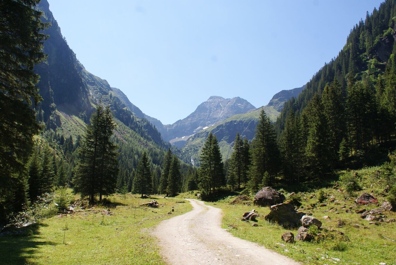
Trail head of the tour is at Seeleiten car park at the valley head of Untertal valley. From Almgasthaus Riesachfall inn you start your hike on the forest lane towards Gollinghütte. At first through a pine forest, later over a nice alpine meadow you hike to Untere Steinwendalm, where you pass by and soon reach Laberer Boden, an alpine meadow with a pond where Hochgolling reflects on the surface.
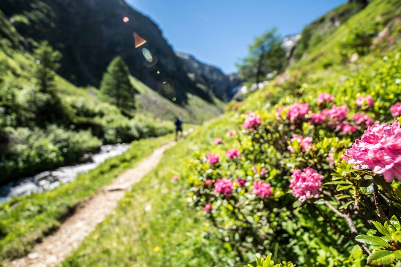
You continue along the forest lane that mostly runs along the Steinriesenbach creek to the ropeway for material transport to Gollinghütte chalet. The forest lane ends here and you continue on the hiking trail to Gollinghütte chalet, where it's time for a first small break. From the chalet you continue on trail n° 702 to Gollingwinkel. This flat, alpine meadow is framed by the dark, steep rock faces of the surrounding mountains.
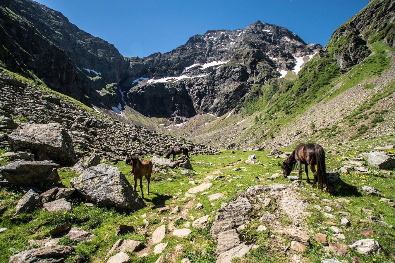
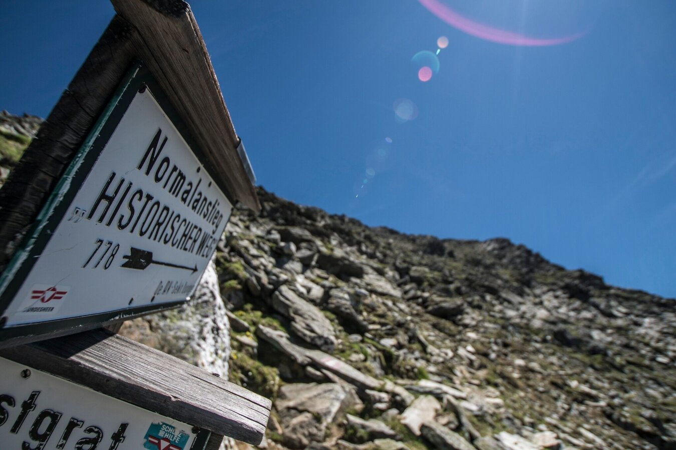
Now follow the trail signs n° 702/778, ascending steeply over scree to Gollingscharte ridge. Snowfields are possible here to the mid of summer. In several switchbacks the trail takes you up to the ridge, which is a good spot for a break.
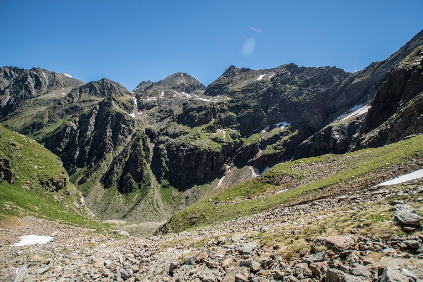
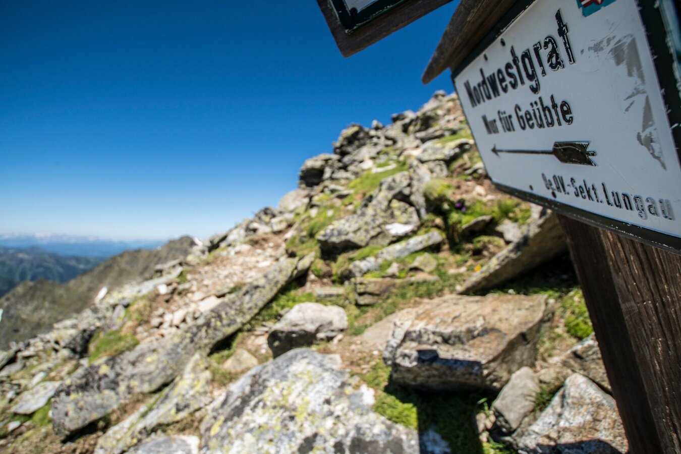
From Gollingscharte you keep left and ascend further to the summit via several rock shoulders and gruff gorges along the West face. In the last third of the ascent the difficult ascent via the West ridge turns off from the standard trail (historic route). The West ridge offers a couple of easy climbing sections.
For the way back take the same route. At Gollinghütte you have earned yourself an extensive break.
There is a parking fee at Seeleiten car park.
- Buses of Planai-Hochwurzen-Bahnen: www.planaibus.at
Surefootedness, and a head for heights are required! Be careful with snowfields, especially in the mornings when they are still frozen from the night. Remember to bring along snacks and drinks for the long hike!
Changes in weather patterns, quick falls in temperature, thunderstorms, wind, fog and snow are some of the dangers that can be encountered on a hiking tour. Hosts of alpine huts and mountain refuges have a lot of experience in the mountains and can give good advice about weather and the trails. Poor equipment, overestimation of one's own capabilities, carelessness, poor personal constitution and/or wrong judgement can lead to critical situations. In case of thunderstorms: avoid summits, ridges and steel ropes.
GPS data and orientation
Available GPS data - just like hiking maps - is only a guidance for orientation and can never depict a trail exactly with all its details. Especially at dangerous spots it is essential to judge on site how to proceed.
In an emergency please call:
- 140 - for Alpine emergencies (all over Austria)
- 112 - European GSM emergency number
Tourist information: www.schladming.com
Information about bus schedules: www.planaibus.at
MOUNTAIN GUIDES
In case you want to join/hire a mountain guide we recommend contacting a local alpine school or mountain guide:
Alpine school Schladming | Herbert Raffalt
Certified mountain and ski guide - Alpine photographer – author
+43 (0)664 8980895 | www.raffalt.com
Mountain and ski school Monte Krah | Gerhard Resch
Certified mountain and ski guide, certified skiing instructor
+43(0)664 1400439 | www.monte-krah.com
Mountain and Adventure School | Heli Rettensteiner
Certified mountain and ski guide
+43 (0)6454 7624 or +43 (0)664 95 05 363 | www.bergundabenteuer.at
Patrick Laszlo
Certified mountain and ski guide
+43 (0)664 42 51 234 | www.bergfuehrer-schladming.at
- Hiking map ‘Hiking WEST’ available at the information offices in the region.
- Schladming hiking map, 1:25,000, available at the Schladming information office.
- Hiking map Schladming-Dachstein, 1:50,000, available at the information offices in the region.
- Hiking guide Schladming-Dachstein by Herbert Raffalt, available at the information offices in the region.


