
Franzi Via Ferrata Reiteralm
Tour description
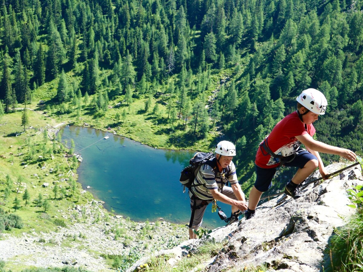
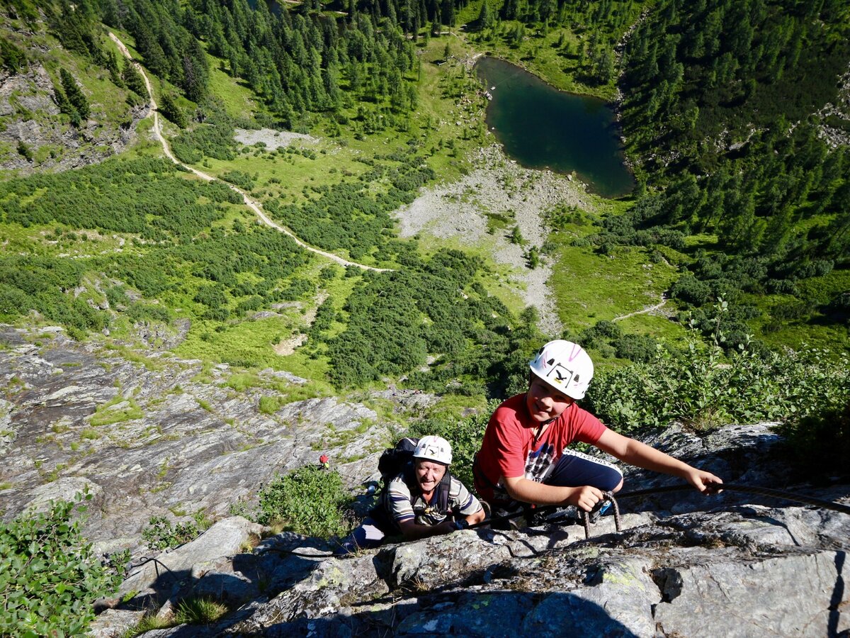
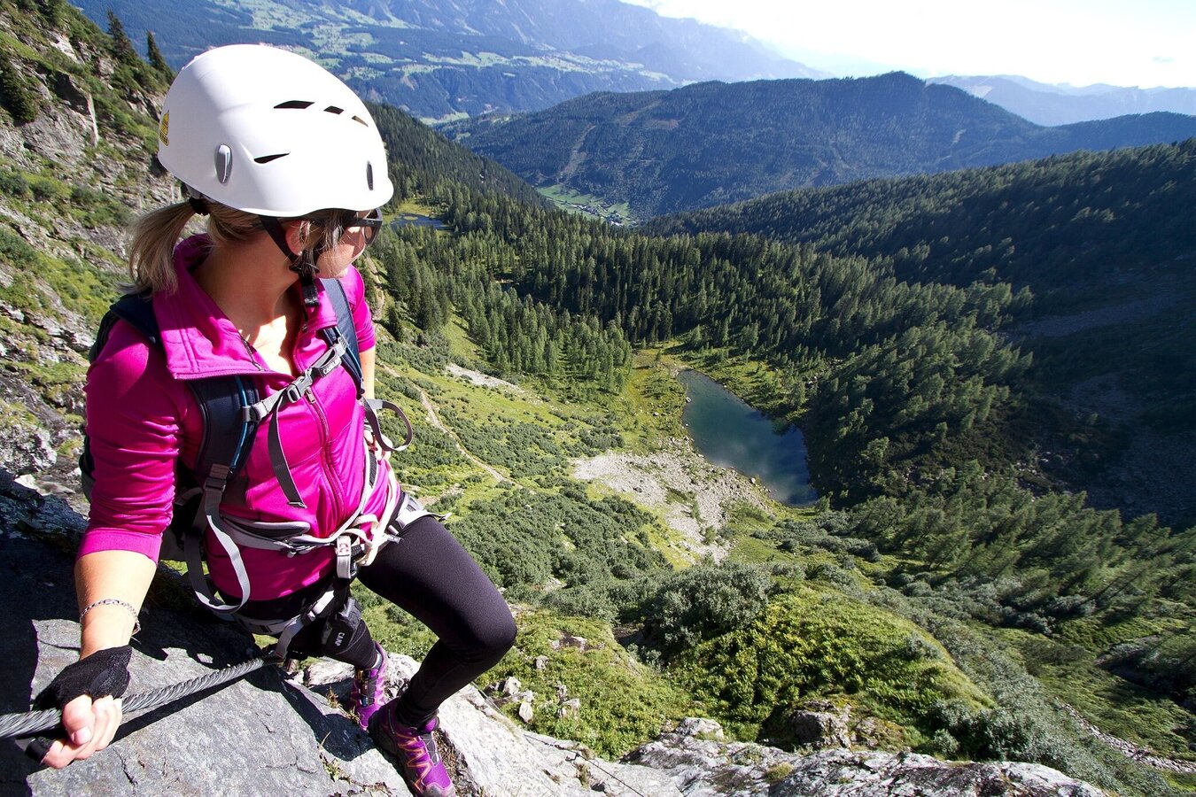
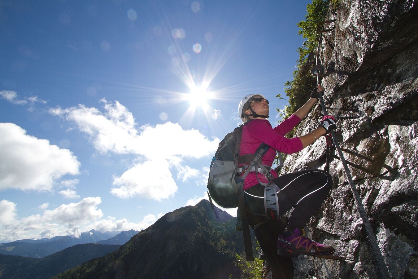
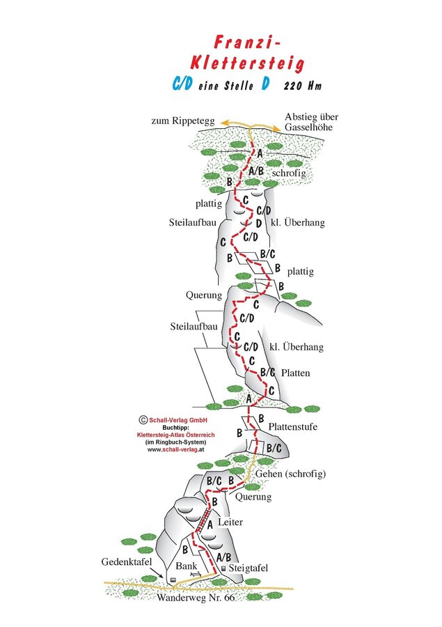
The Franz Klettersteig on the Reiteralm is the first via ferrata in the Schladminger Tauern. It is a via ferrata with several variants and a sporty route through the vertical Gasselwand between the existing hiking paths of the Reiteralm Rundwanderweg. It shouldn't be underestimated; The toughest passagae is in the upper section and demands major reliance on the steel cable. Good in combination with a hike to the top of the Rippetegg, with unique scenersy including constant views of the Dachstein massif.
Times:
- Via Ferrata - 1:00 h
- Time to Base - 0:30 h
- Time from Top - 0:45 h
- Total - 2:30 h
The tour
Map, elevation profile & further information
Approach to the ferrata:
From the Preunegg Jet top station, a half-hour hike in the direction of Mirror Lake brings you to the starting point, just above the hiking path next to a bench.
Descent:
At the top, continue right over the Gasselhöhe back to the starting point at the Preunegg Jet top station, alternatively, go to the left and climb up the Rippetegg (ca. 1:30).
Approximately 4 km West of Schladming take exit Pichl from highway B320 Ennstalbundesstraße and continue on Preuneggstraße road towards Reiteralm. Taking a couple of switchbacks you reach the valley terminal of Preunegg-Jet gondola which also operates in summer (operating times at www.reiteralm.at).
Otherwise continue on Reiteralmstraße road (toll road) to Eiskarhütte, Reiteralmhütte or Gasselhöh'-Hütte huts.
Parking is available at the valley terminal of Preunegg Jet gondola as well as at the huts of Eiskarhütte, Reiteralmhütte or Gasselhöh'-Hütte.
Ramsauer Verkehrsbetriebe offers a bus connection to the valley terminal of Preunegg-Jet gondola on Monday, Tuesday and Wednesday.
- Ramsau Verkehrsbetriebe buses: www.rvb.at
Further bus connections to the valley terminal of Preunegg-Jet gondola: Bus timetables | Schladming-Dachstein
From there take the cable-car (operating times at www.reiteralm.at) to the top.
Driving up by car via a toll road is also possible
The ferrata is NOT recommended for beginners, as it usually is moist/wet and therefore adds additional difficulty to the route!
Tour at own risk! No liability for Alpine dangers (weather, etc.).
Changes in weather patterns, quick falls in temperature, thunderstorms, wind, fog and snow are some of the dangers that can be encountered on a hiking tour. Hosts of alpine huts and mountain refuges have a lot of experience in the mountains and can give good advice about weather and the trails. Poor equipment, overestimation of one's own capabilities, carelessness, poor personal constitution and/or wrong judgement can lead to critical situations. In case of thunderstorms: avoid summits, ridges and steel ropes.
GPS data and orienteering
Available GPS data - just like hiking maps - is only a guidance for orientation and can never depict a trail exactly with all its details. Especially at dangerous spots it is essential to judge on site how to proceed.
In an emergency please call:
- 140 - for Alpine emergencies (all over Austria)
- 112 - European GSM emergency number
Via ferrata set, including climbing harness and helmet.
Difficulty:
a couple of C/D sections, mostly B/C and easier.
Security:
Safeguarded with metal bows and steel ropes.
Tourist information: www.schladming.com
Information about bus schedules: www.rvb.at
Information about cable-car operating times: www.reiteralm.at
- Topo, available at Alpinverlag.at
- KOMPASS Map 31 Radstadt, Schladming, Flachau - available in the Information Office Ramsau
- Summer Recreation Map WEST - available in all Information Offices in the region Schladming-Dachstein
