
Summit Tour to the Knallstein
Tour description
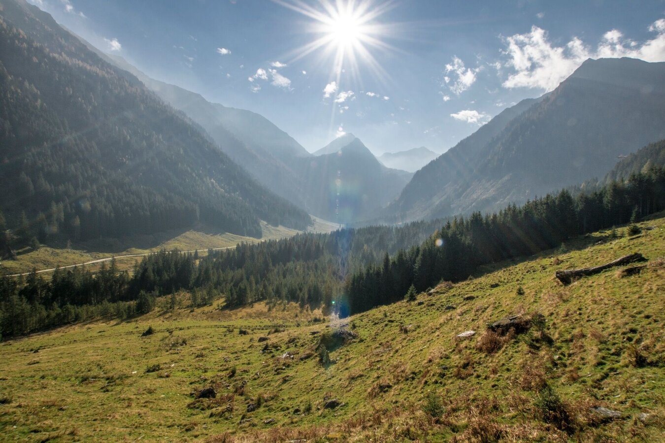
The small mountain village of St. Nikolai, at the turn-off for the Sölkpass, the beautiful onion dome of the church set against the magnificent backdrop of the Knallstein. Just beyond the car park at the entrance to the village, we make a right at the trail crossing and keep on the forest lane for about 30 minutes. At the first big bend, an alpine trail heads steeply uphill, a shortcut to bypass the extended switchbacks of the forest path. Walking through beautiful high forest, we pass the tree line and come to the Kaltherbergalm, with the first 500 vertical meters now under our belts.
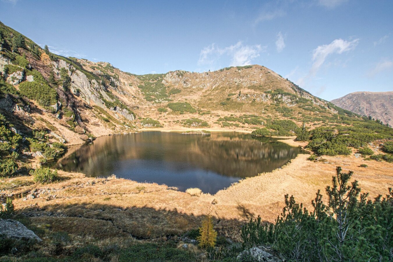
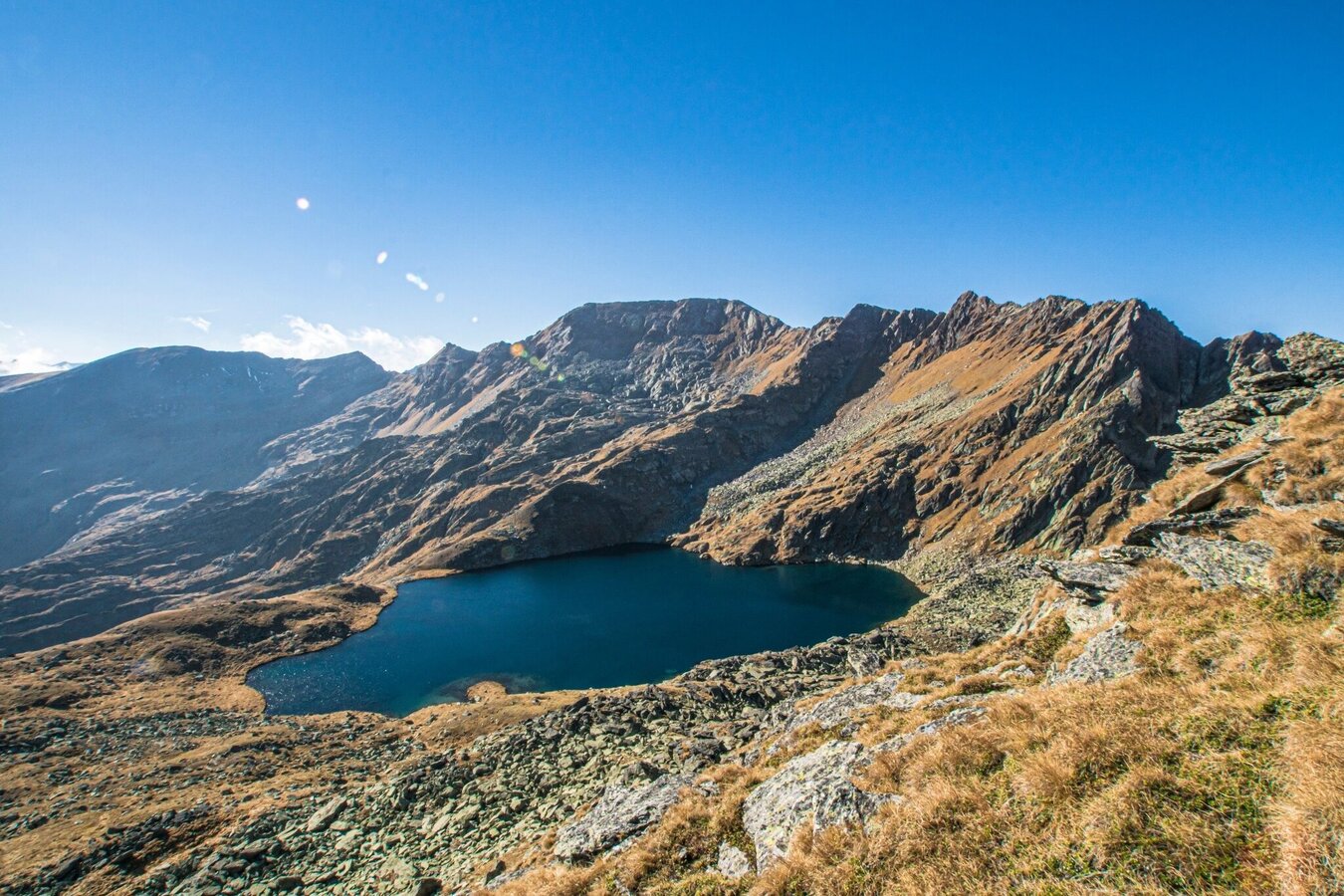
After these alpine pastures, our next climb already awaits (300 m), leading us up a steep ridgeline into a beautiful cirque, nestled amid which are two picturesque lakes, the Unterer & Oberer Klaftersee. The subsequent climb takes us to the left of the lakes, then up via a spur of rock accompanied by beautiful views back towards the lakes, an island of reeds and meandering streams. This section is filled with variety, bringing us relatively quickly to the next lake, just 300 m higher up: the Weissensee, elev. 2,229 m. After the gap, the mighty figure of the summit shows itself in all its immensity. In a giant semicircle, the rocky cirque with peaks as high as 2,500 m encloses the western side, while our ascent on the summit first takes us along the mountainside, then along the ridgeline itself. Only once we are on the ridge, do we have open views to the N, W and S.
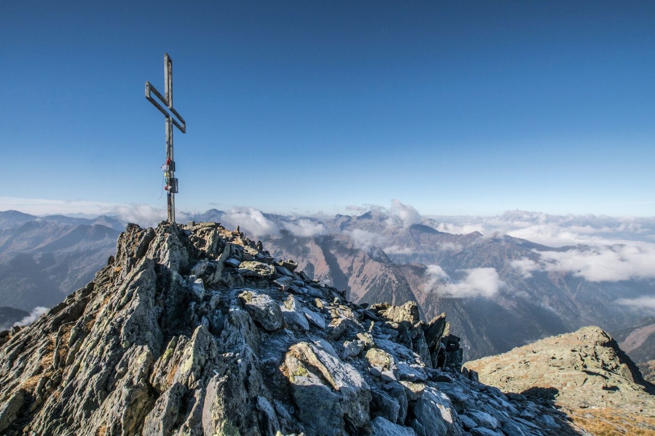
This significant peak towers above all other mountains within a wide radius, promising views that are exceptionally impressive. During our long hike down, we have plenty of time to take a close look at the various types of terrain; from rocky cirques to green alpine pastures, from larch forest to dark high forest.
The tour
Map, elevation profile & further information
Immediately after the parking lot at the entrance to the village of St. Nikolai im Sölktal, turn right at the crossroads and follow the forest road for a good 40 minutes. At the first big bend, an alpine path leads steeply uphill and shortens the longer serpentines of the forest road. Through beautiful high forest you reach the Kaltherbergalm above the tree line and have thus made the first 500 meters in altitude. After the alpine pastures, the next ascent (300 m) awaits, which leads steeply over a mountain ridge into a beautiful cirque, in which two picturesque lakes lie embedded, the Untere and the Obere Klaftersee.
The following climb passes the lakes on the left, then uphill along a rocky spur with a very nice view back to the lakes with the reed island and the interesting stream meanders. This section is very varied and brings us relatively quickly to the next lake, about 300 m higher, the Weißensee at 2,229 m above sea level. After the saddle, the enormous summit structure shows itself in its full size. In a huge semicircle, the rocky cirques with peaks up to 2,500 m enclose the western side, while the summit ascent leads first along the flank and then over the ridge. Only at the ridge you also have a clear view to the north, west and south. After a short stretch along the ridge, the summit is reached at 2,599 m.
Trail conditions: forest road, alpine paths, alpine paths. Stepped ascent to the summit.
Arrival at Stein/Enns train station with ÖBB.
Cab Stefan Mayer: +43 676 54 09 858
Valley bus from July 5 to September 7, 2025 - this makes crossings in the Sölktäler Nature Park possible. You can also travel comfortably by train and the valley bus will take you to the starting point of your hike. Click here for the timetable.
In the area of Kaltherbergalm you can meet free-roaming grazing cattle. Caution is required, especially with dogs. Extended tour - endurance required!
Weather changes, rapid drop in temperature, thunderstorms, wind, fog and snow fields are objective dangers and require the right behavior on the way. Hut keepers are experienced mountain connoisseurs, they can give good tips on the weather and the course of the trail. Lack of equipment, overestimation of one's own abilities, carelessness, poor physical condition and a wrong assessment can lead to critical situations. During thunderstorms: avoid peaks, ridges and rope belays at all costs.
GPS data and orientation aids:Available GPS data - as well as hiking maps - are only an orientation aid, since they can never represent an exact image or the richness of detail of a path in reality. Especially in the case of danger spots, it must therefore always be decided in the end on the basis of the conditions on site whether and how the further course of the path looks like.
In case of emergency, please dial the following emergency numbers:140 - for alpine emergencies - Austria-wideNo.112 - Euro emergency call GSM emergency call service
Take rainproof and warm clothes and enough water, possibly also a snack, wear shoes with non-slip profile soles. A first aid kit should also be in your backpack.SummitLynx - Your digital summit and hut book - available worldwide and always with you!
Mountain guides from the region: www.schladming-dachstein.at/mountainguides
For more information, please contact the Schladming Dachstein Tourist Office - Sölktäler Nature Park Information Center:
Phone: +43 3687 23310 501
mailto:info@schladming-dachstein.at
Stein an der Enns 107
8961 Sölk
The brochure “Schladming-Dachstein Hiking” is available in all information offices in the region.


