


Schladming Town Tour


Tour description
The walk through the old town of Schladming takes you past historic buildings and sites, which are often connected with the mining history of Schladming. Also, the tour takes you to popular places of the more recent history, such as the Planai stadium, being the finishing area at the Alpine Ski World Championships in 1982 and 2013.
The walk takes you to the following buildings and sites (among others):
- Planai stadium
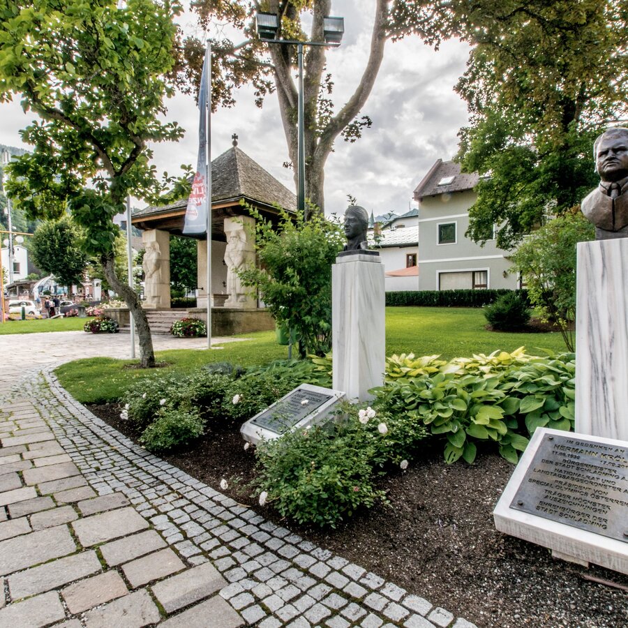
- Schladming town hall & Rathaus park containing several memorials
- "Alte Post" - today the Johann hotel in Schladming, being the oldest inn in town
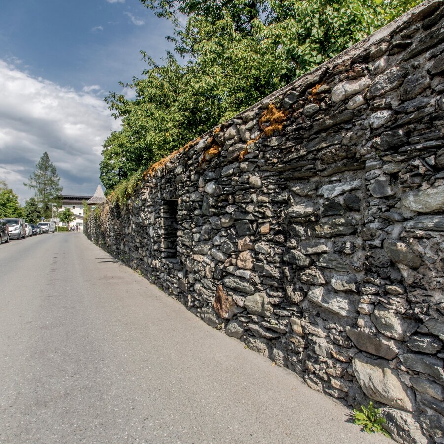
- Remnants and ruins of Schladming's town wall and fortification
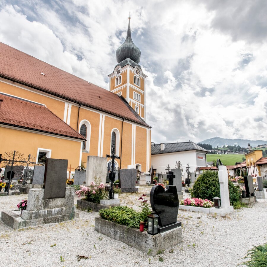
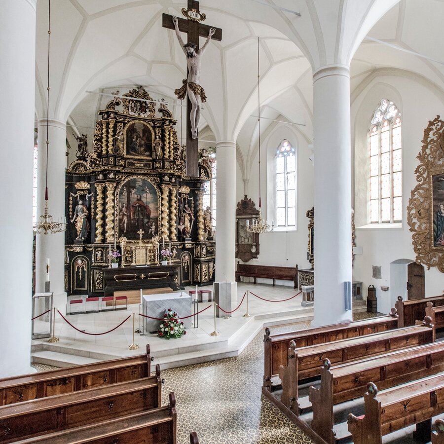
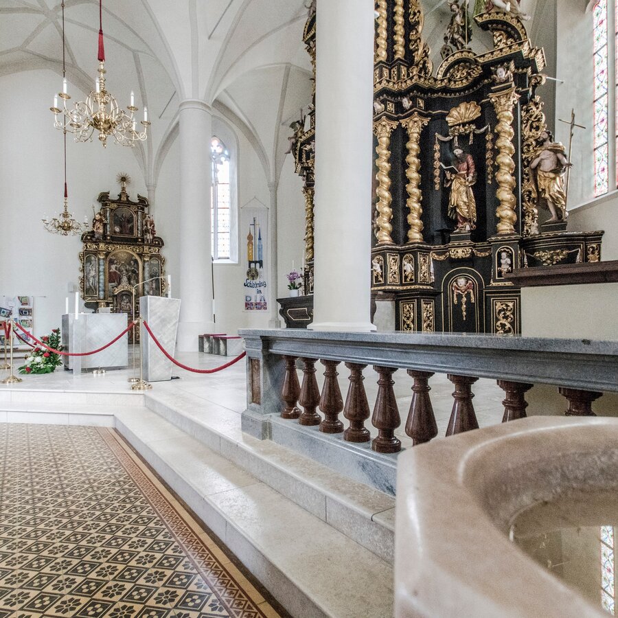
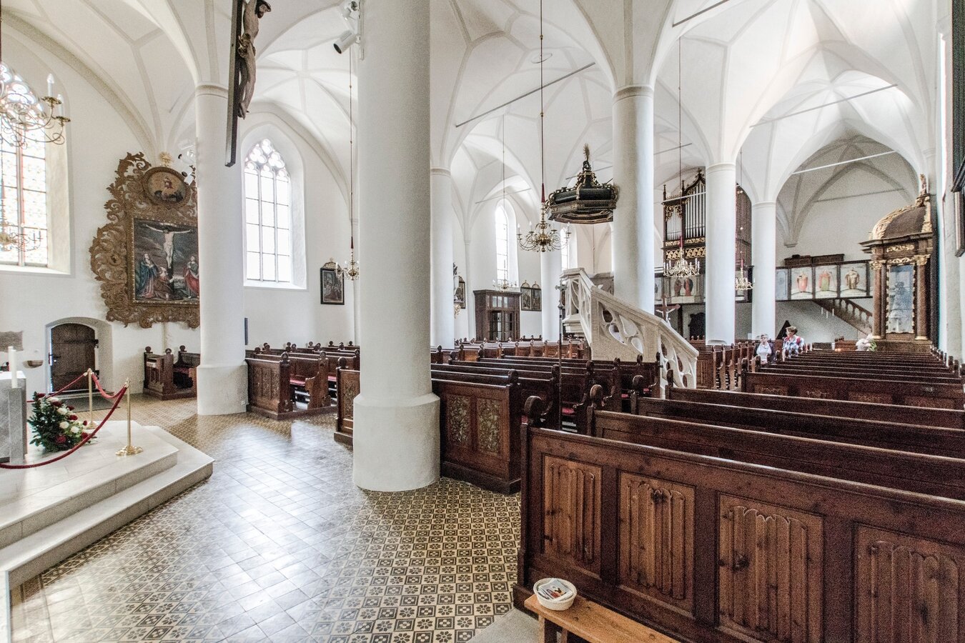
- Protestant church of Schladming, Peter & Paul
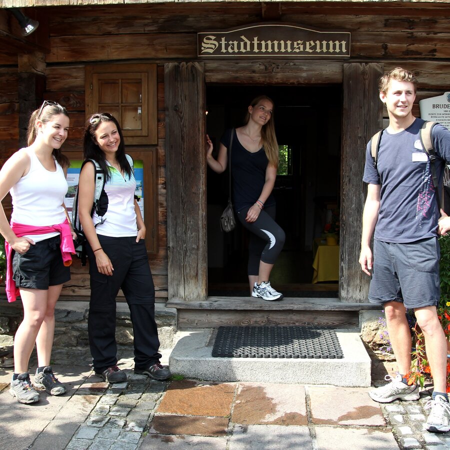
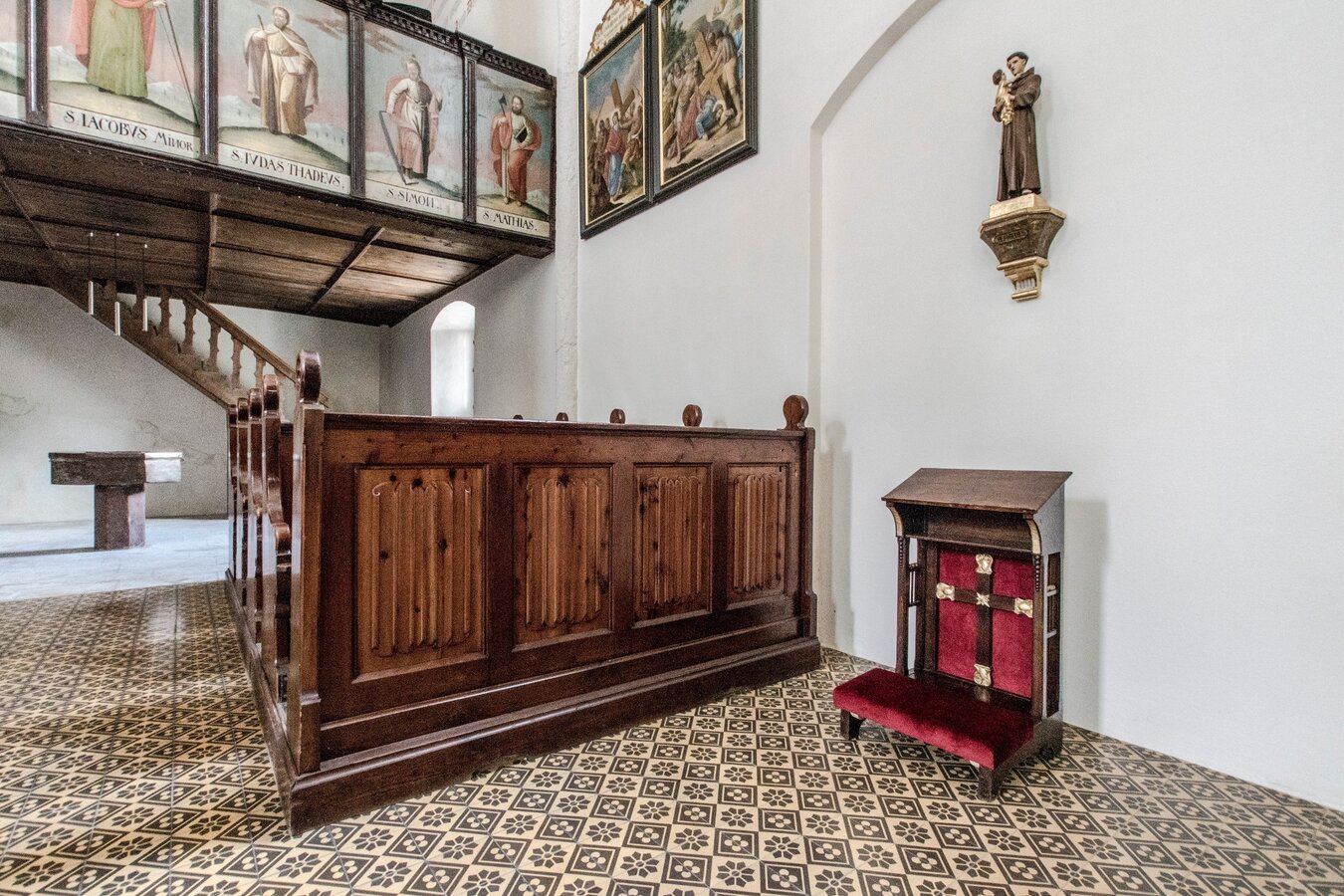
- "Bruderladehaus" - today the town museum
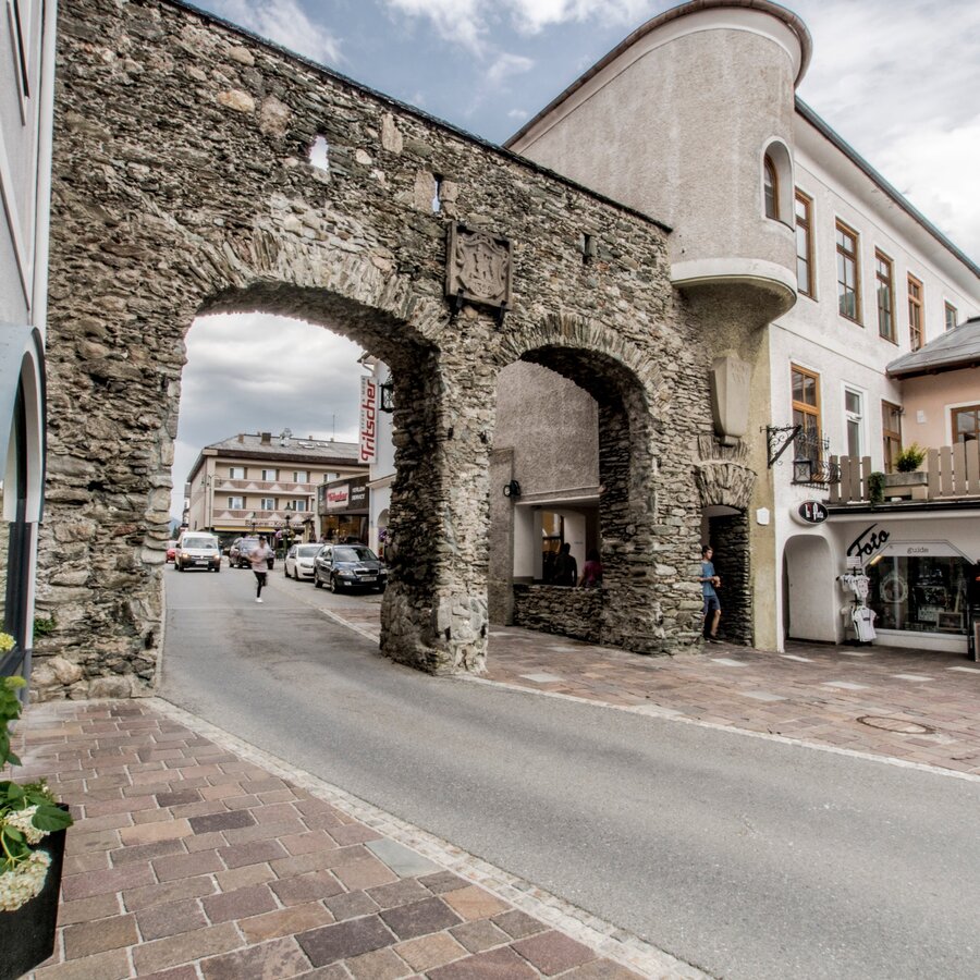
- Salzburger Tor - the last remaining one of the formerly 3 town gates
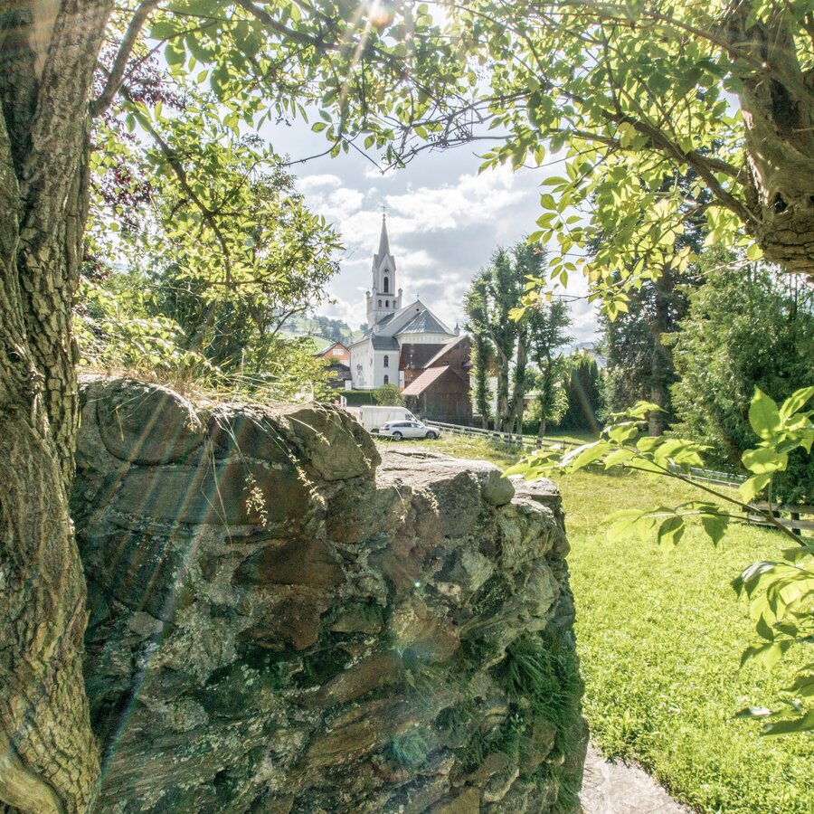
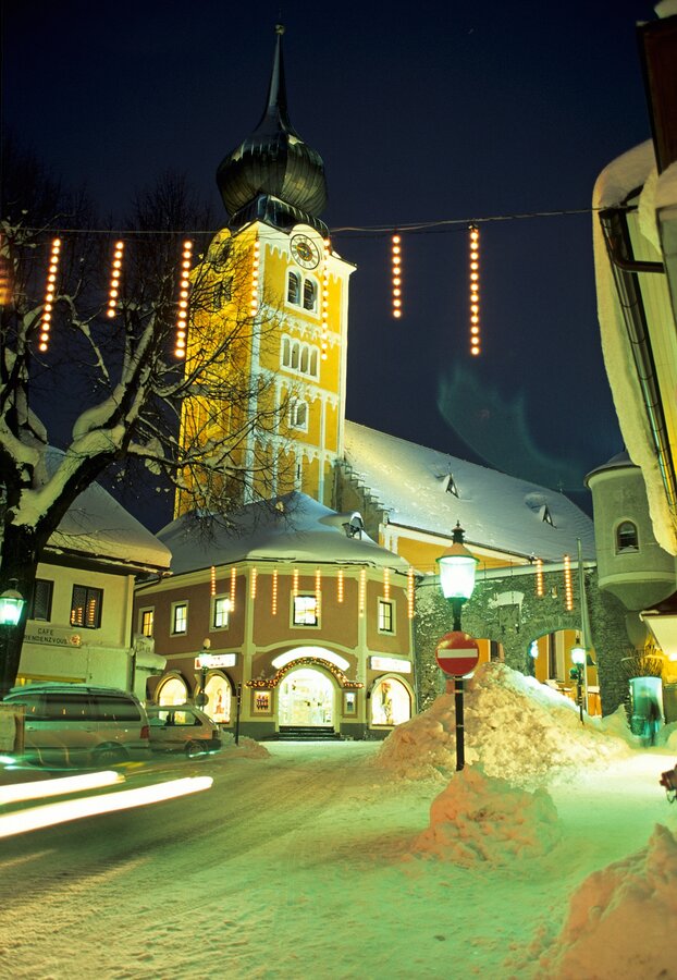
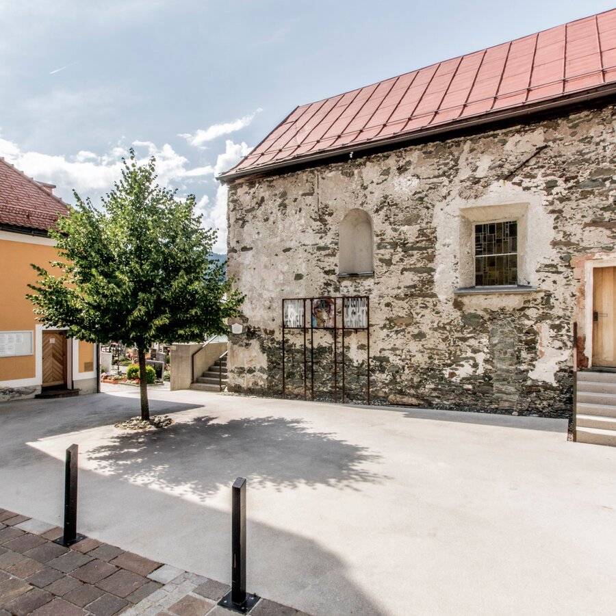
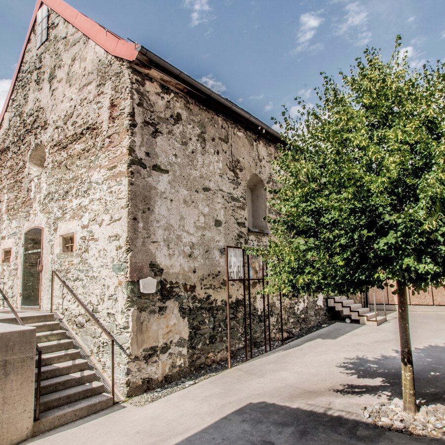
- Catholic church of Schladming, St. Achatz
- Anna chapel Schladming with historic tomb slabs
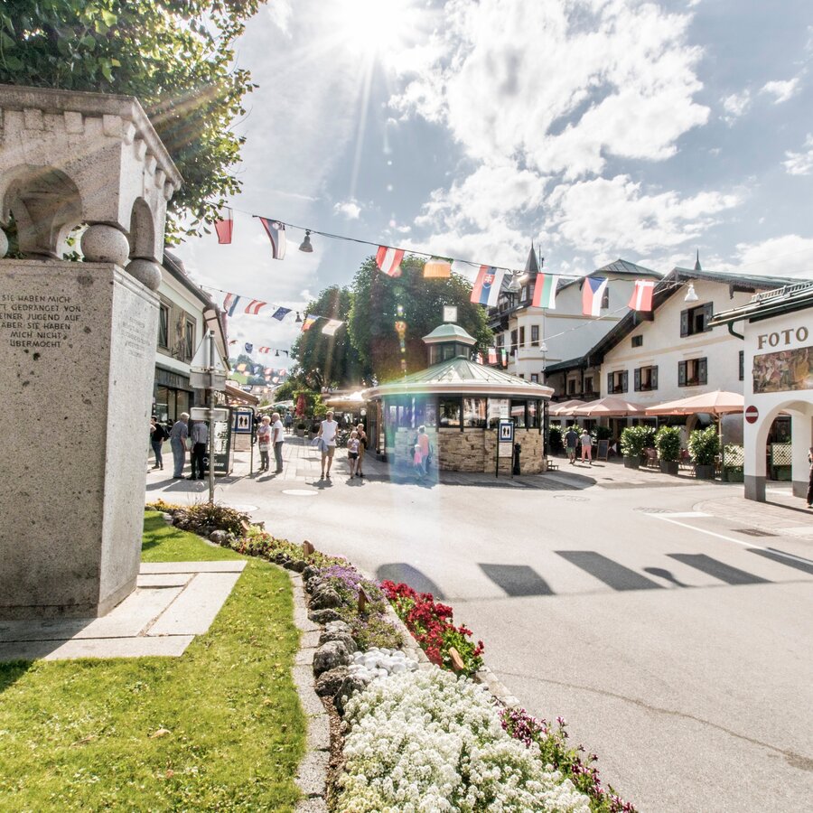
- Main square Schladming (pedestrian area)
The tour
Map, elevation profile & further information
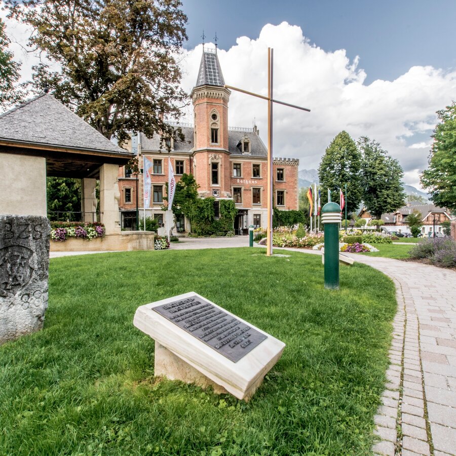
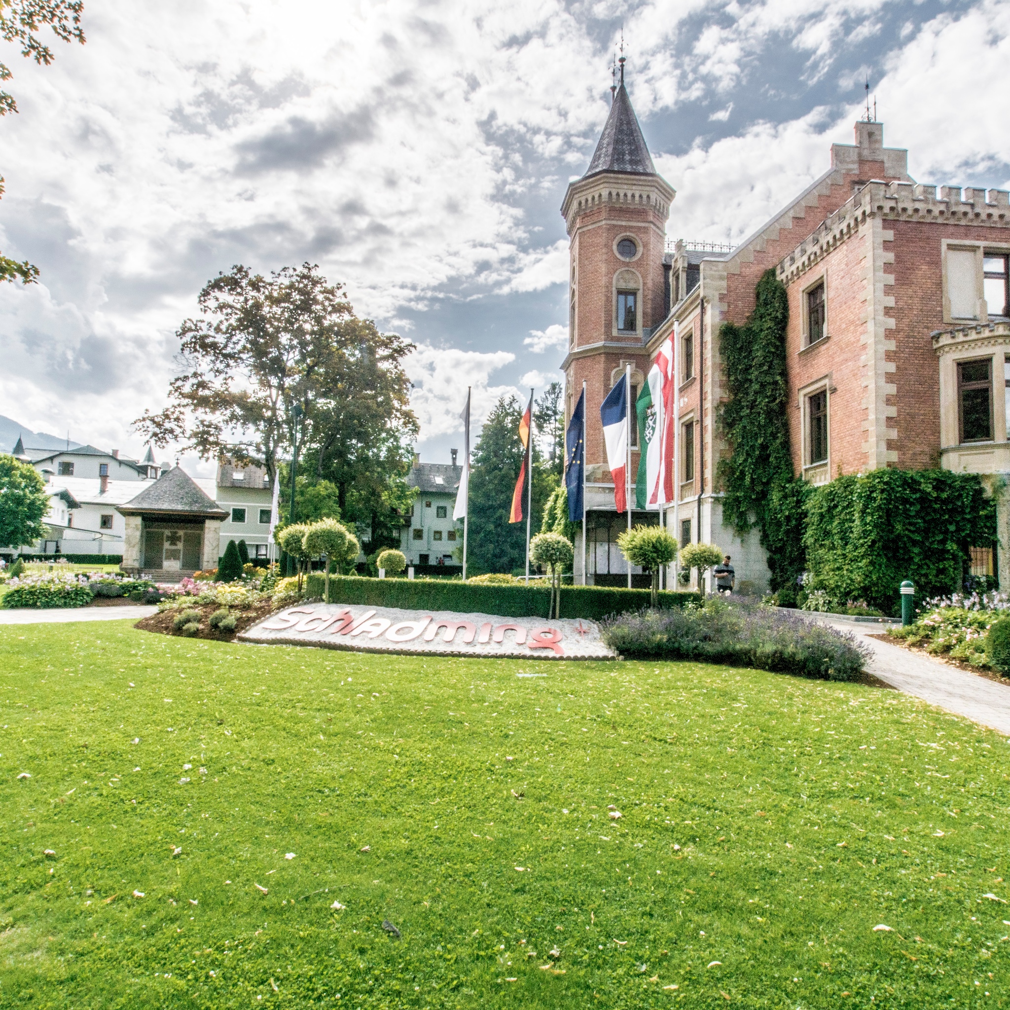
The tour starts at Rathausplatz square which is situated next to (north) of the town hall of Schladming township. The square is one of the main bus stops within the town of Schladming. Next to it, parking lot "P3" is the most central parking lot for individual traffic.
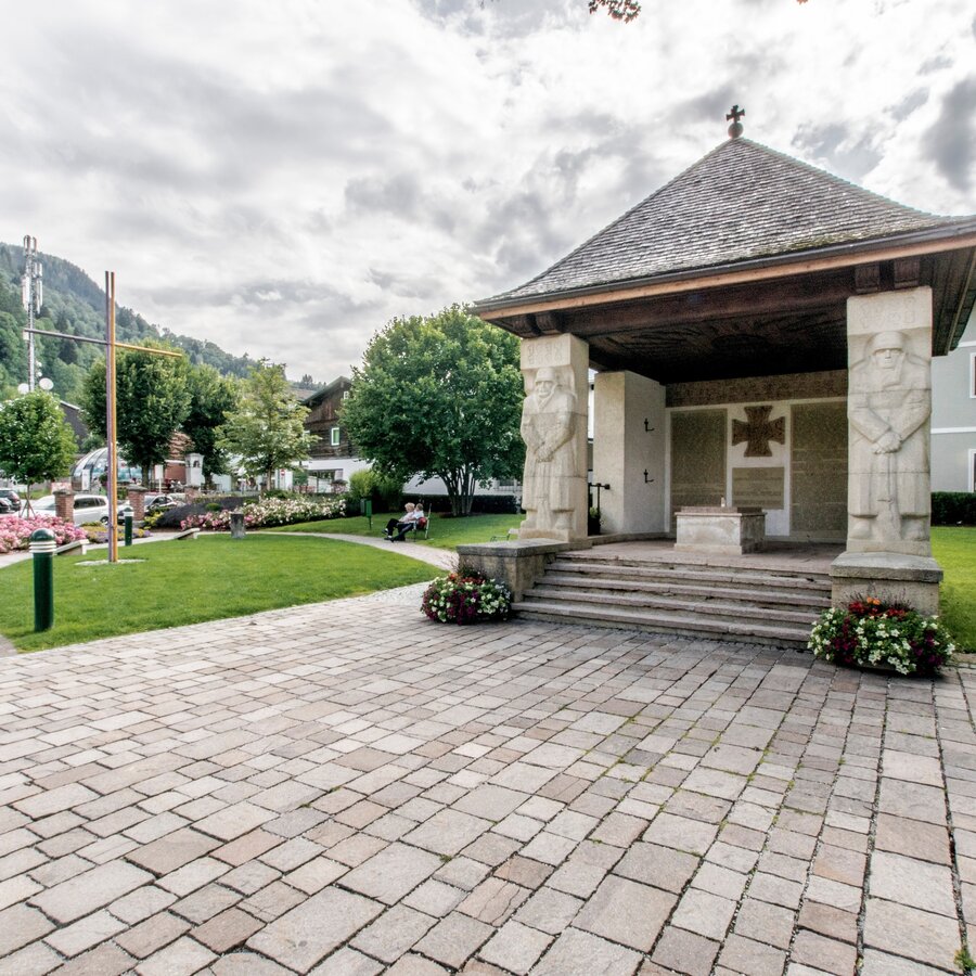
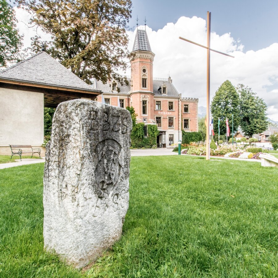
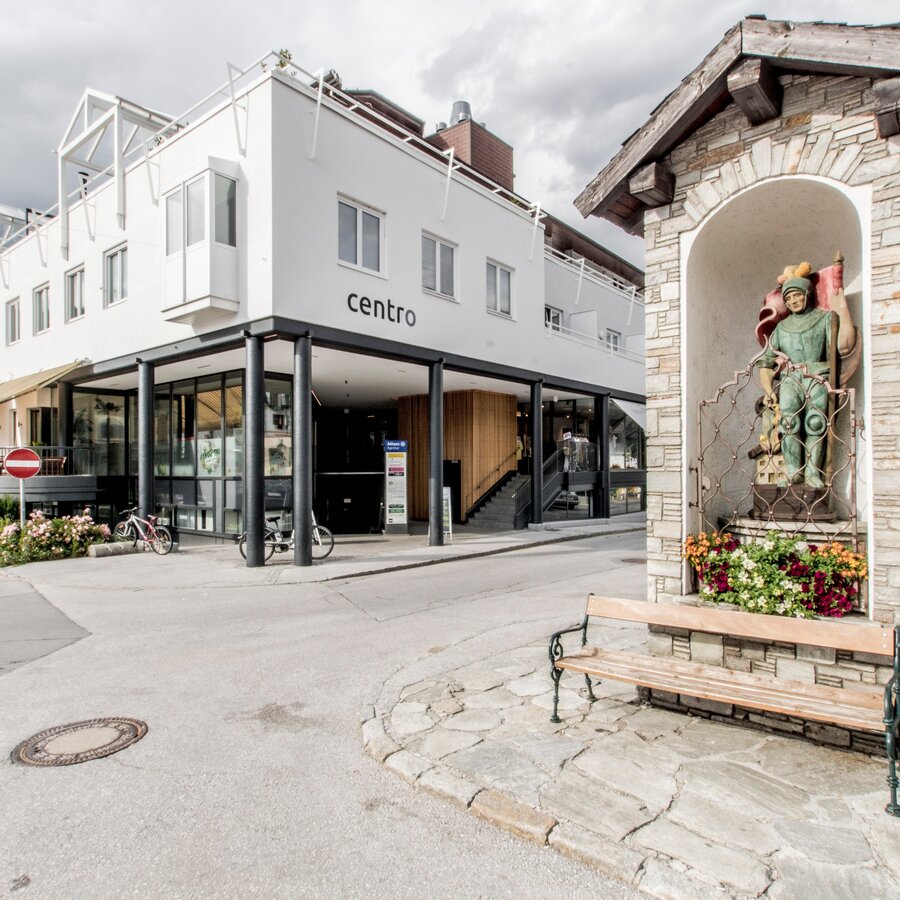
From Rathausplatz you start the tour towards Schulgasse (west) where you will encounter the last remaining watch tower of the former town wall after just a couple of steps. Walking the passage between the tower and the public toilet there, the foot and cycling path takes you into the small Rathaus park, surrounding the town hall of Schladming, which was originally built as a hunting lodge. The "Bürgerschafts-Burgfriedstein" is also located in the park, being one of the boundary stones formerly used to declare the boundaries of the township. The stones bears the coat of arms used by Schladming when it held the title of market town. Moreover, the park accommodates badges of Schladming's twin towns, a war memorial and a playground.
At the southwestern corner of the park, the main square (being a pedestrian area) connects to the park. Here the war memorial of the Peasant's War reminds of the rebellion of farmers and miners in 1525. Opposite of the memorial, Hotel JOHANN (formerly known as "Alte Post") is home to the oldest inn of Schladming (about 400 years old). Before continuing into the old town and the pedestrian area you turn around and walk along Coburgstraße road (past the Rathaus park to the East). You walk straigjt at the roundabout traffic and reach the Planai stadium. Presumably, the area along Coburgstraße road was the location of the first settlements in Schladming.
Have a look at the Planai stadium and then head back for the town center. For doing so, take the "Schießstattgasse" foot path between "Tauernhof" bible school and Intersport "Charly Kahr", taking you to the Berggasse alley. Make a left there and follow it to the ruins of a watch tower (from 1629). Walk back into the direction of the town hall (via Karolinengasse) and make a left into "Ritter-von-Gersdorff-Straße" (at the Generali insurance office), the street being named after a mining tradesman. The first house on the left side of the street is the "Reißingerhaus", which used to be in possession of Ritter von Gersdorff knight.
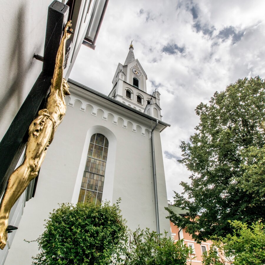
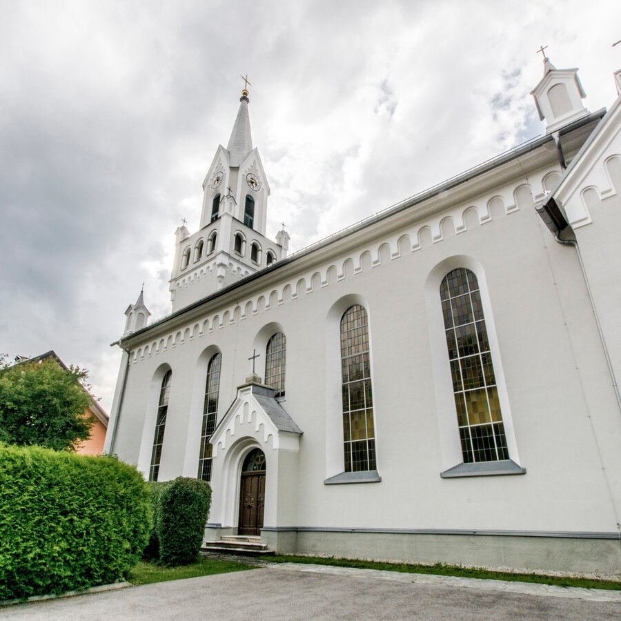
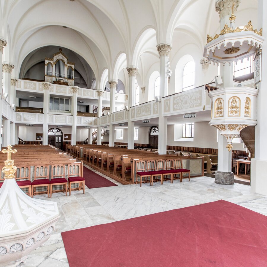
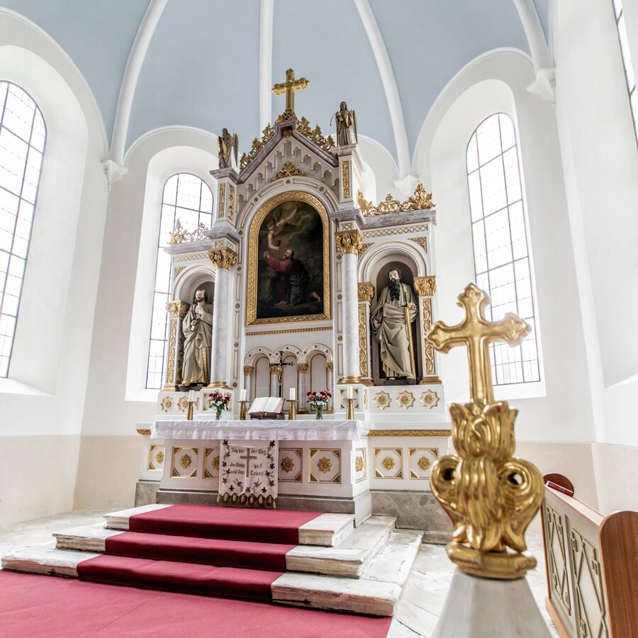
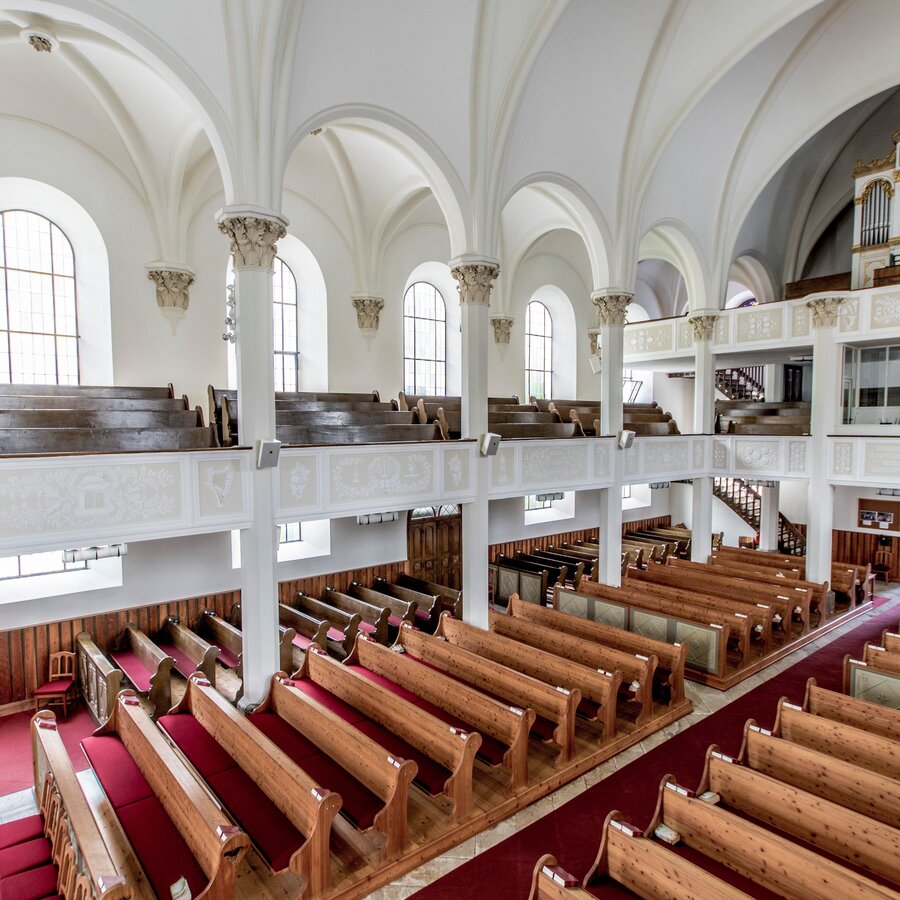
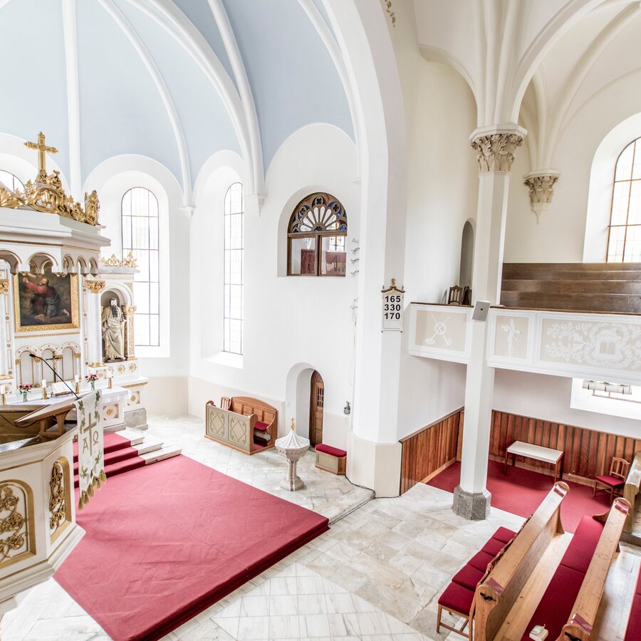
The road flows into "Vernouilletgasse" alley at the "Blue Tomato Shop" - "Vernouillet" being one of the pioneers establishing tourism in Schladming. Walking west, you pass by the Protestant rectory and you reach the (white) Protestant church, Peter & Paul. The northern facade of the rectory shows a stuff ore - indicating that it used to be a building of the mining administration.
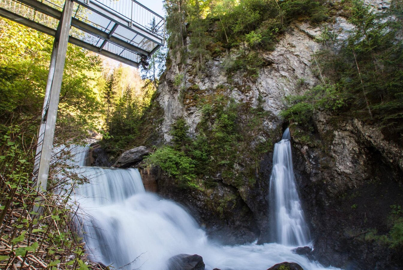
You then walk past the church and continue along Martin-Luther-Straße road until you reach the entrance to Talbachklamm gorge. The wide trail through the gorge is the beginning of the theme trail "Wild Waters" (information boards about the trail can be found at Kraiter parking lot which you pass by) and leads slightly uphill to the neighbouring village of Untertal. In the course ot the town walk you only walk up to the viewing platform (about 150 meters into the gorge).
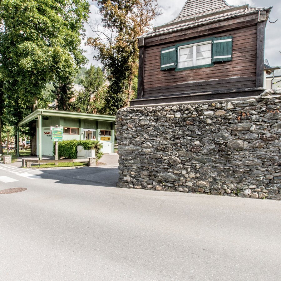
Walk back to the intersection Martin-Luther-Straße/Talbachgasse and make a left which takes you downhill the steep road passage of "Geißbühel" ("goat hill" owes its name to the fact, that goats were driven up here to the higher alpine pastures via this hill). The intersection on top of the hill used to be the location of one of the town gates of Schladming, the so-called "Fleischer-Tor". Walking down the Talbachgasse road you reach the "Bruderladehaus", a former welfare institution of miners, nowadays the town museum Schladming.
From the town museum continue North and walk on into Ramsauer Straße until you reach the house n° 133 (left street side). This house is a historic miners' house with artistic paintings on the folding shutters. This district of town used to be place for crafts and workshops when Schladming was an important mining town.
Via the footpath at the miniature golf site you walk over to Dachsteingasse. Make a right (to the Southeast) and continue straight on, until you reach Salzburger Straße right in front ot the last remaining town gate - the "Salzburger Tor". Next to it, there are the catholic church "Saint Achatius" and the Anna chapel, displaying historic tomb slabs on the outer walls. These huge stones (from the 16th century) used to be placed on top of the graves and are made from red marble. A well preserved section of the former town wall is surrounding the graveyard at the catholic church.
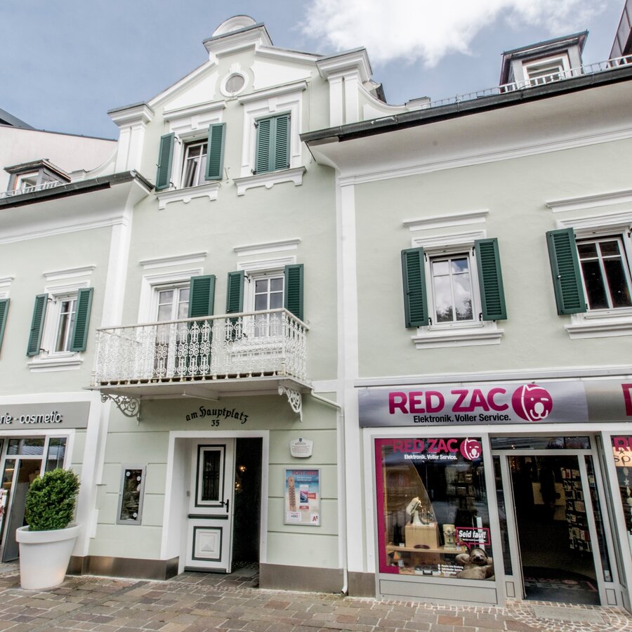
From Kirchplatz square at Anna chapel you follow the Salzburger Straße road (which runs north here towards the Protestant church in the South) to the pedestrian area at main square. On the square, the first building to the left is the county court, originally built by Johann Ritter von Gersdorff (a mining administrator). It also used to be the home of composer Ernst Ludwig Uray, born in this house.
The second house on the opposite side (behind the music pavillon) used to be the town hall, when Schladming was still a market town (constituting itself in 1849). You can now walk back to your starting point via the main square. However, it is interesting to take a left into Steirergasse in the middle of the square and walk to the statue of Saint Florian. This wooden statue was created by sculptor Helmuth Simonlehner from Schladming. Continue straight past the statue and then make a right into Schulgasse. Along another well preserved section of the town wall you walk back to the starting point at Rathausplatz square.
Parking lot "P3" (fee), directly at Rathausplatz square.
Buses can also park here.
In the town of Schladming you can take the Citybus. From Rohrmoos take the Planai buses to Rathausplatz, from Ramsau take the buses of Ramsauer Verkehrsbetriebe. Bus stop "Rathausplatz".
- Citybus and buses from Rohrmoos - www.planaibus.at
- Buses from Ramsau - www.rvb.at
Basically, the tour is possible year-round. However, especially the section from the trail head Wild Waters at Kraiter car parking to the viewing platform above the Talbach river at Talbachklamm can be slippery during the winter months due to the constantly high humidity coming from the river in the gorge. Please be especially careful!
- Hiking or trekking shoes with grip sole, jacket.
- The trail is also suitable for prams.
- Audio guide app "Story2Go Schladming" for your smartphone.
There is also the possibility to take part in a guided tour through the town. Information is available at the tourist office Schladming.
-
App-Store-Download "Story2Go Schladming"https://apps.apple.com/at/app/story2go-schladming/id1571490862
-
Google-Play Download "Story2Go Schladming"https://play.google.com/store/apps/details?id=de.radiotourism.story2go.schladming
- Website of the township of Schladming containing interesting historic information:http://gemeinde.schladming.at/index.php/stadtgemeinde/sehenswertes.html
- Website of the town museum Schladming:http://museum.schladming.at/
- Schladming-Dachstein FROM ABOVE - 360° drone images with bird's eye view of Schladming:https://vonoben.schladming-dachstein.at/sommer/
- content page of Schladming:https://www.schladming-dachstein.at/en/schladming
- Schladming town map, available at the tourist office Schladming.


