


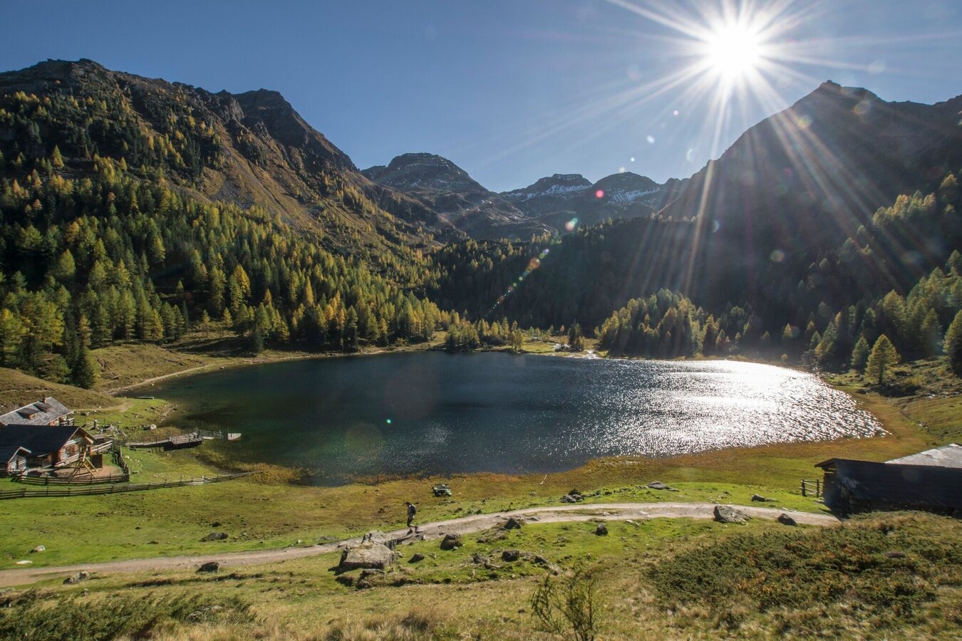
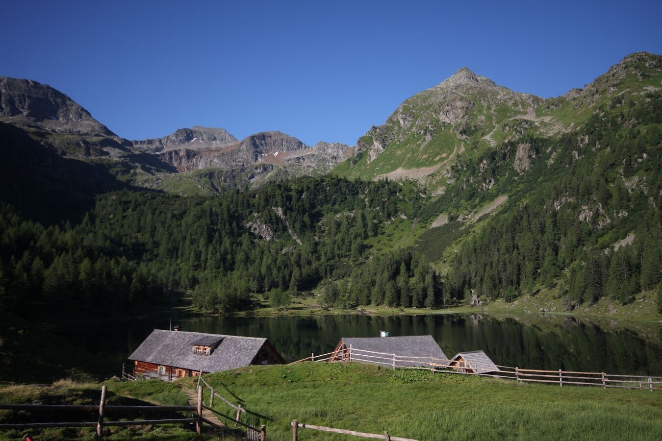
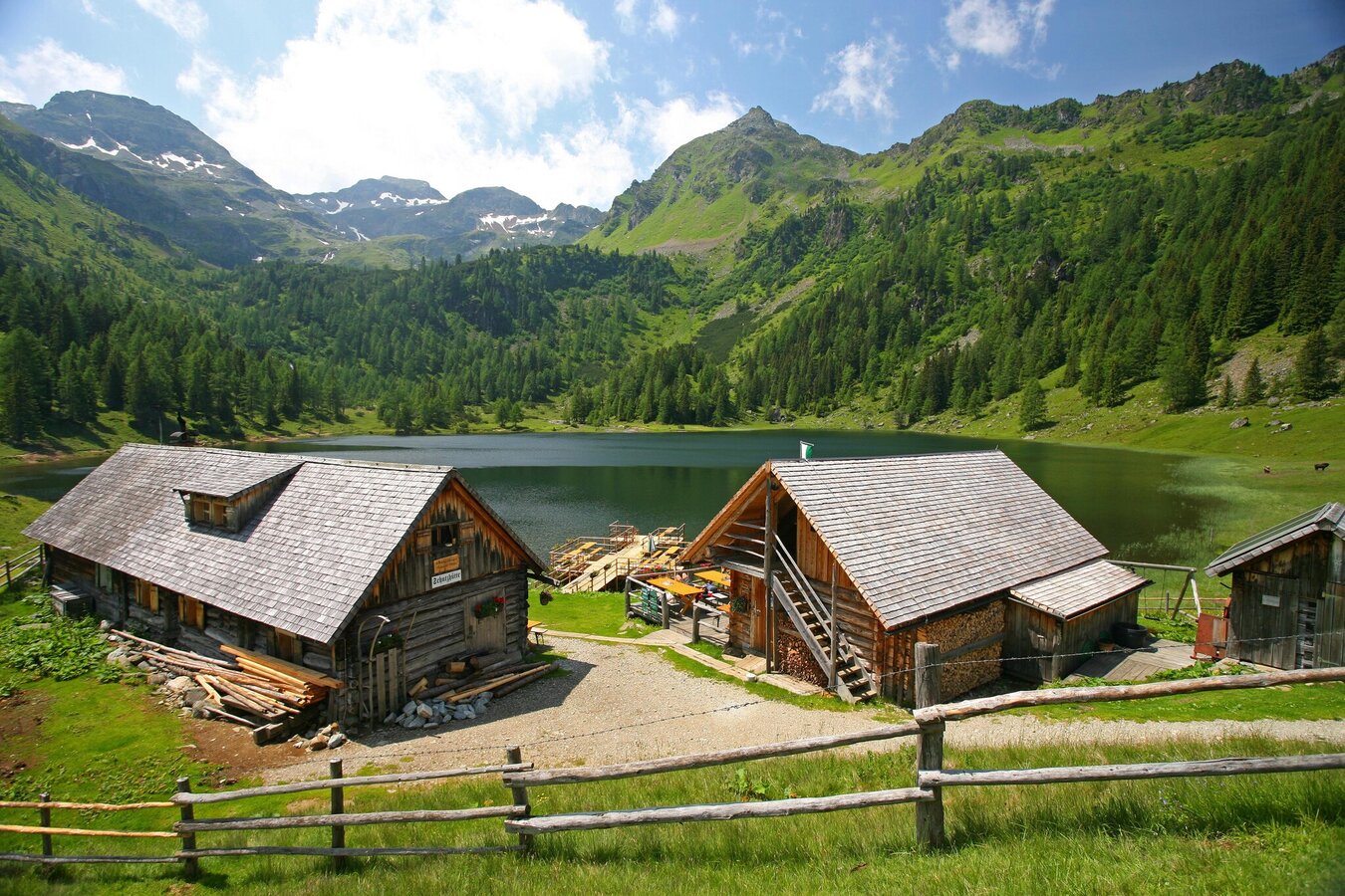
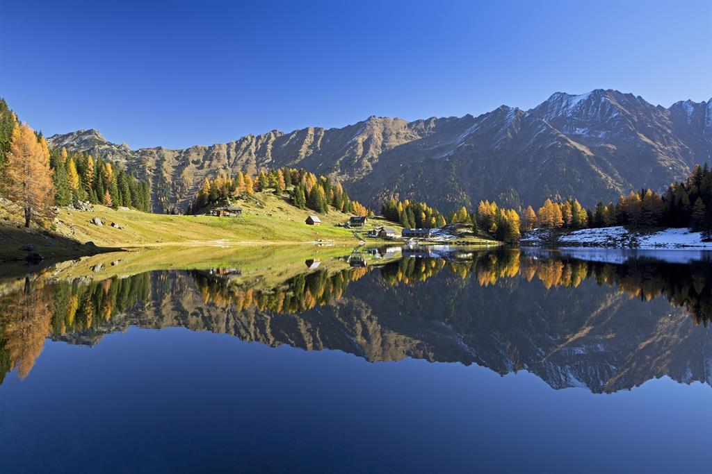
Duisitzkarsee Lake - a gem of nature

Tour description
Attention: It is recommended to use the alpine trail no. 775 to the middle. After that, the hike should be continued along the forest path!
The hike to Duisitzkarsee Lake starts from the valley floor at Eschachalm. Through pine forest with 2 larger clearings you ascend to one of the most popular photo motifs in Styria. In the warm summer months the lake is also a good opportunity for refreshment. Be considerate of the fish in the lake and avoid, for example, stirring up dust. In addition, please do not go into the water with sunscreen, as this can upset the sensitive ecology of the lake.
The tour
Map, elevation profile & further information
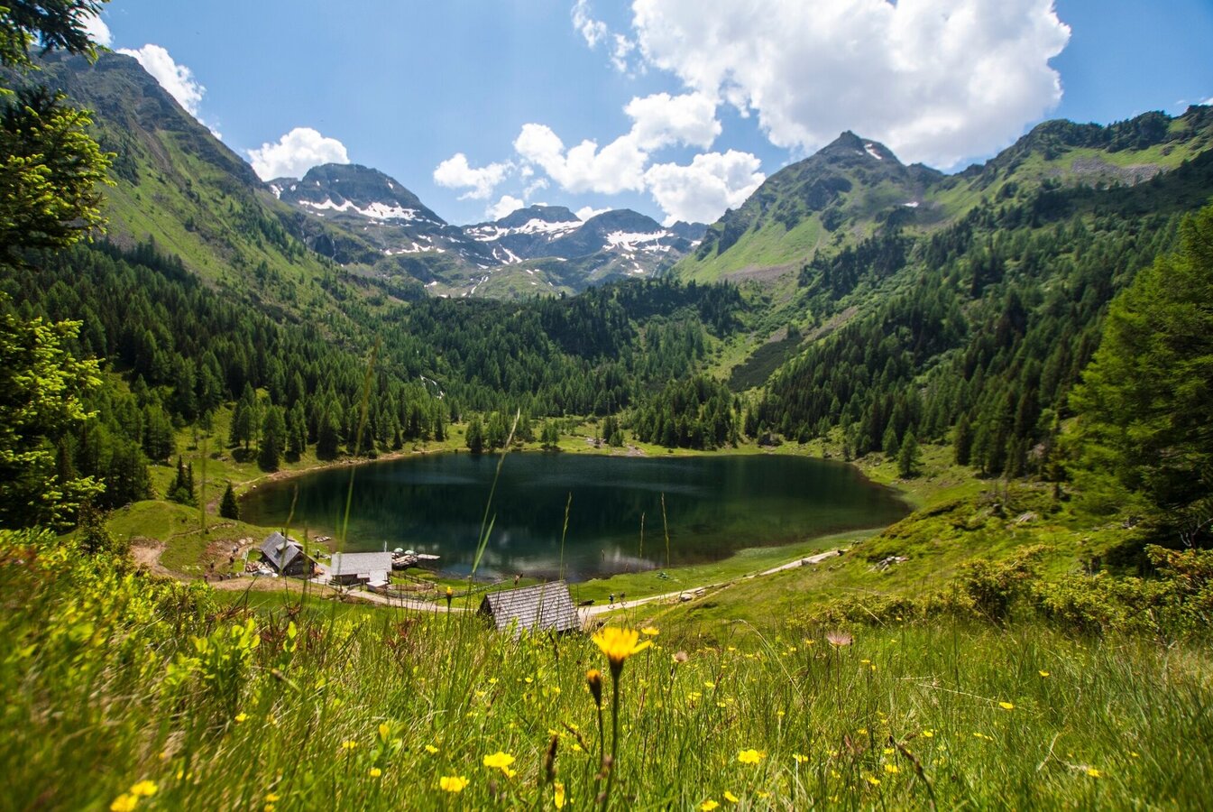
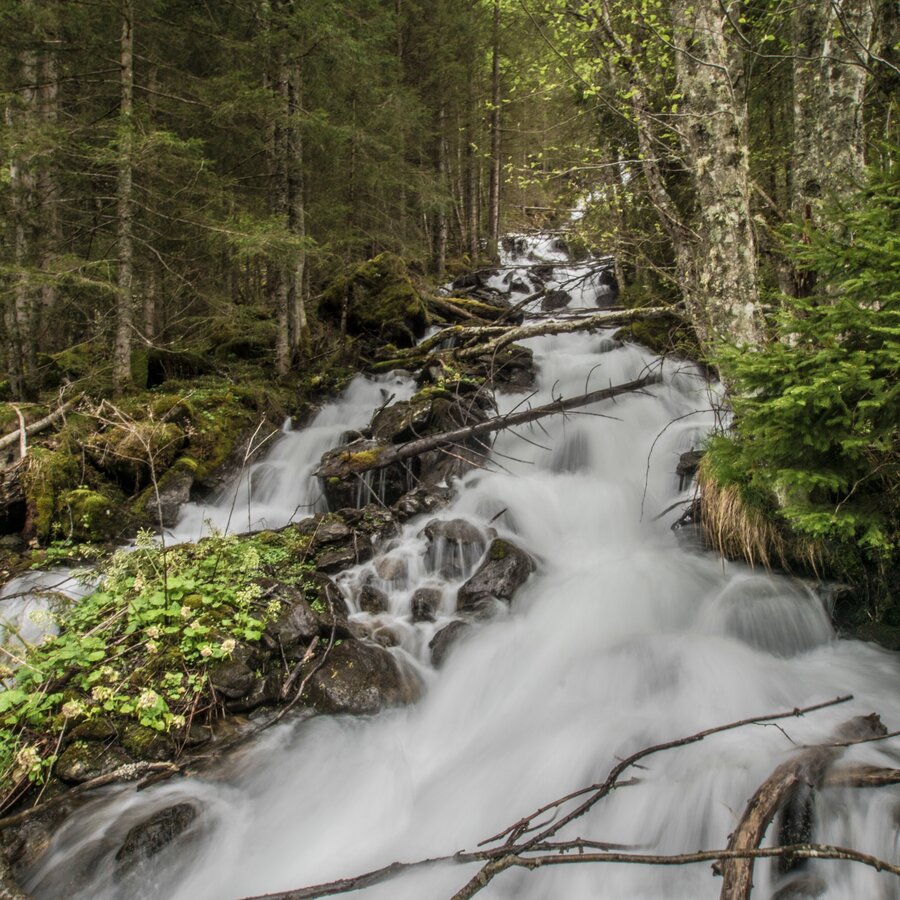
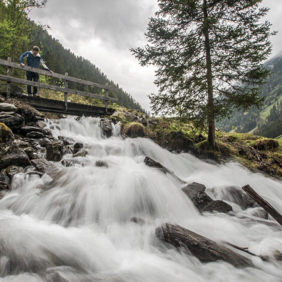
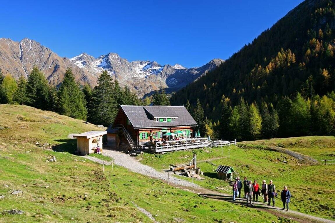
From the trail head at Eschachboden you follow trail n° 775 towards Duisitzkarsee Lake. At the beginning the trail ascends quite steeply, passing the waterfall of Seebach creek through the pine forest on the way to Saghütten chalets, which you reach after approximately 45 minutes. After a short break you continue to the clearing of Kesslerboden where the trail is a little less steep than in the beginning. Saghütten and Kesslerboden offer a great view to the valley head of Obertal valley with Samspitze, Sandspitze, Zwerfenberg and Elendberg summits.
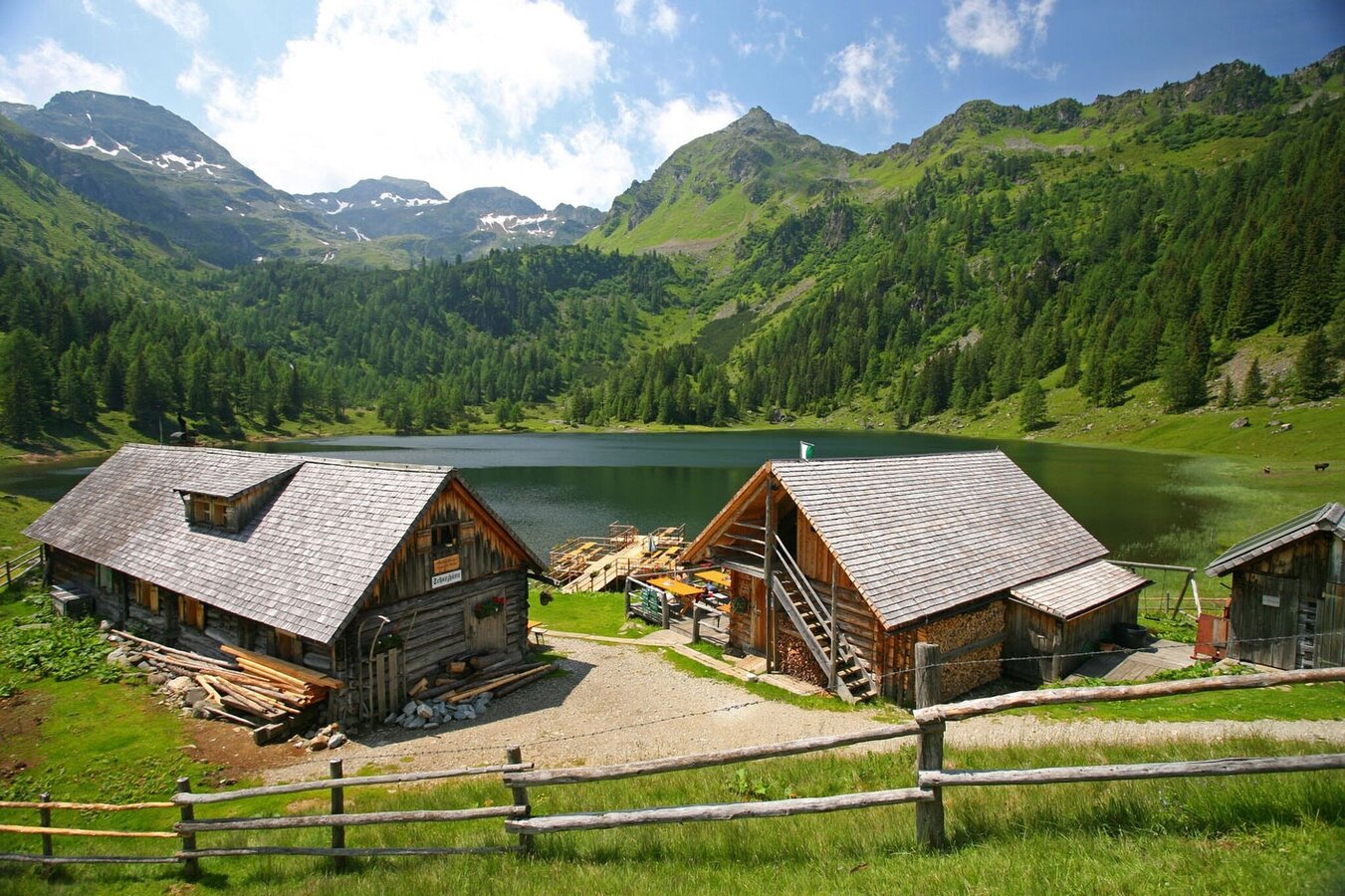
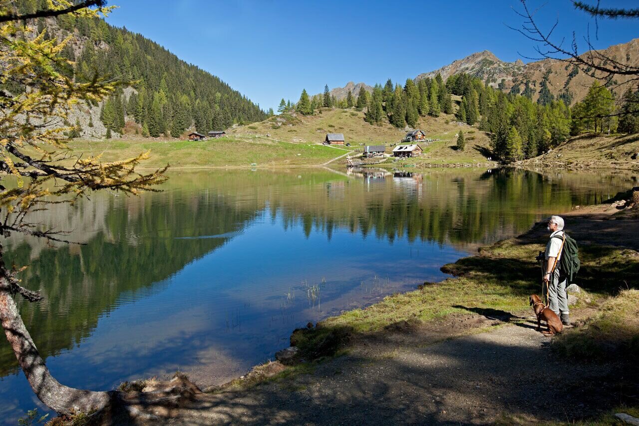
Beyond Kesslerboden the trail starts to ascend steeper again. After a couple of switchbacks through the forest you reach Duisitzkarsee Lake after another 30 minutes, where Duisitzkarseehütte and Fahrlechhütte chalets invite for refreshments and a snack. Duisitzkarsee Lake is a picturesque mountain lake and the hike is a perfect option for families.
The hike is also possible along the forest road, this takes about 15 minutes more to the lake.
- Buses of Planai-Hochwurzen-Bahnen: www.planaibus.at
Changes in weather patterns, quick falls in temperature, thunderstorms, wind, fog and snow are some of the dangers that can be encountered on a hiking tour. Hosts of alpine huts and mountain refuges have a lot of experience in the mountains and can give good advice about weather and the trails. Poor equipment, overestimation of one's own capabilities, carelessness, poor personal constitution and/or wrong judgement can lead to critical situations. In case of thunderstorms: avoid summits, ridges and steel ropes.
GPS data and orienteering
Available GPS data - just like hiking maps - is only a guidance for orientation and can never depict a trail exactly with all its details. Especially at dangerous spots it is essential to judge on site how to proceed.
In an emergency please call:
- 140 - for Alpine emergencies (all over Austria)
- 112 - European GSM emergency number
A well-packed backpack is helpful and especially when touring Alpine terrain a tuque, gloves, a windproof jacket and pants are standard equipment. Good, waterproof shoes, sun glasses, sun cream and sufficient beverages are essential too. Torch light, a map of the area, knie and a small first-aid kit should also be in the backpack.
Ankle-high hiking shoes are recommended.
We highly recommend a hike to the lake in autumn. The golden larch trees give a special atmosphere to the lake and the cirque. No matter which time of the year - spring, summer or fall - a short walk around the lake is always a good option!
From the valley head at Eschachalm further into Obertal the landowners do not allow to bring along dogs.
Tourist information: www.schladming.com
Information about bus schedules: www.planaibus.at
- Hiking map ‘Hiking WEST’ available at the information offices in the region.
- Schladming hiking map, 1:25,000, available at the Schladming information office.
- Hiking map Schladming-Dachstein, 1:50,000, available at the information offices in the region.
- Hiking guide Schladming-Dachstein by Herbert Raffalt, available at the information offices in the region.


