
Winter Walking in Untertal
Tour description
The inns along the route serve regional dishes, some of which use products from their own farms. There are entry points at the Hinkerbrücke, at the Tetter Inn, at the observation tower at the Tettermoor, at the Waldhäuslalm, near the Sondlalm and at the Weiße Wand Inn.
Please avoid using the nearby cross-country ski trails. These are groomed for cross-country skiers and unfortunately footprints in the trail make cross-country skiing much more difficult.
The Untertal winter hiking trail has been awarded the Austrian Hiking Quality Seal.
The tour
Map, elevation profile & further information
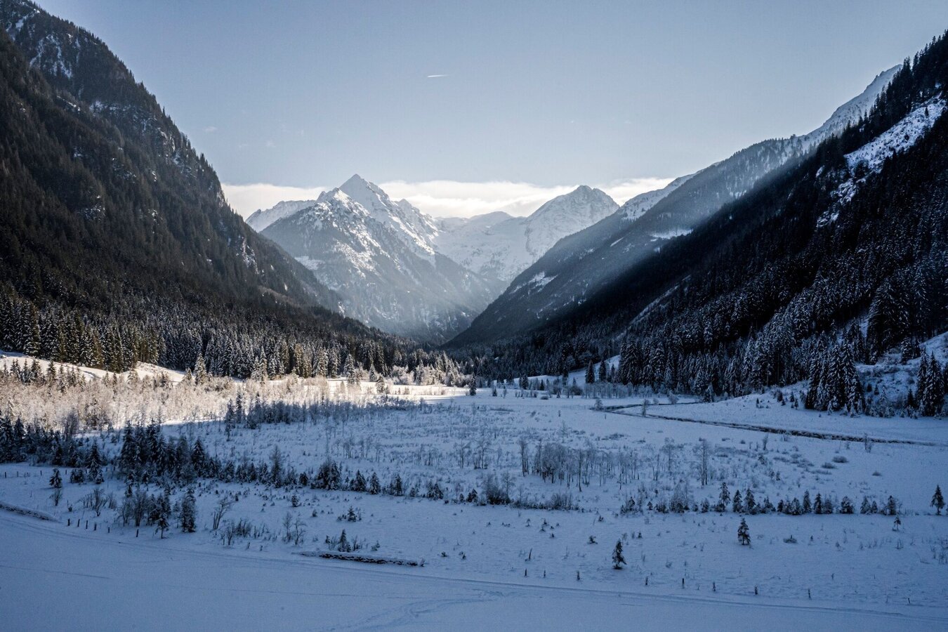
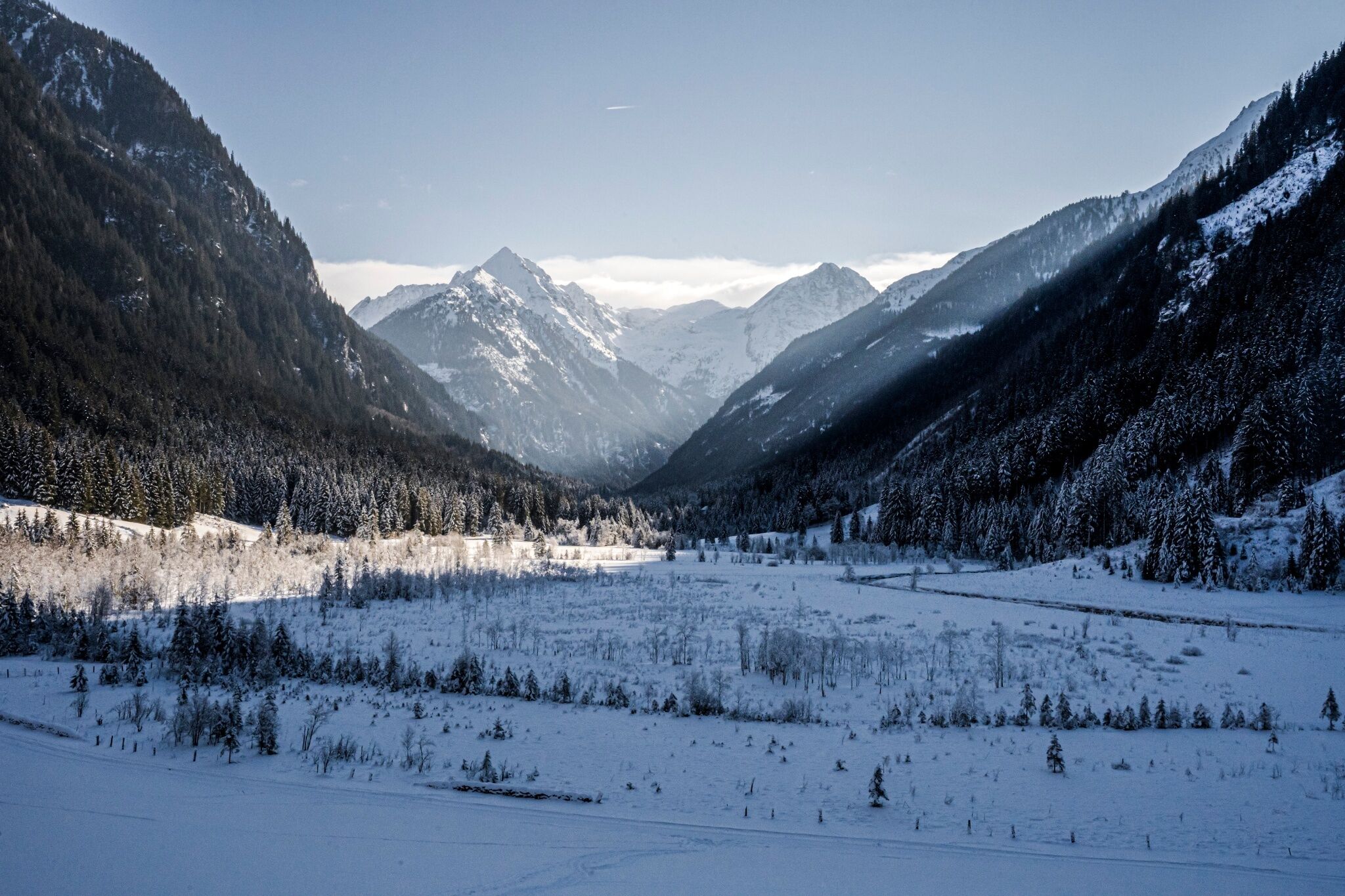
From Gasthof Tetter, follow the signs into the valley along the Wilde Wasser theme trail. The trail accompanying the Untertalstraße road is prepared for pedestrians by the cross-country skiing machine. After just a few metres, you will reach your first highlight - the Aussichtsstadl Tettermoor. Here you can enjoy a marvellous view over the snow-covered moor in winter. Continue into the valley past the lookout tower through the forest to the Waldhäuslalm (TIP: you can enjoy curling here). Directly after the Waldhäuslalm, turn right, cross the bridge over the Untertalbach stream and continue along the cleared forest path to the Sondl-Alm. Along the way you have a wonderful view of the cross-country ski trails, which also lead along the Untertalbach stream to the Sondl-Alm.
From there, continue to the Sondl-Alm car park at the Sulzberg bridge. Cross the bridge and walk along the road to the right for approx. 300 metres until you finally reach the Weiße Wand inn. Hike back to the starting point on the familiar route or alternatively on the cleared road from the Sulzberg bridge to the Waldhäuslalm. From Waldhäuslalm, you can also take the bus back out of the valley.
As an alternative to starting at Gasthof Tetter, you can also start at one of the other inns, or even start from the Hinkerbrücke bridge into the winter wonderland in Untertal.
Exit the Ennstal federal road B320 in Schladming-Mitte and continue in the direction of Rohrmoos-Untertal via the L722 Rohrmoosstraße. At the roundabout in Rohrmoos, turn left (3rd exit) onto the L723 Tälerstraße to Untertal. Through the village of Untertal and further on the Untertalstraße to one of the starting points.
Parking is available at the starting points Hinkerbrücke (public), Gasthof Tetter, Tettermoor (public), Waldhäuslalm, at the road near Sondlalm (public) and at Gasthaus Weiße Wand (public in winter).
With the bus line 974 from Schladming via Rohrmoos to the Gasthof Tetter or to the Waldhäuslalm. Timetable in the Schladming-Dachstein app or online at www.planaibus.at
Your equipment should ideally include:
- Ankle-high, warm shoes. Waterproof, warm shoes with a treaded sole are ideal. Optional: Gaiters for additional snow protection.
- A hood and warm clothing, ideally layered. Don't forget a change of clothes for longer winter hikes: a wind and waterproof jacket and trousers.
- A small backpack with a warm drink in a thermos and snacks as needed
- Sun protection
- Cell phone
- First aid kit
- Optional: crampons/snow spikes (snow chains for shoes), telescopic hiking poles for better grip and balance.
Take a whole day to savour the menus of the various restaurants.
With the Schladming-Dachstein winter hiking ticket, you can easily reach the Untertal valley by bus for winter hiking or cross-country skiing.
https://www.schladming-dachstein.at/Winterwanderticket
Schladming-Dachstein Winter Leisure Card WEST, available at the information offices in the region.


