


Talbachklamm Tour

Tour description
A very varied route, whereby the trail through Talbachklamm gorge is suitable for prams. On the way you can grab a snack at Landalm Inn, Hotel Landauer or (in case you take the variante via Rohrmoos) at Rohrmooser Schlössl inn. Highlights are Talbachklamm gorge itself and lookout platforms in the gorge and in the village of Untertal.
The tour
Map, elevation profile & further information
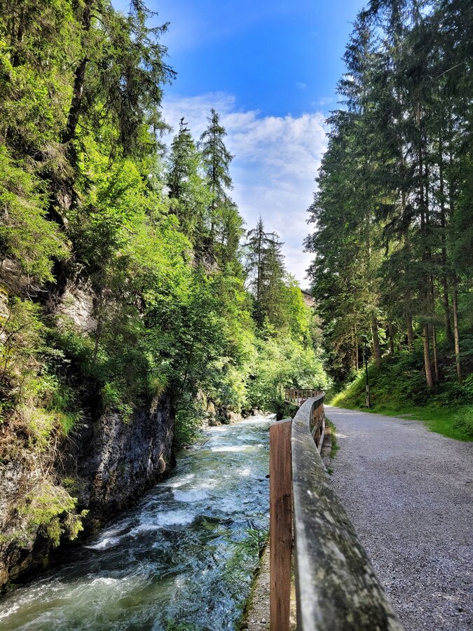
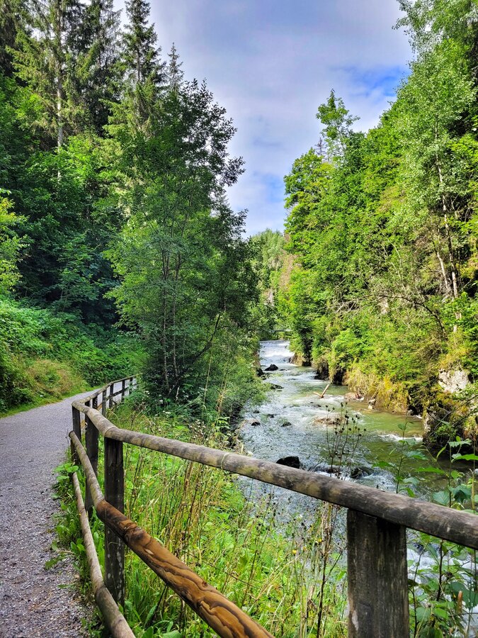
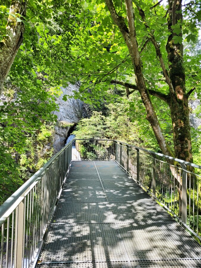
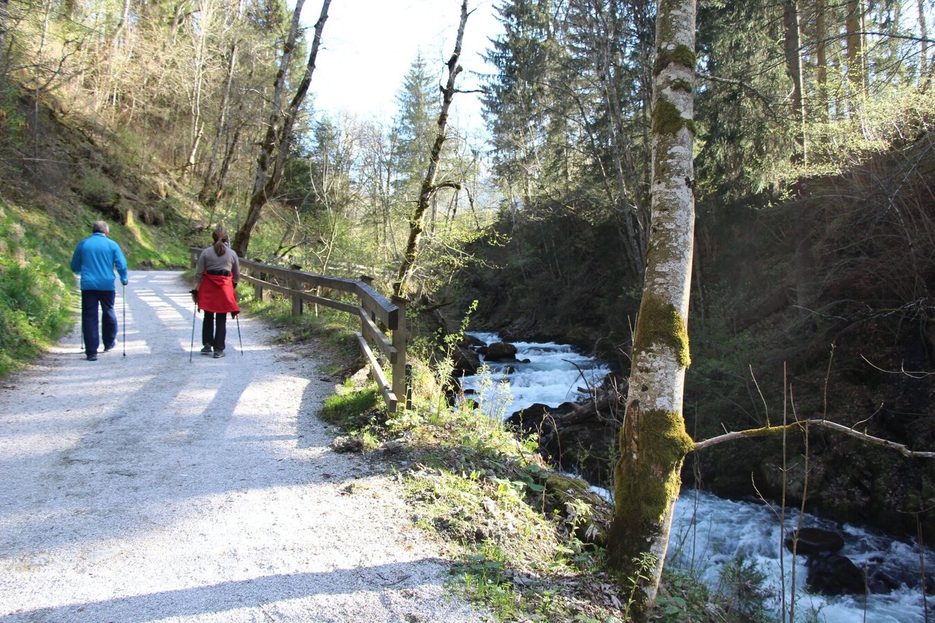
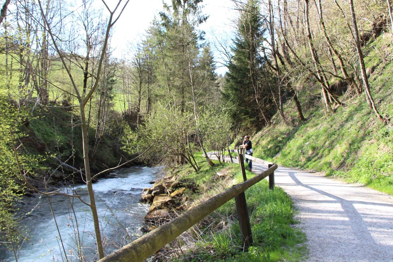
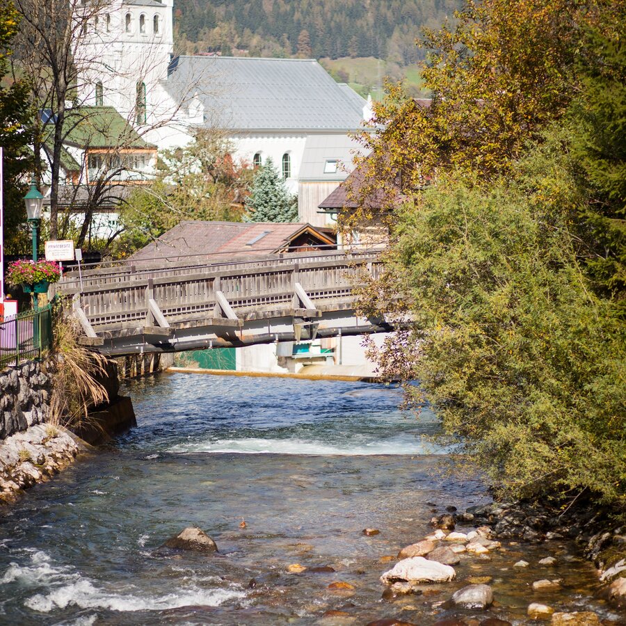
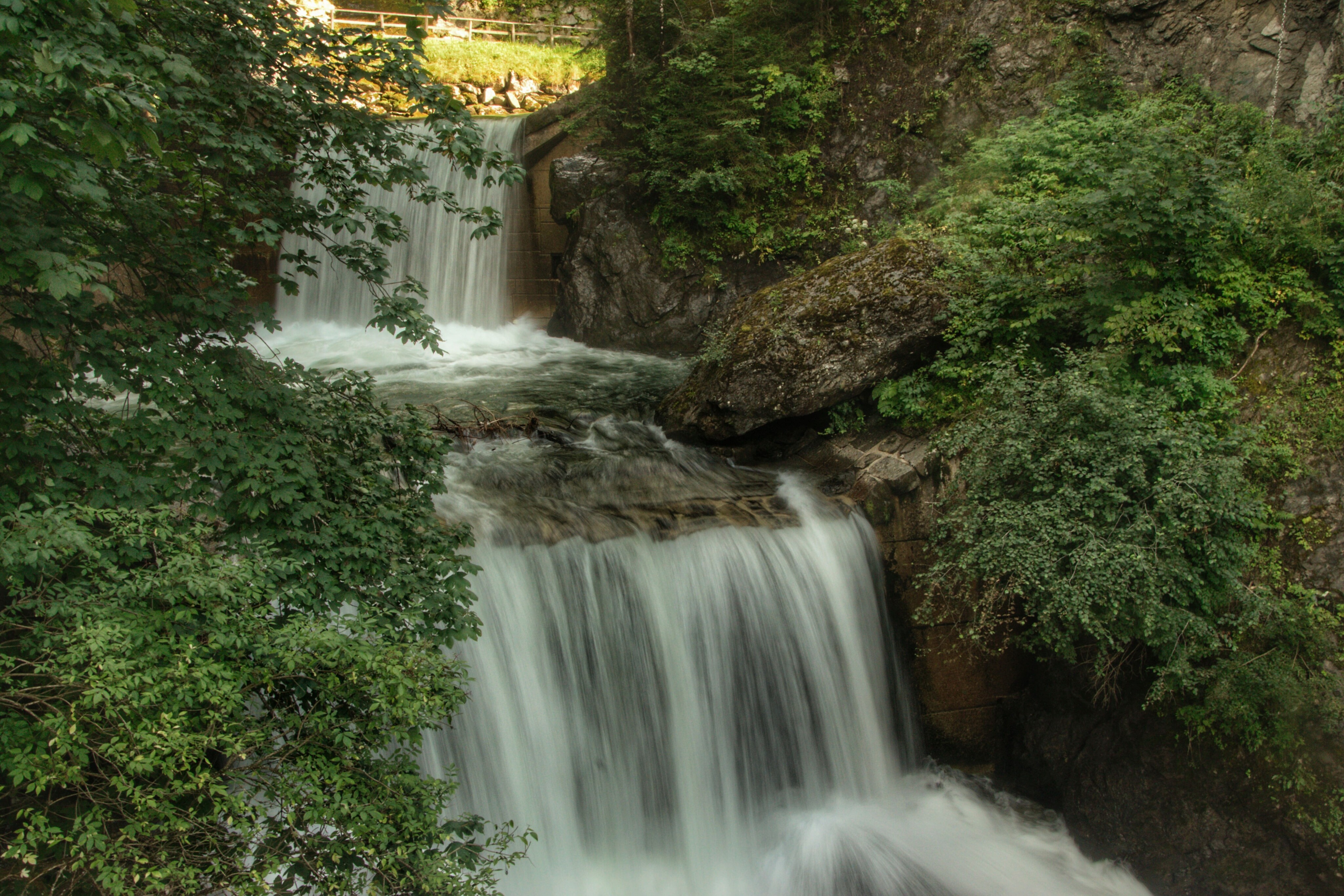
You start your hike at the "Wild Waters" hiking trail head at the Kraiter car park in Schladming. You walk up the Talbachgasse and branch-off left at the wooden trail portal at the entrance to Talbachklamm gorge. The path now takes you uphill along the Talbach creek and after a frew meters you have the opportunity to experience the unbridled power of the Talbach from a dizzying height from a lookout platform - you are completely safe though. Now the trail ascends gently on a path suitable for strollers and you make your way alongside the thunderous Talbach creek – uphill for ca. 45 minutes until you reach the village of Untertal. Here, another viewing platform at the confluence of Obertalbach and Untertalbach creeks invites for a break at the water as do Landalm Inn and Hotel Landauer.
From the hiking portal it goes back briefly on the same path, after the war memorial Untertal you now follow the Spreitzweg on the slopes of the Planai out of the valley. Along the little-used access road you have a beautiful view of the Rohrmoos and down into the gorge. At the end of the street you reach the Spreitzhof, where you now hike a somewhat steeper ravine down to "Grubegg" and back to the valley-side exit of the Talbachklamm.
From federal highway B320 take exit "Schladming-Mitte". Continue towards "Zentrum/Rohrmoos" (town center). At the first roundabout (BILLA) take the 2nd exit (straight on) and at the next one the 3rd exit towards "Zentrum" (town center). After crossing the bridge make a right in to Talbachgasse street at the first intersection and follow the street to its end - you have reached Kraiter car park. In case you start in Rohrmoos take the second exit at the 2nd roundabout and go on into the direction of Rohrmoos. At the roundabout in Rohrmoos take the thrid exit to the village of Rohrmoos Untertal
Parking is available at Kraiter car park or at the valley terminal of Planai cable car (Planet Planai).
In the village of Untertal there are also some parking spots available opposite of the fire department.
In the town of Schladming you can take the Citybus. From Rohrmoos take the Planai buses to Planet Planai, from Ramsau take the buses of Ramsauer Verkehrsbetriebe. In case you start in the village of Untertal take the Planai buses from Schladming (Planet-Planai, Lendplatz) or Rohrmoos (Rohrmoos-Zentrum) to the village of Untertal - bus stop "Untertal-Dorf".
- Citybus and buses from Rohrmoos - www.planaibus.at
- Buses from Ramsau - www.rvb.at
Changes in weather patterns, quick falls in temperature, thunderstorms, wind, fog and snow are some of the dangers that can be encountered on a hiking tour. Hosts of alpine huts and mountain refuges have a lot of experience in the mountains and can give good advice about weather and the trails. Poor equipment, overestimation of one's own capabilities, carelessness, poor personal constitution and/or wrong judgement can lead to critical situations. In case of thunderstorms: avoid summits, ridges and steel ropes.
GPS data and orienteering
Available GPS data - just like hiking maps - is only a guidance for orientation and can never depict a trail exactly with all its details. Especially at dangerous spots it is essential to judge on site how to proceed.
In an emergency please call:
- 140 - for Alpine emergencies (all over Austria)
- 112 - European GSM emergency number
Hiking or trekking shoes with grip sole, jacket.
The trail is also suitable for prams.
Also possible to start from the village of Untertal.
- Hiking map ‘Hiking WEST’ available at the information offices in the region.
- Schladming hiking map, 1:25,000, available at the Schladming information office.
- Hiking map Schladming-Dachstein, 1:50,000, available at the information offices in the region.
- Hiking guide Schladming-Dachstein by Herbert Raffalt, available at the information offices in the region.


