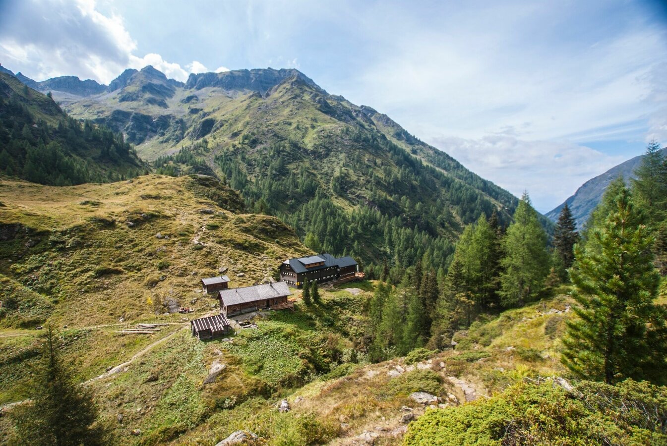
Planai High Trail with overnight at Preintalerhütte chalet
gemiddeld gesloten Summit tours · Schladming
The Alpinsteig Höll will be closed over the winter until probably mid-May 2024. As usual, the reopening will take place in spring after an appropriate inspection and renovation measures! The Seeleiten car park in Untertal is also closed.
Out of consideration for the wild animals, we ask that you behave particularly quietly and considerately when hiking here during the winter and only during the day outside of twilight hours.
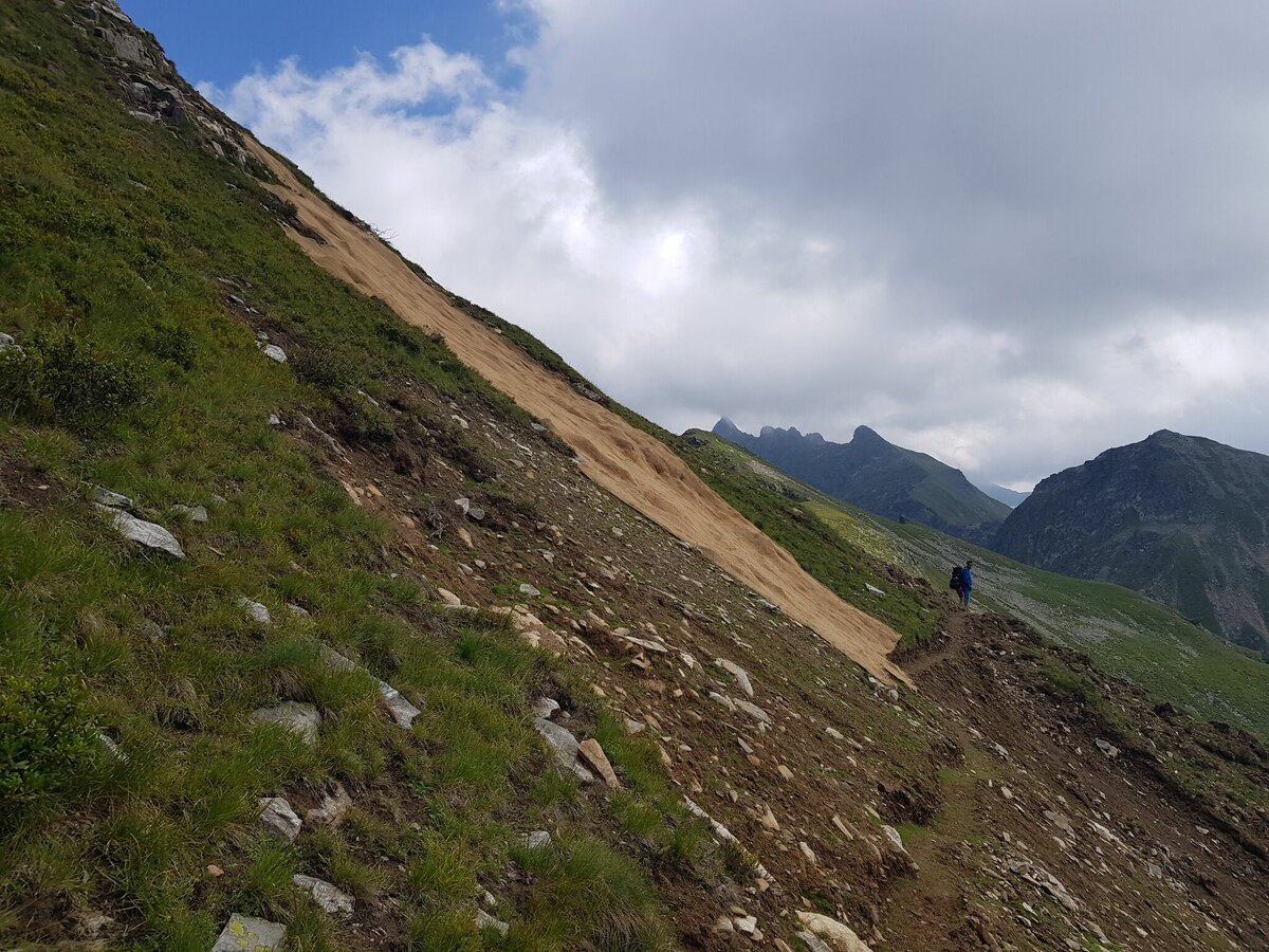
Planai High Trail is a challenging alpine hike in the Schladminger Tauern range. Narrow paths, which are quite exposed partially, take you from the famous skiing mountain Planai to Preintalerhütte chalet inmidst of the Schladminger Tauern range. Along the route a variant via Höchstein summit is possible, but only recommended for experienced hikers! The route is an alpine trail – surefootedness and a head for heights are a must, therea a short secured passages with steel ropes. Caution in early summer when encountering snow fields and periods of rain, the wet grassy mountainsides and rain-sodden trail are sources of danger. The high-alpine mountain scenery offers suprising and incredible views to the Schladminger Tauern range.
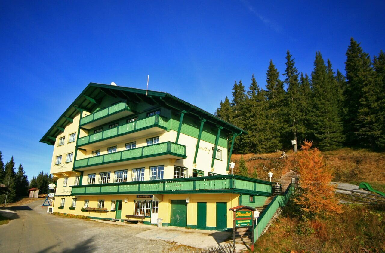
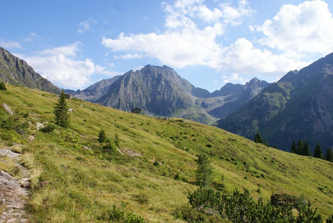
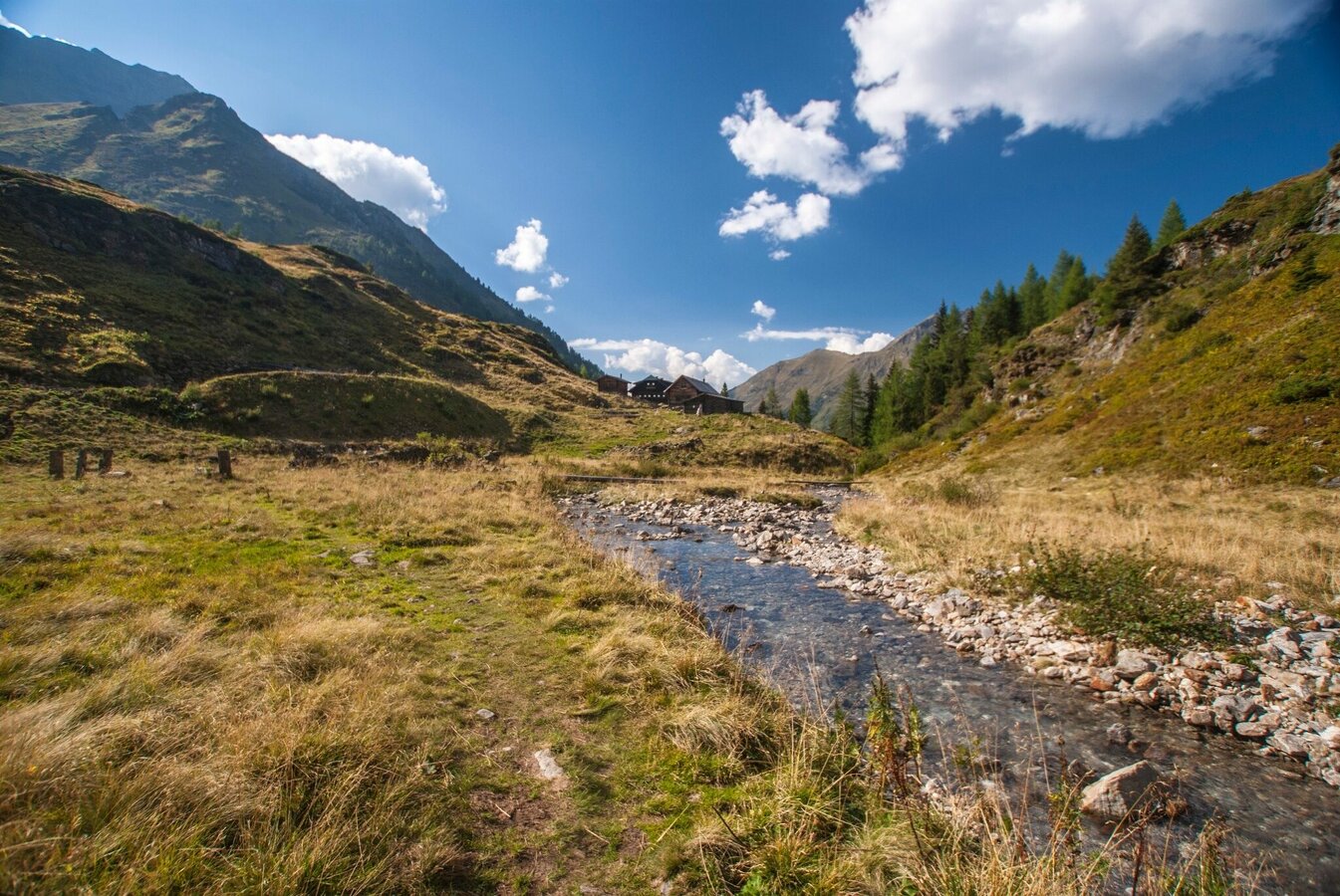
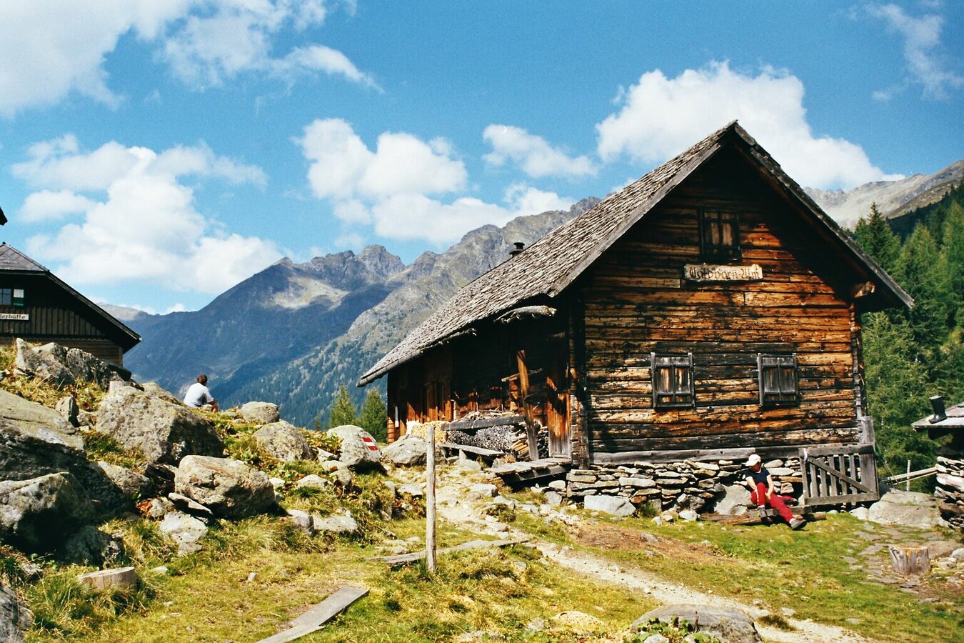
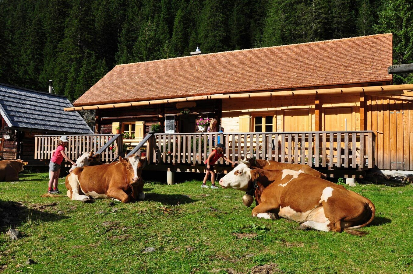
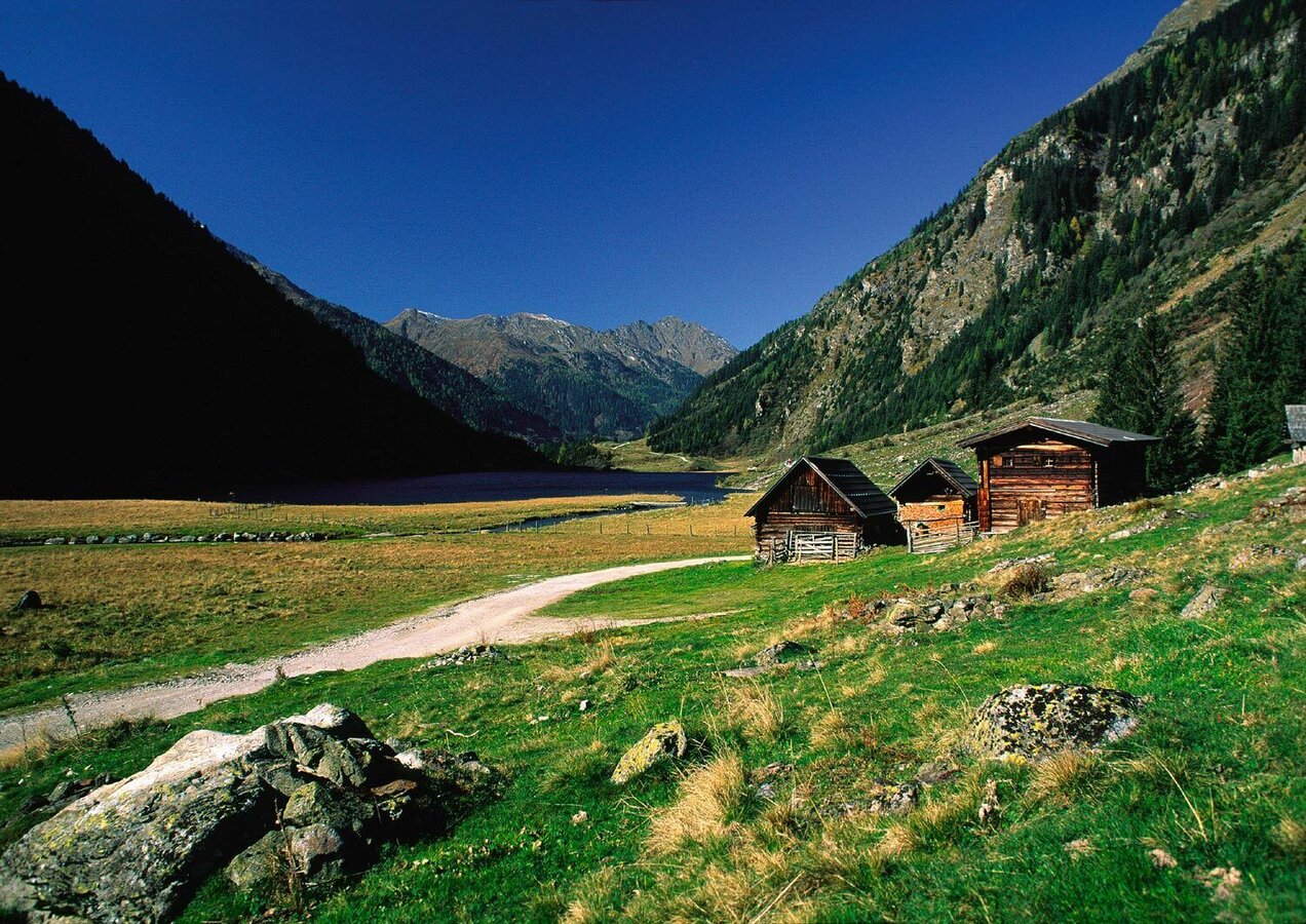
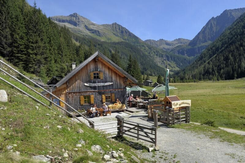
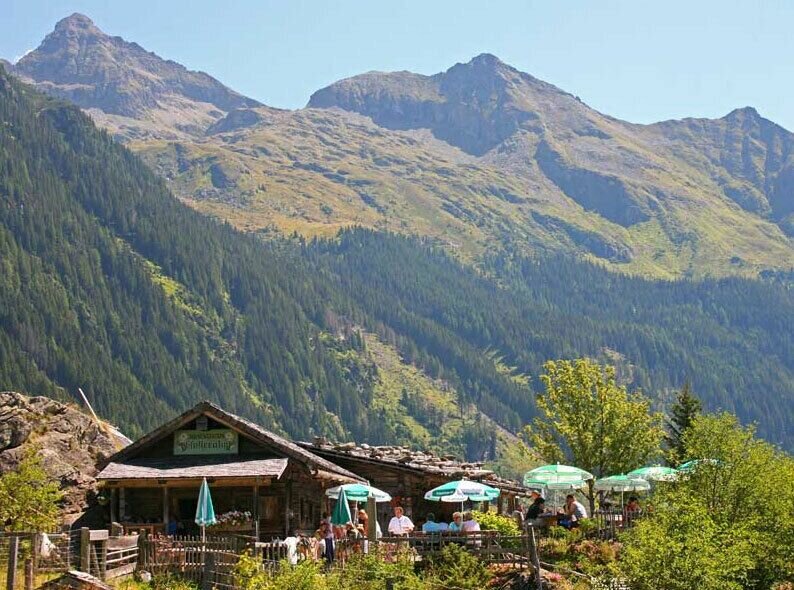
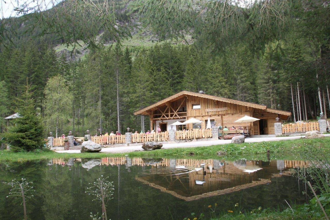
The 2nd day is an quite easy hike, descending from Preintalerhütte and Waldhornalm to Untertal valley via Riesachsee Lake. Along the way, Berallerhütte at Kotalm, Kaltenbachalm, and Gfölleralm are offering refreshments.
Fotogalerij

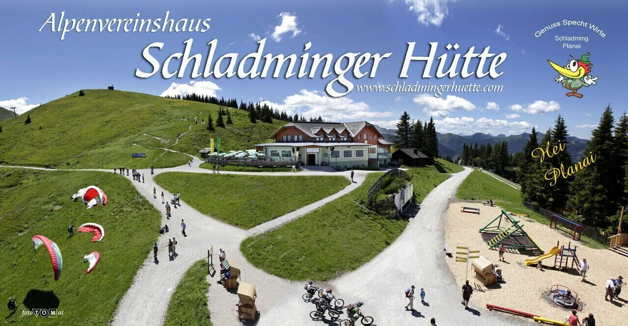
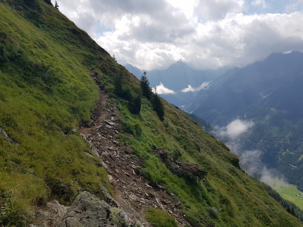
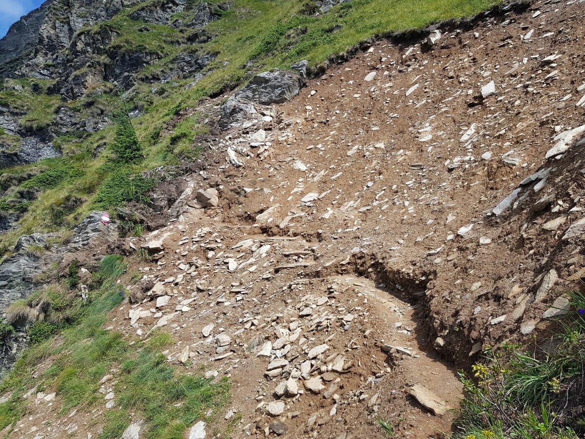
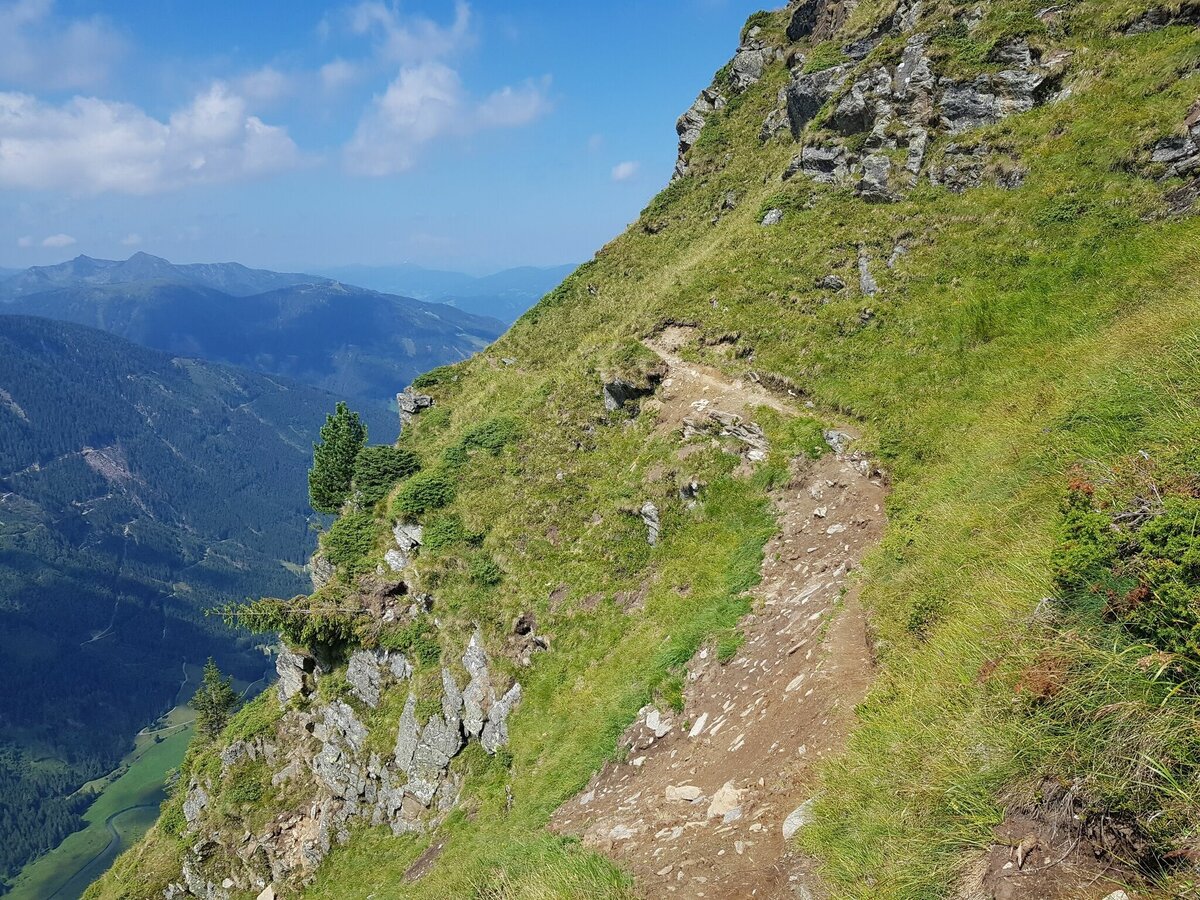
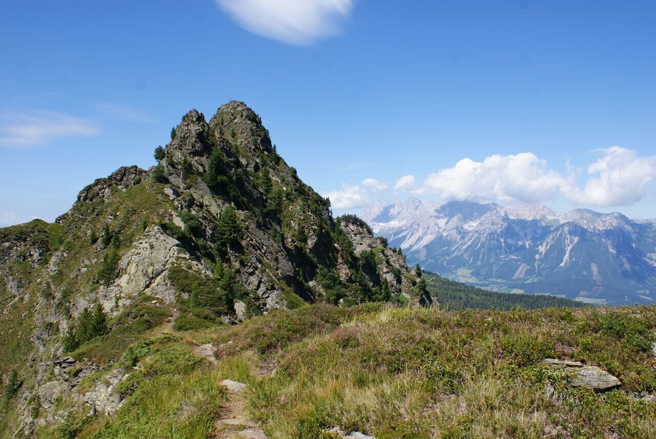

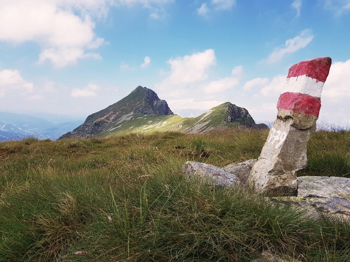
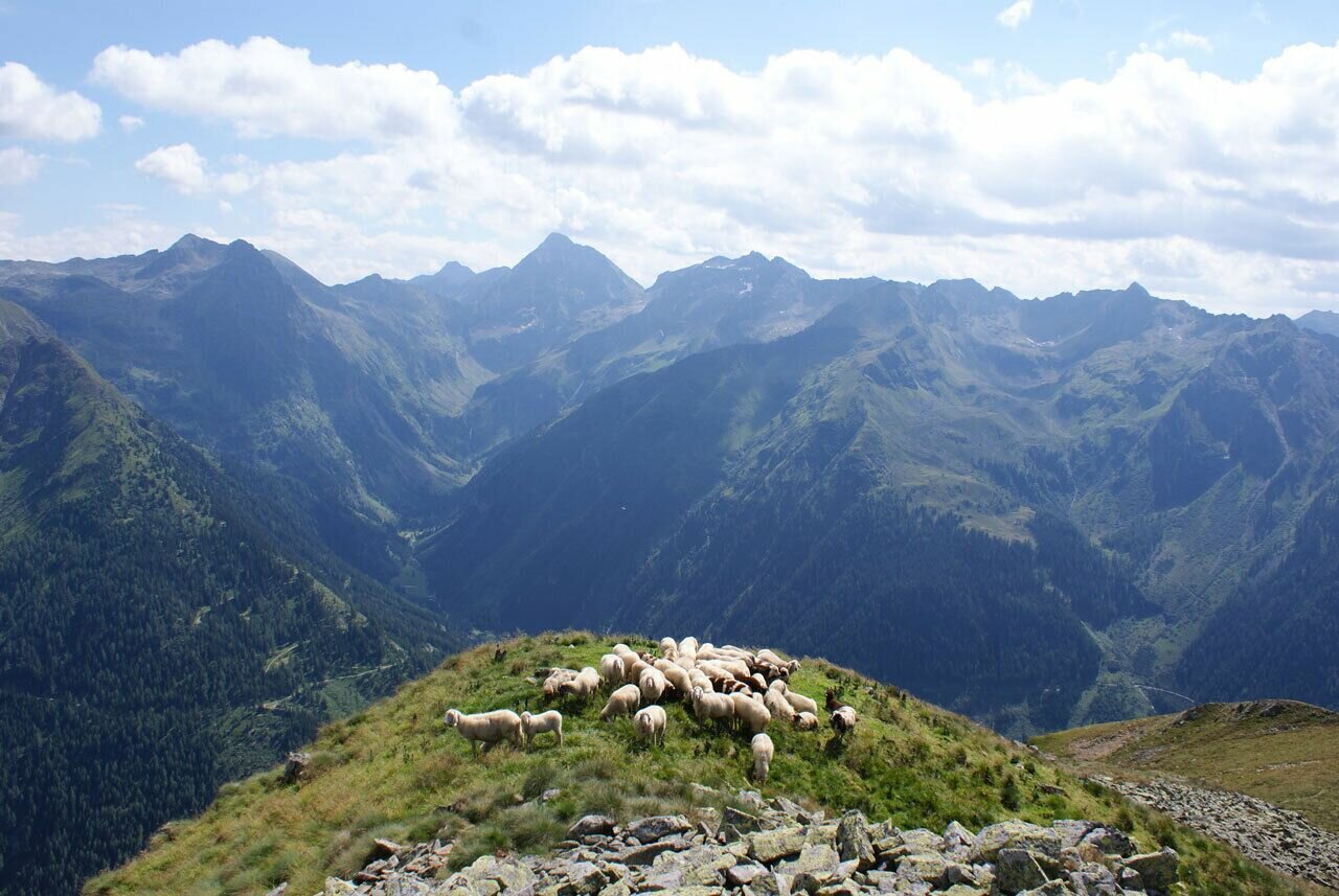
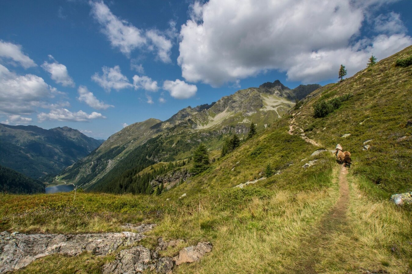


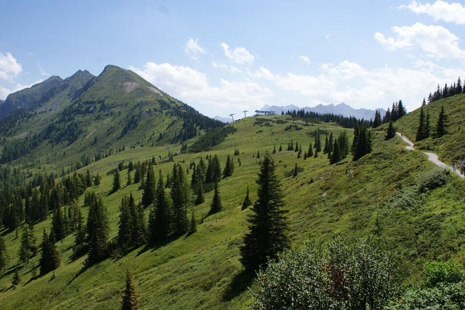
From the mountain station of the Planai cable car at Schladminger Hütte, follow path no.779 over the Planai summit or on the panoramic circular route to the Krahbergsattel. Through a short forest passage and then ascending towards Krahbergzinken, you branch off halfway up the Krahbergzinken and follow the narrow path to the rocky connecting ridge of the Seerieszinken. Great care must be taken on this section! The panorama is terrific.The trail leads a little below the Höchststein ridge along the southwest flank to Spielbühel.
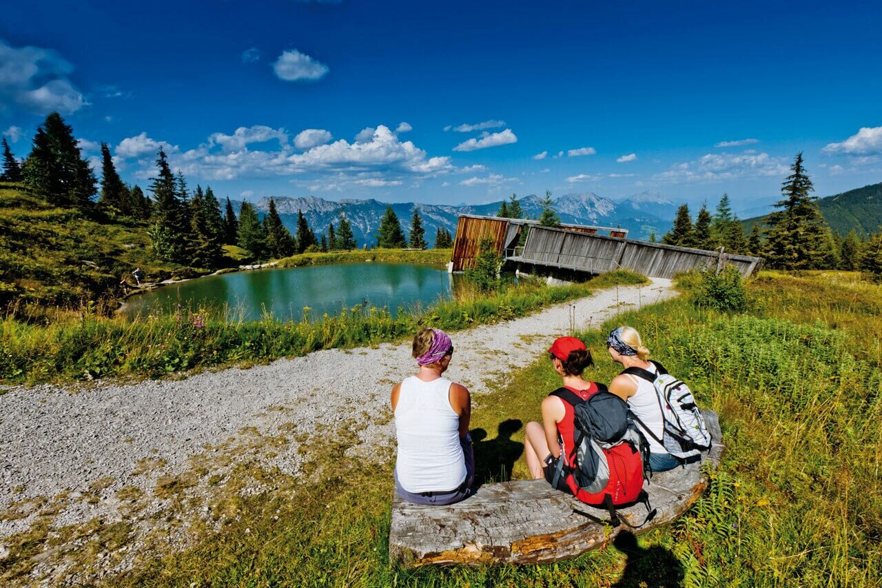
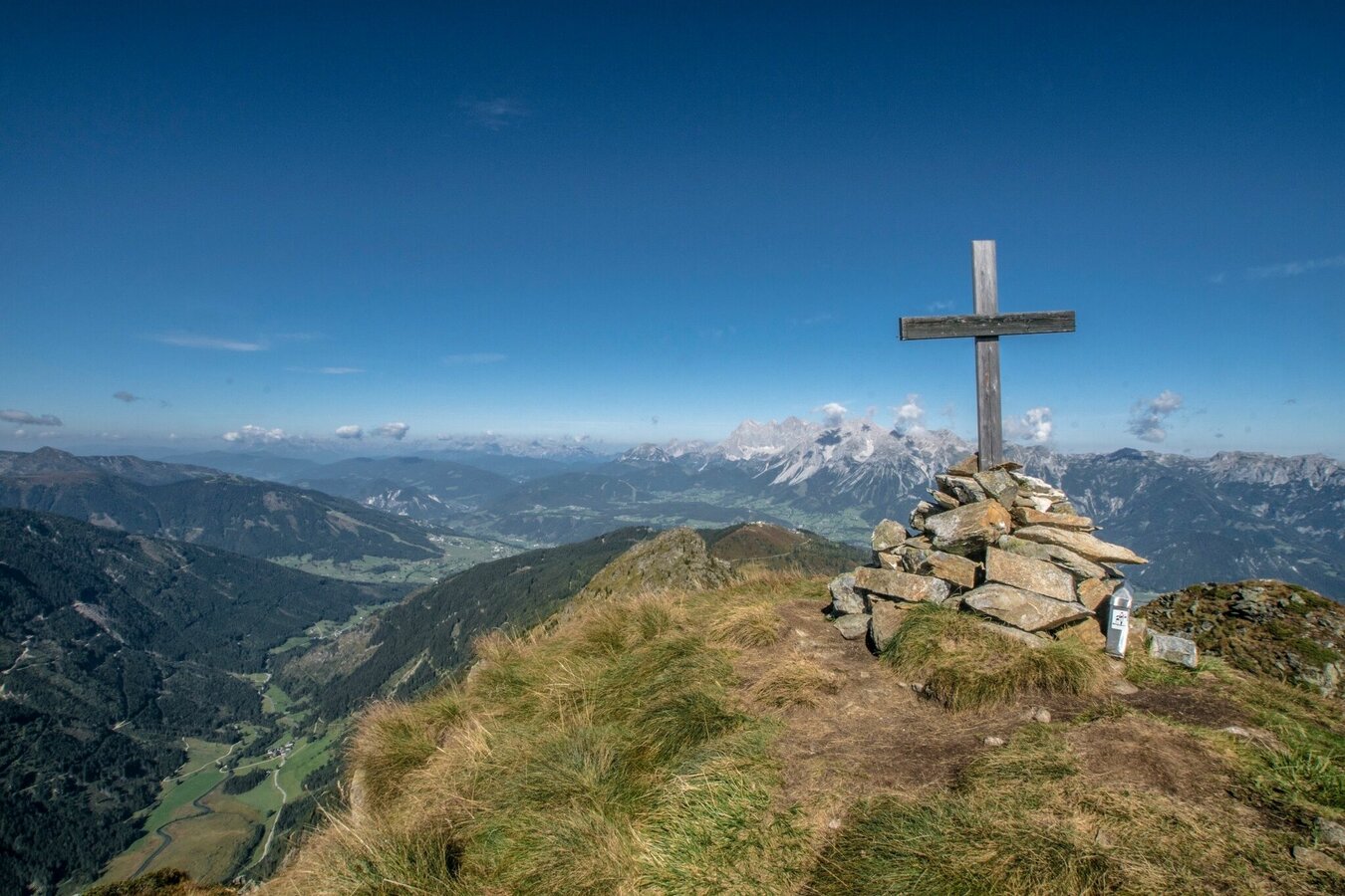
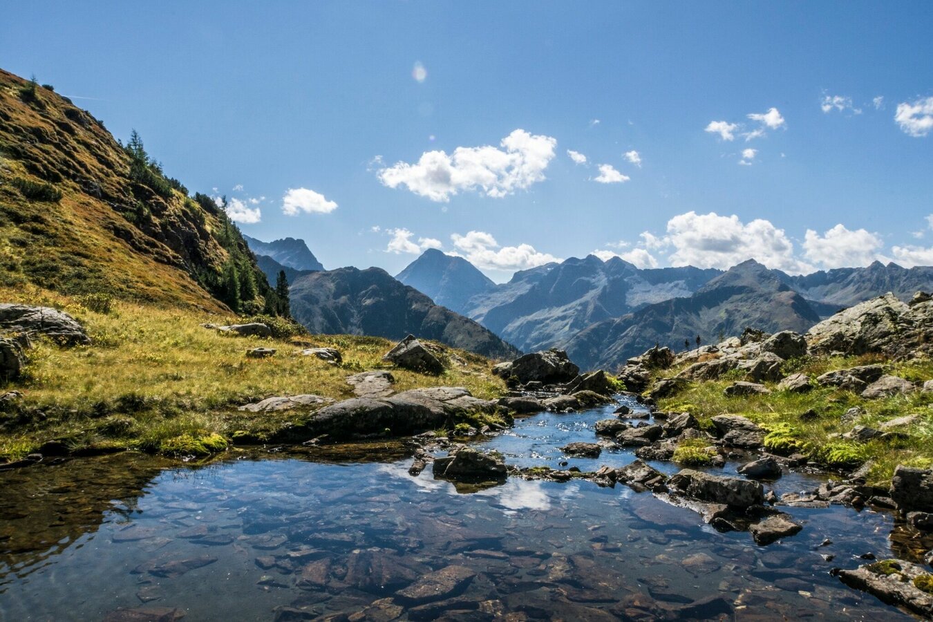
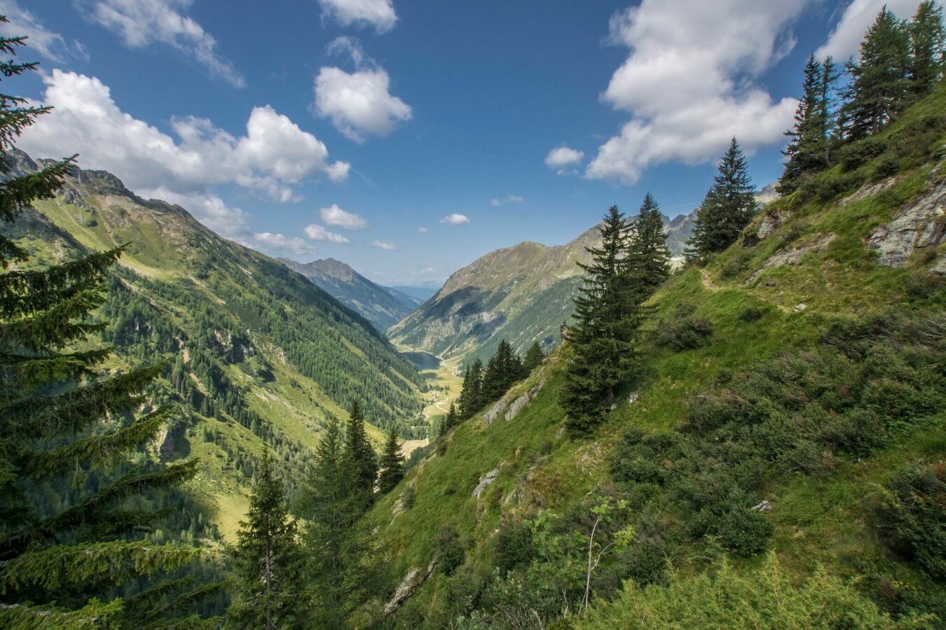
There, for the first time, the Riesachsee becomes visible deep below. After the Hasenkarscharte, you come to the junction on the Höchsteingipfel. Follow path no. 779 and no. 781, after crossing the Kaltenbachkares you reach another cross at the Neualm, where you continue straight on on the so-called Höfertsteig no. 782. From the Neualm you reach the Preintalerhütte and the Waldhornalm in one good hour. Here you have earned a long rest.
The next day, hard-working hikers can take a tour to the Sonntagskarseen or even descend directly to the Seeleiten car park.
In the town of Schladming you can take the Citybus. From Rohrmoos take the Planai buses to Planet Planai, from Ramsau take the buses of Ramsauer Verkehrsbetriebe.
- Citybus and buses from Rohrmoos - www.planaibus.at
- Buses from Ramsau - www.rvb.at
From Planai stadium take the Planai cable car to the starting point.
From Seeleiten car park take the Planai buses back to Schladming or Rohrmoos.
Changes in weather patterns, quick falls in temperature, thunderstorms, wind, fog and snow are some of the dangers that can be encountered on a hiking tour. Hosts of alpine huts and mountain refuges have a lot of experience in the mountains and can give good advice about weather and the trails. Poor equipment, overestimation of one's own capabilities, carelessness, poor personal constitution and/or wrong judgement can lead to critical situations. In case of thunderstorms: avoid summits, ridges and steel ropes.
GPS data and orienteering
Available GPS data - just like hiking maps - is only a guidance for orientation and can never depict a trail exactly with all its details. Especially at dangerous spots it is essential to judge on site how to proceed.
In an emergency please call:
- 140 - for Alpine emergencies (all over Austria)
- 112 - European GSM emergency number
Tourist information: www.schladming.com
Information about bus schedules: www.planaibus.at
Information about cable-car hours: www.planai.at
360° drone images
Get yourself an overview with our 360° drone images:
- To Planai via Höfertsteig trail: https://vonoben.schladming-dachstein.at/sommer/index.php?S=317
- View over Riesachsee Lake: https://vonoben.schladming-dachstein.at/sommer/index.php?S=318
- The trail near Rabenköpfl: https://vonoben.schladming-dachstein.at/sommer/index.php?S=327
- The trail between Seerieszinken and Krahbergzinken: https://vonoben.schladming-dachstein.at/sommer/index.php?S=328
- Hiking map Schladming, 1:25.000, available at the tourist office Schladming.
- Hiking map Schladming-Dachstein, 1:50.000, available at the tourist office Schladming.


