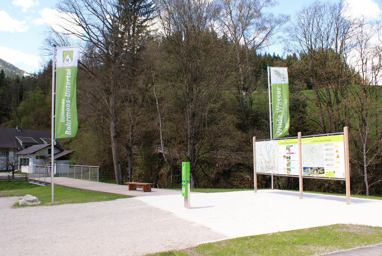
Theme trail Wild Waters
snadné uzavřené Water hikes · Schladming
Winter closure of the road from the Gasthof Weiße Wand. Blocked until April 30, 2024.
Note: The yellow hiking trail signs are generally only valid in summer. Exceptions are direction boards with the “Winter Walking” icon. Otherwise, winter paths have their own signage.
The Alpinsteig Höll will be closed over the winter until probably mid-May 2024. As usual, the reopening will take place in spring after an appropriate inspection and renovation measures! The Seeleiten car park in Untertal is also closed.
Out of consideration for the wild animals, we ask that you behave particularly quietly and considerately when hiking here during the winter and only during the day outside of twilight hours.
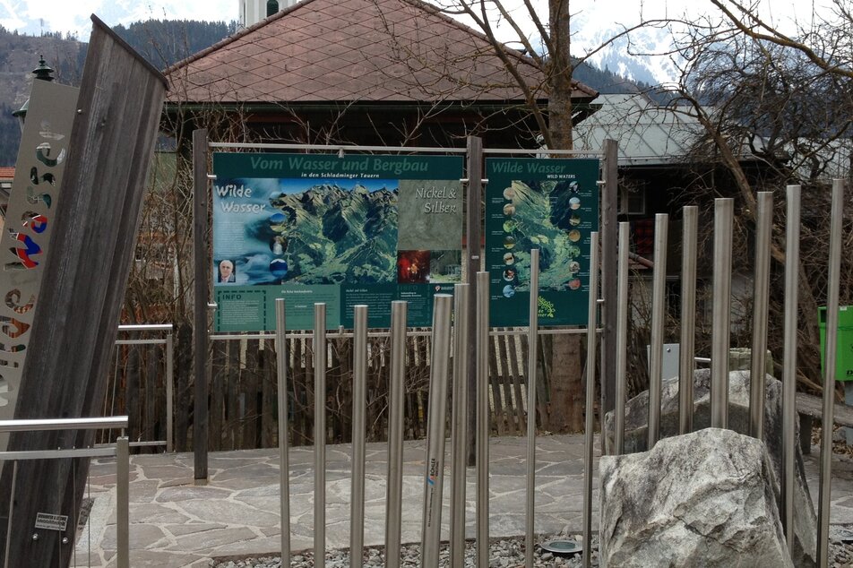
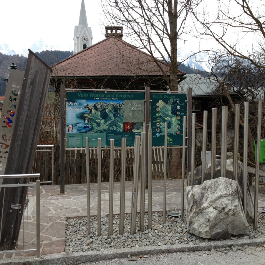
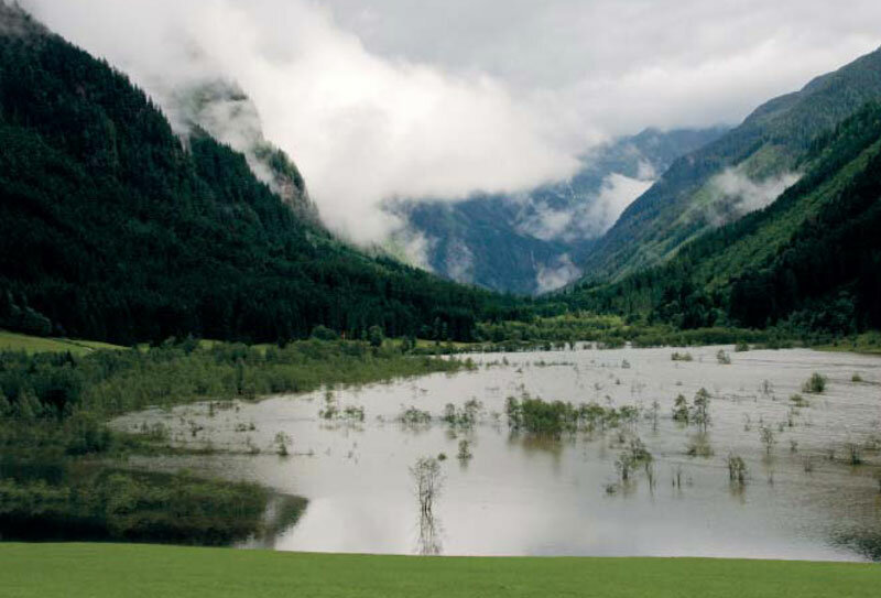
14.5 kilometers of “Wild Waters” illustrate our most precious natural resource in all its facets – from quietly glistening and crystal-clear, to thunderously frothing and foaming, in freefall over the rocks of the Schladminger Tauern. A unique nature experience, for which it earned international recognition in 2009 as the very first National Geographic Hiking Path.
Conditions
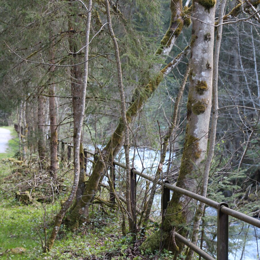
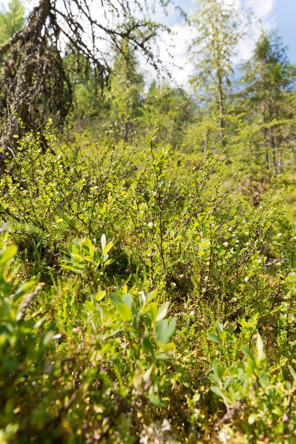
gorge trail, meadow path, alpine pastures, short sections on roads, forest and alpine trails
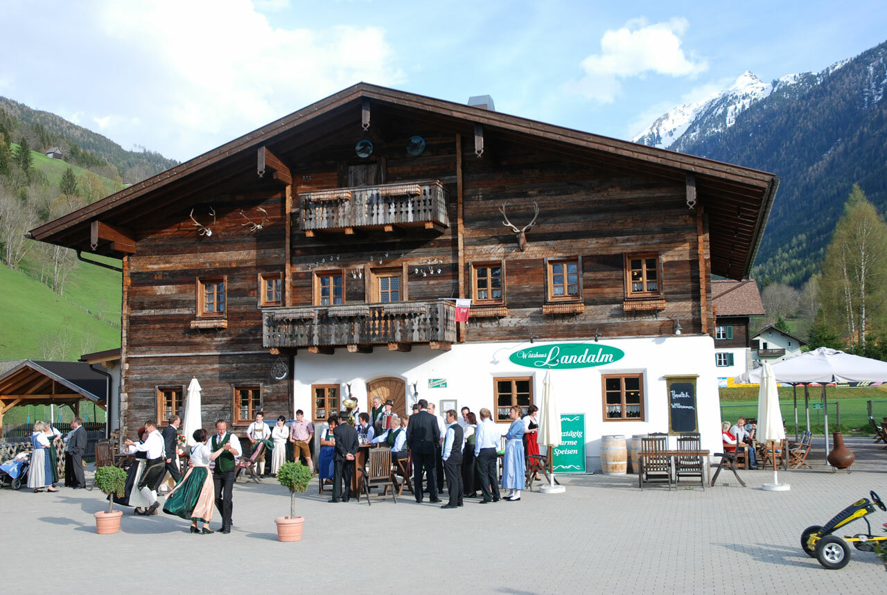
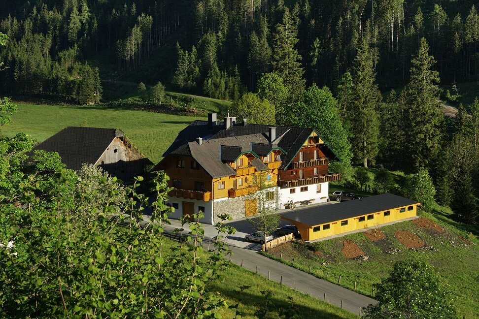
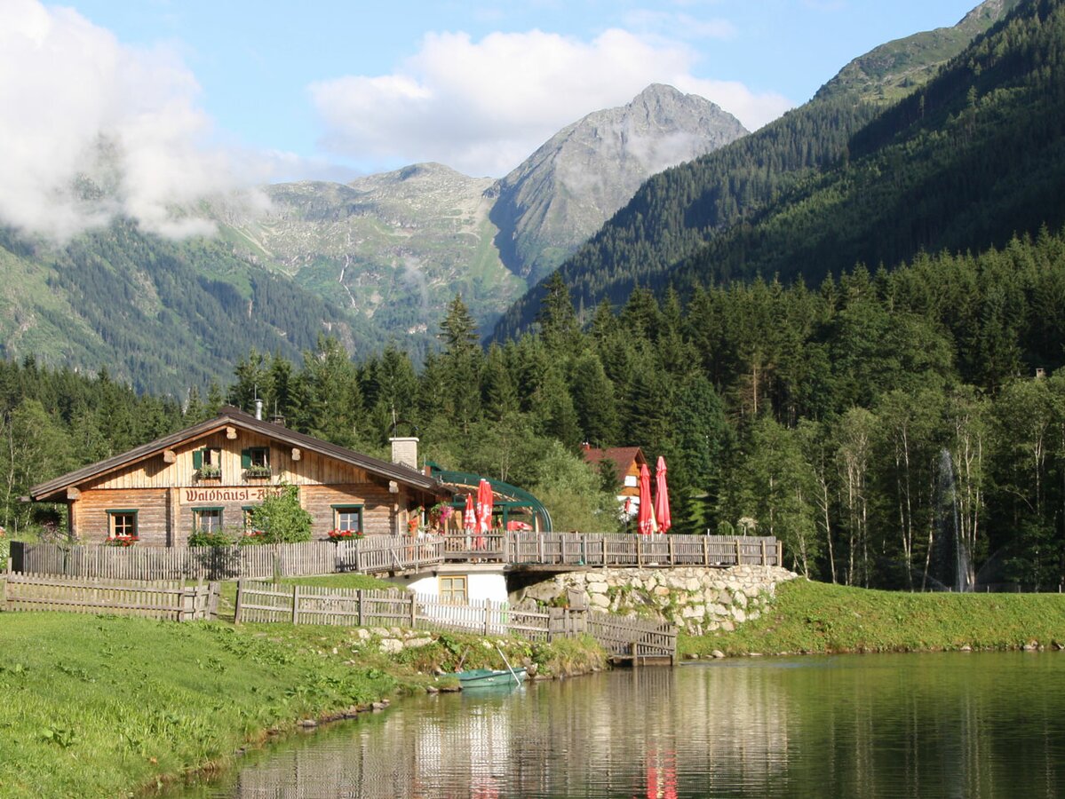
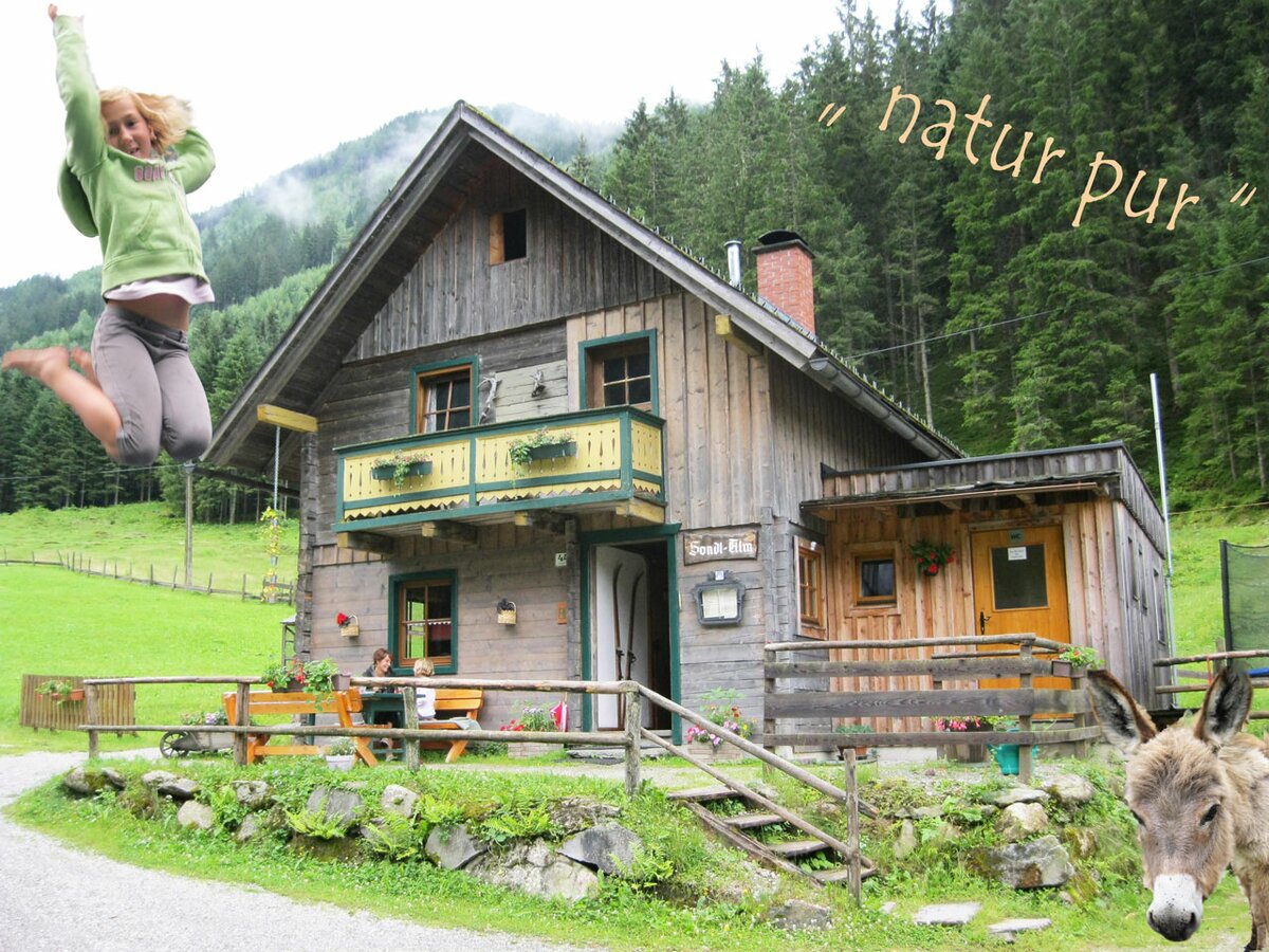
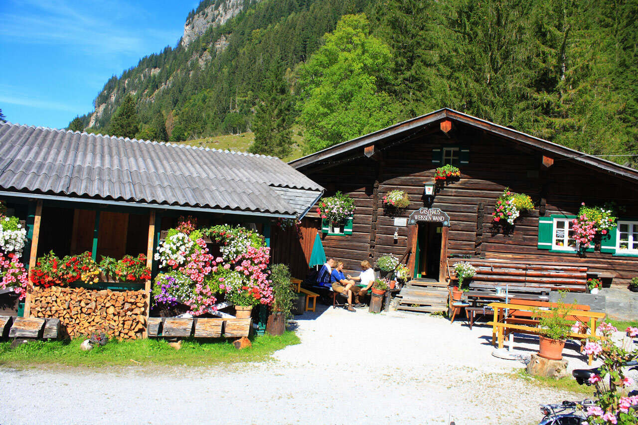
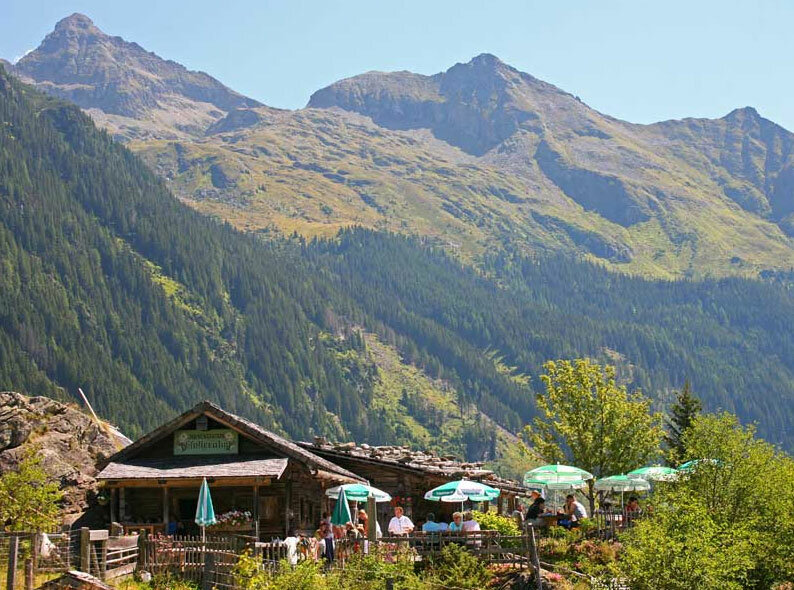
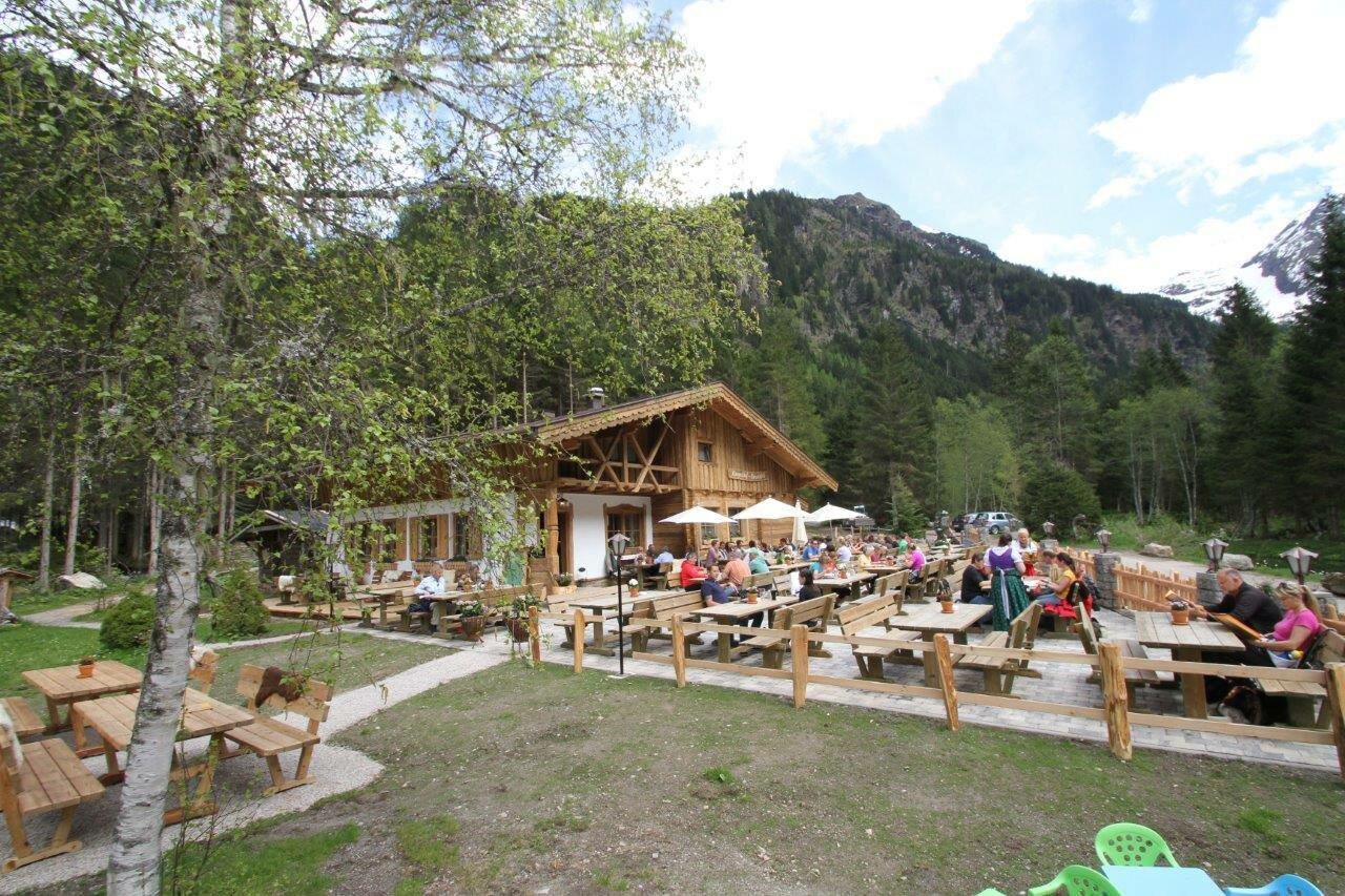
Restaurants/Alpine huts
- Talbachschenke
- Landalm & Hotel Landauerhof
- Gasthaus Tetter
- Waldhäuslalm
- Sondlalm
- Gasthaus Weiße Wand
- Almgasthaus Riesachfall
- Gfölleralm
- Kaltenbachalm
Highlights
- Talbachklamm gorge
- Toteisboden nature reserve
- Tetter moor
- 50 meters-long cable footbridge
- Lake Riesachsee
Fotogalerie
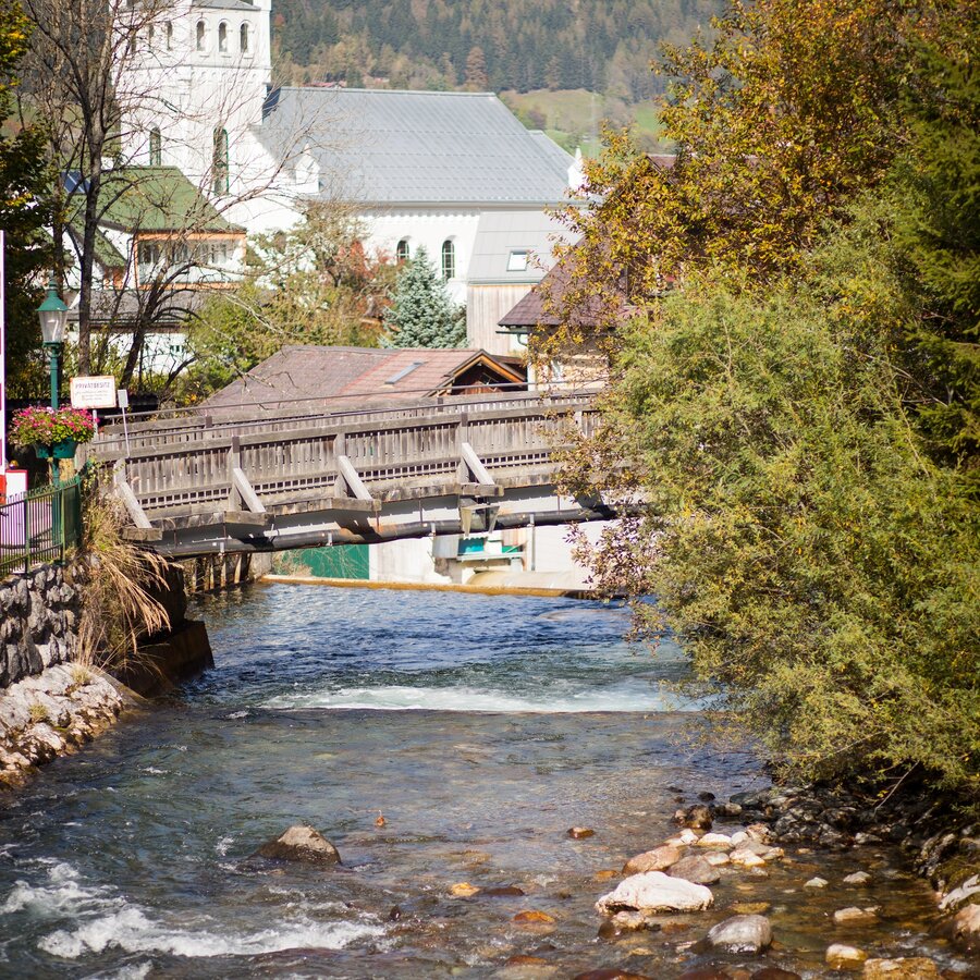
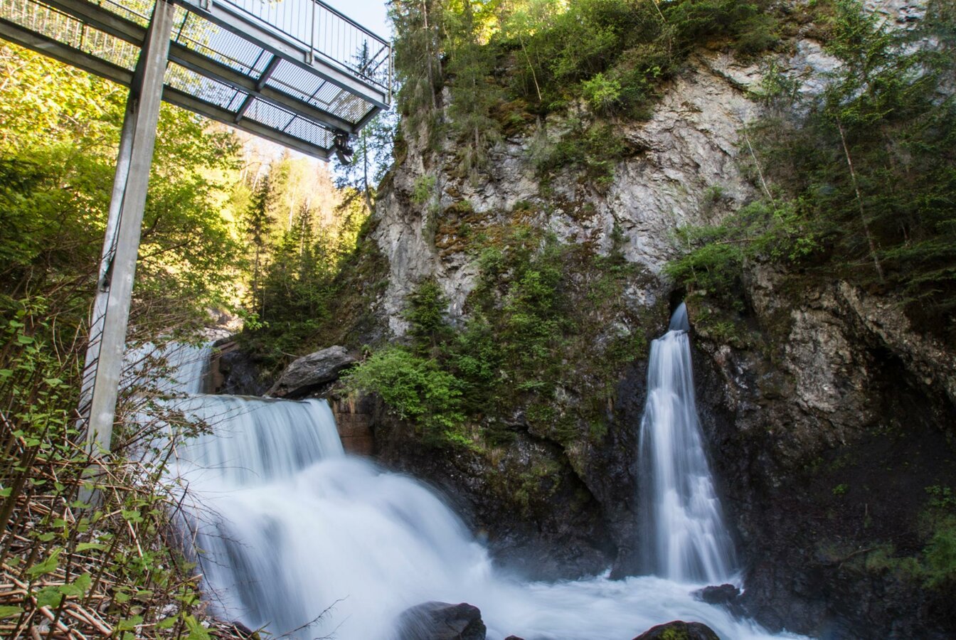
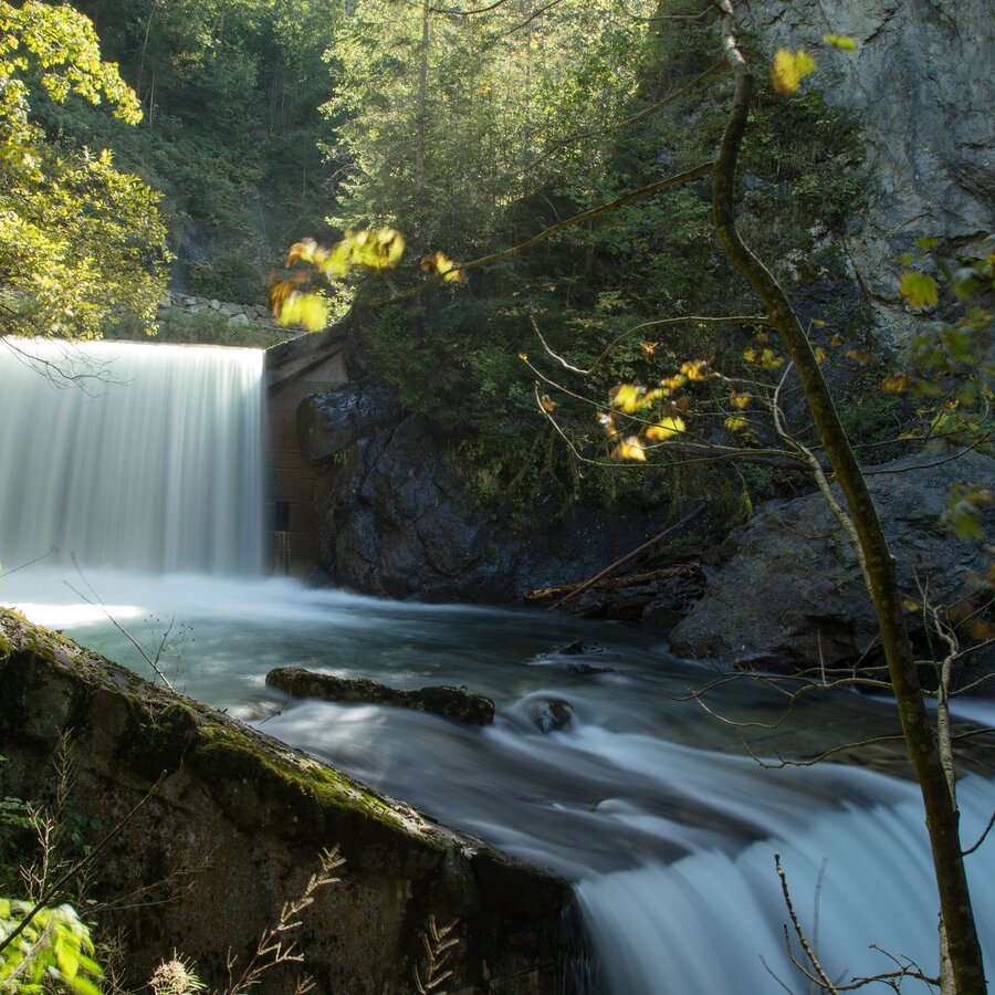
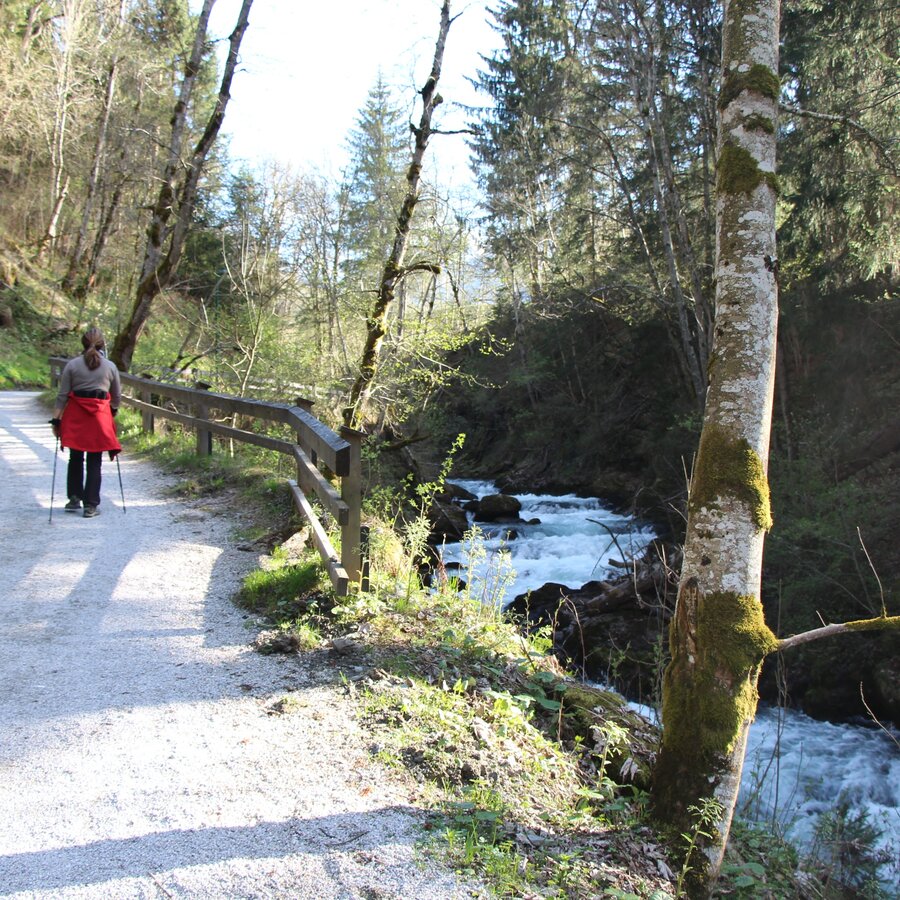
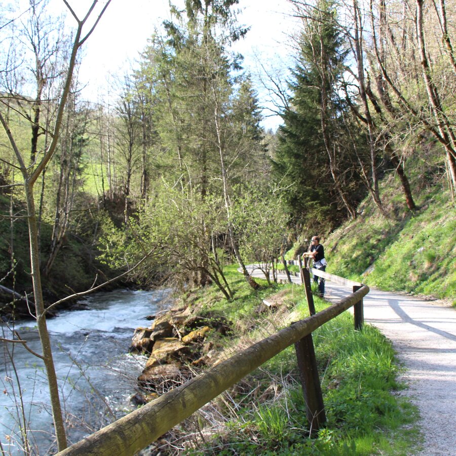
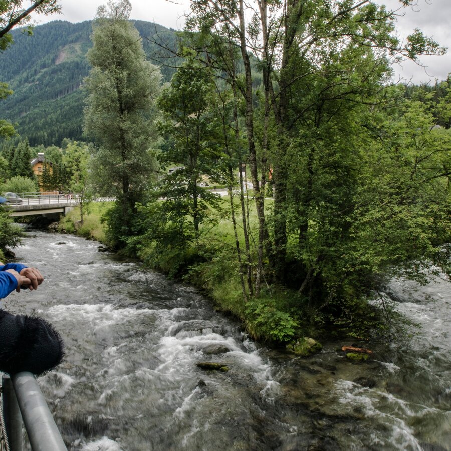
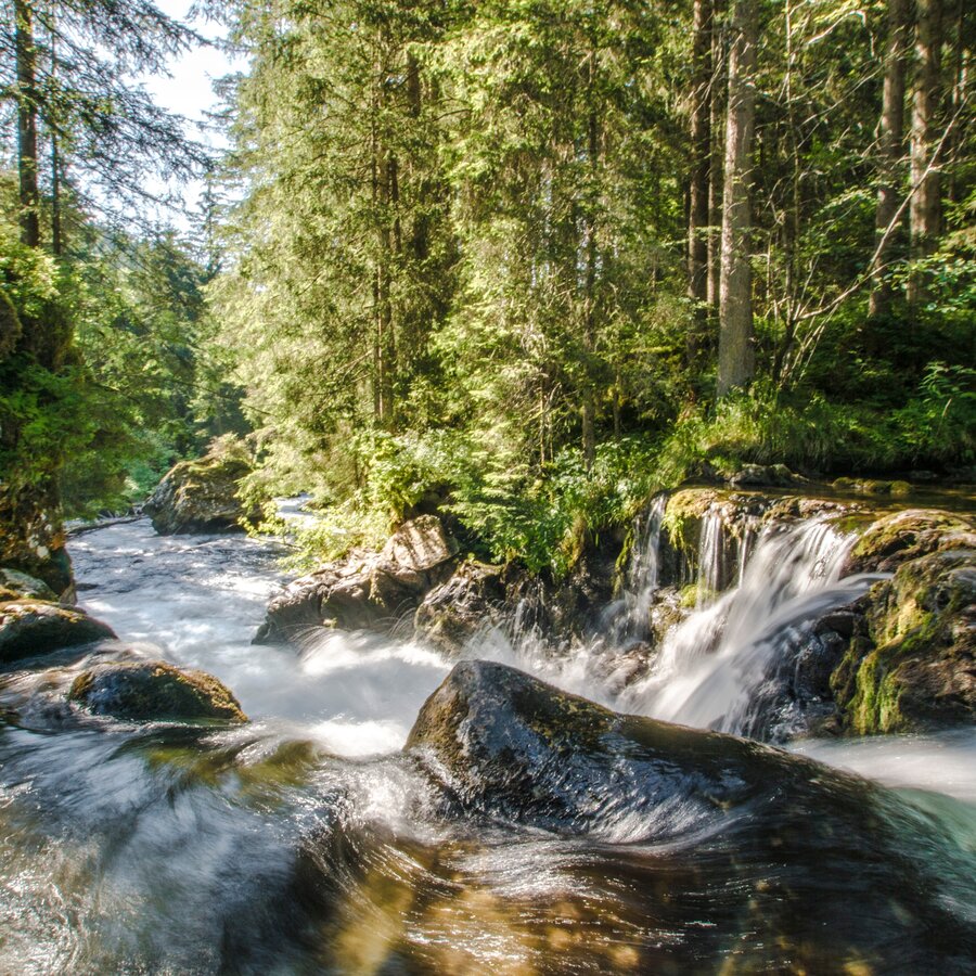
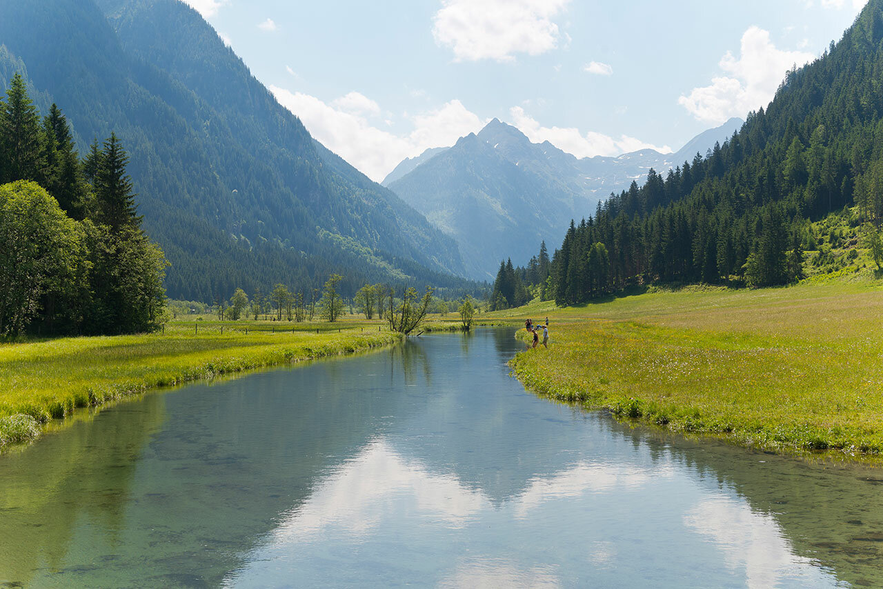
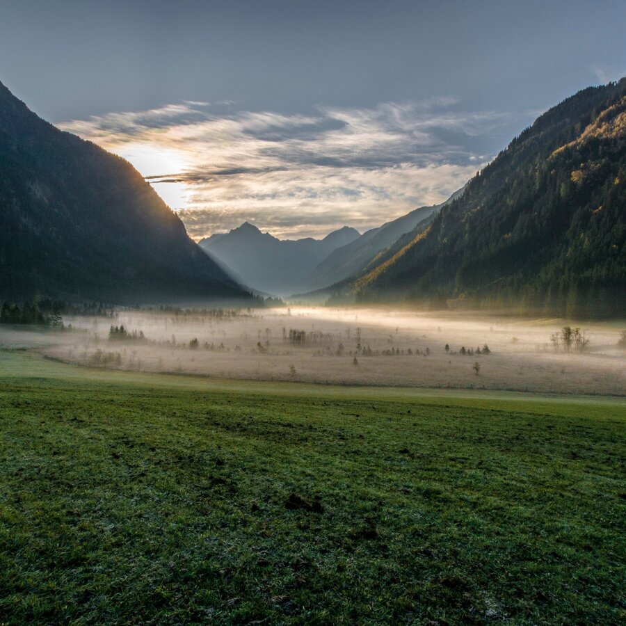
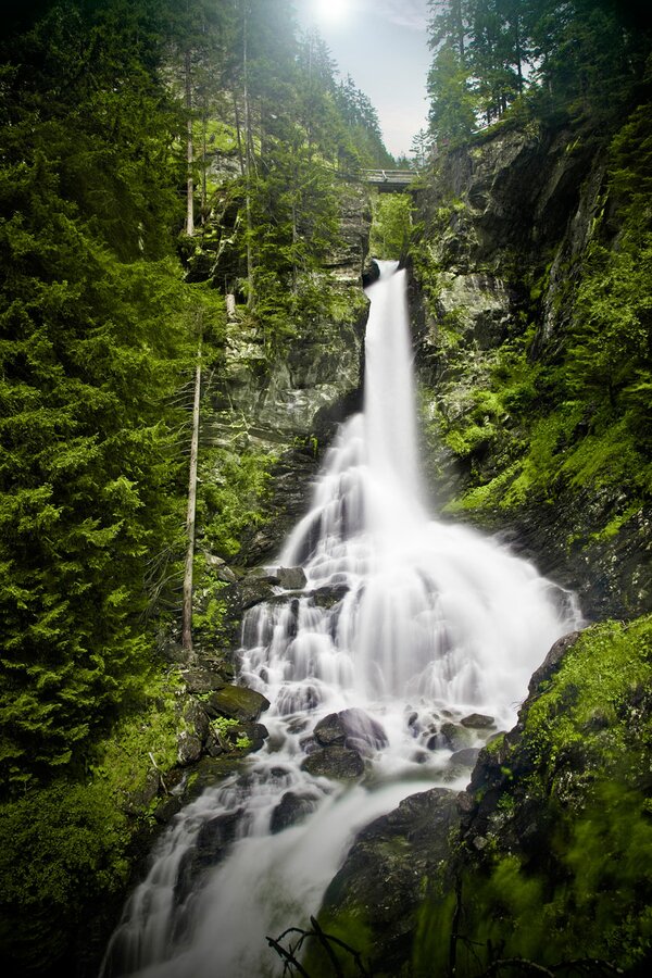
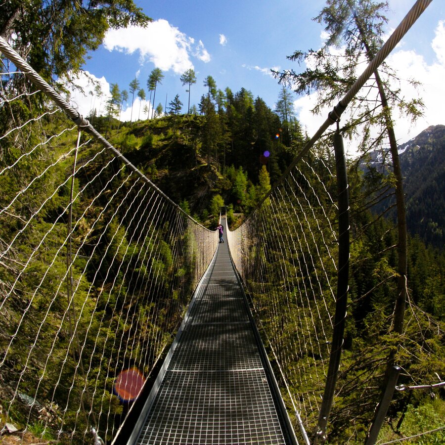
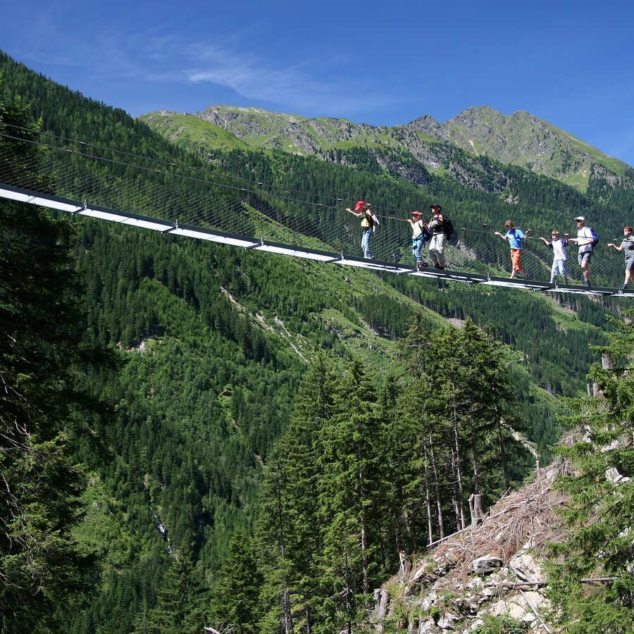
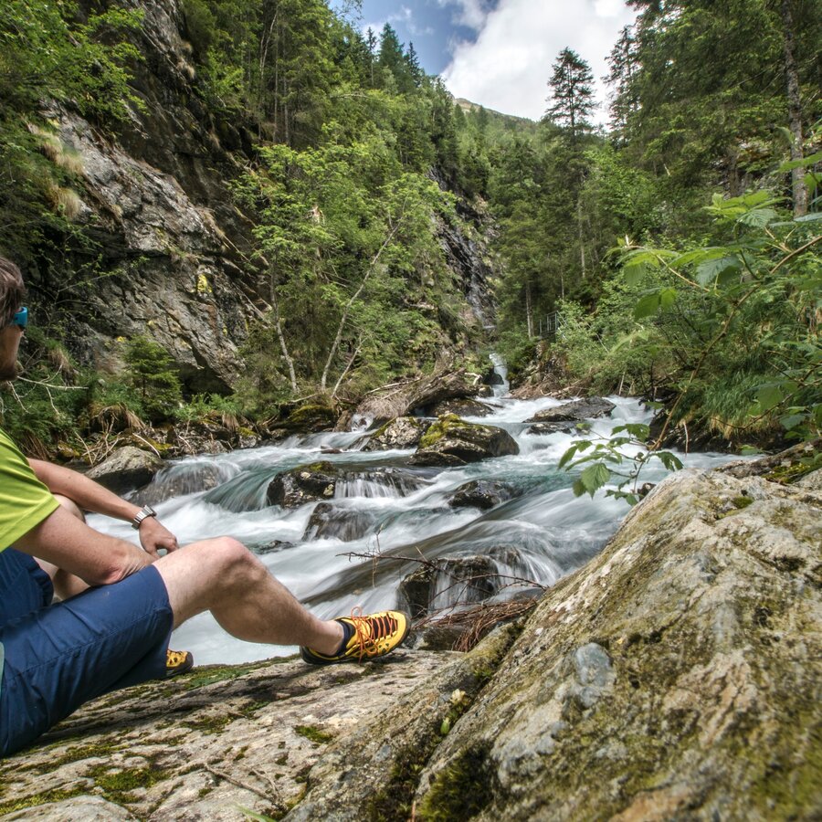
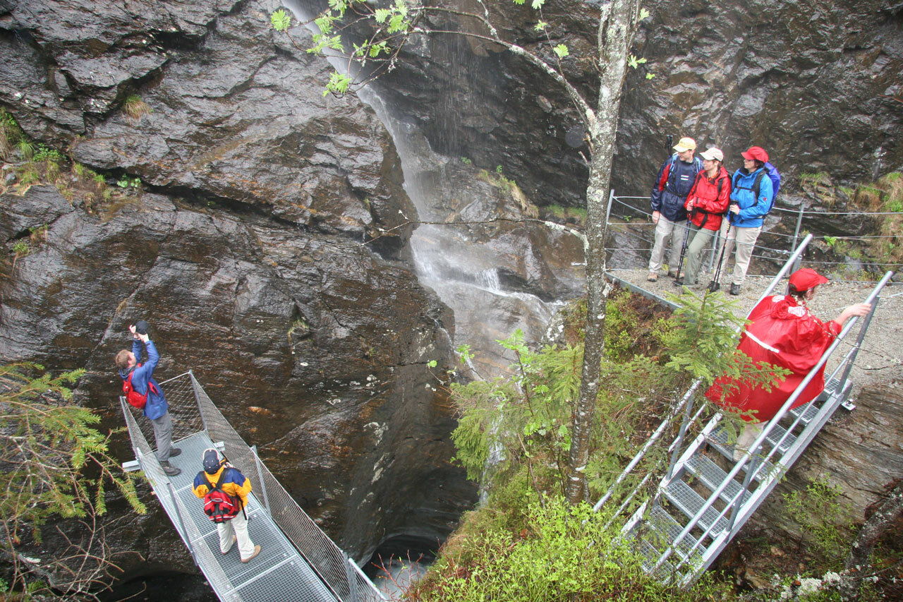
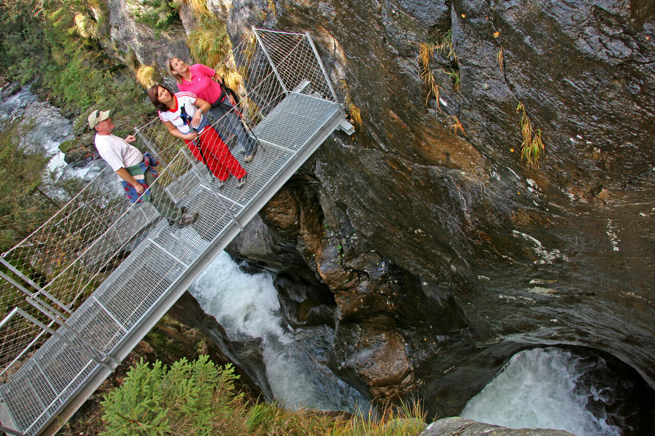
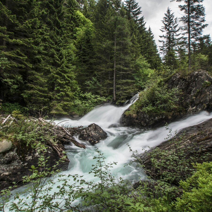
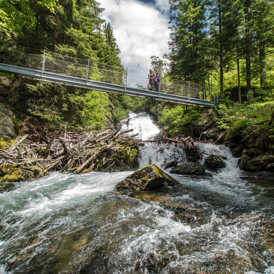
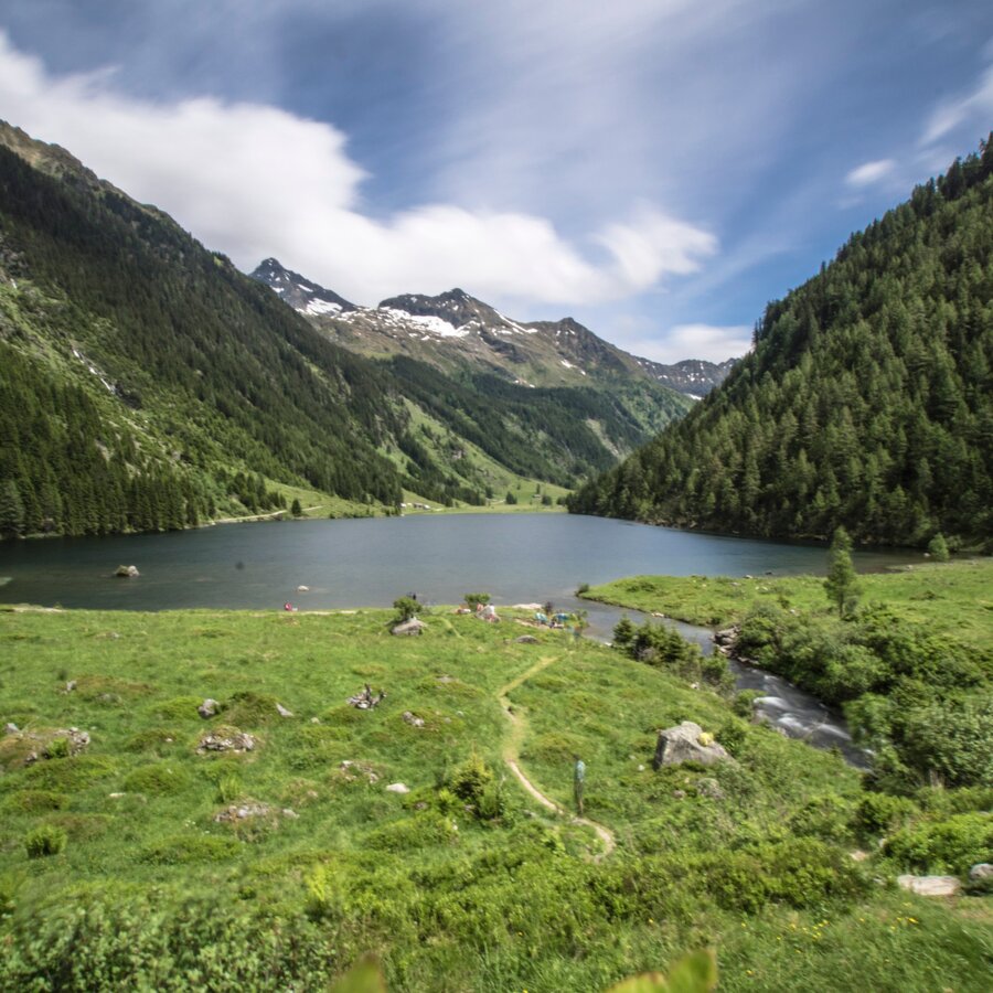
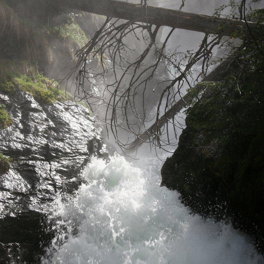
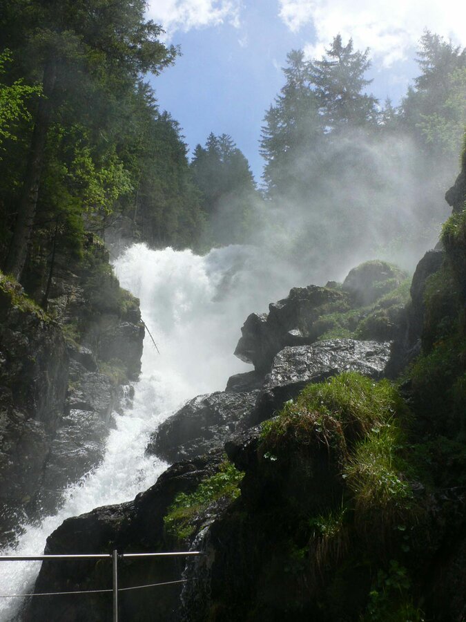


Du beginnst die Tageswanderung Wilde Wasser in Schladming beim Kraiterparkplatz, ständig begleitet vom schnellen und wild tosenden Talbach. Sanfter wird’s ab Untertal Ort, am Feuerwehrdepot vorbei, am Weg entlang saftiger Wiesen bis zur Janer- und Hinkerbrücke. Dort geht es weiter zum Toteisboden, mit seinem natürlichen Kanal- und Belüftungssystem aus der Eiszeit, das besondere Voraussetzungen für diese einzigartige Pflanzenwelt bietet. Über saftige Almböden kommst Du am Tettermoor an, einem Gebiet von atemberaubender Schönheit und Ruhe, der Talbach mäandert still und langsam durch das Moor. Der nächste Wegabschnitt führt Dich sanft über Wiesen und durch Wald am kristallklaren Untertalbach – mit gemütlichen Gasthäusern und Almhütten für die Rast. Ab dem großen Seeleiten Parkplatz beginnen sehr aufregende Teilstücke der ››Wilden Wasser‹‹ Wanderung – am Waldsteig Riesachfall und dem Alpinsteig "durch die Höll" kannst Du das Element Wasser in seiner reinsten Kraft spüren. Der prächtige Riesachwasserfall fällt in zwei Katarakten insgesamt 140 Meter zu Tal – mit Aussichtsplattformen die den höchsten Wasserfall der Steiermark in fast greifbare Nähe rücken. Wenig später kannst Du auf der 50 Meter (!) langen Hängebrücke den Wildbach in der Höllschlucht aus schwindelerregender Höhe betrachten. Danach gelangst Du über zahllose Stufen sicher durch die einzigartige Höllschlucht bis zur urigen Gfölleralm und wenige Minuten weiter zum malerischen Riesachsee. Am linken Seeufer lädt die Kaltenbachalm zur Rast ein. Zurück zum Seeleitenparkplatz empfehlen wir den bequemen Forstweg.Hinweis: Der Alpinsteig "Höll" ist NICHT für Hunde geeignet - Tipp: Umgehung über Forststraße zum RiesachseeTourplanungWander- oder Sportschuhe mit Profilsohle, Aufgrund der zahlreichen Einkehrmöglichkeiten, kann auf Proviant verzichtet werden. Der abwechslungsreiche und völlig ungefährliche Weg ist besonders auch für Kinder geeignet. Eine Begehung mit einem Sportkinderwagen ist gut möglich. Für Jogging, Walking und Nordic Walking ist die Route ebenfalls zu empfehlen.
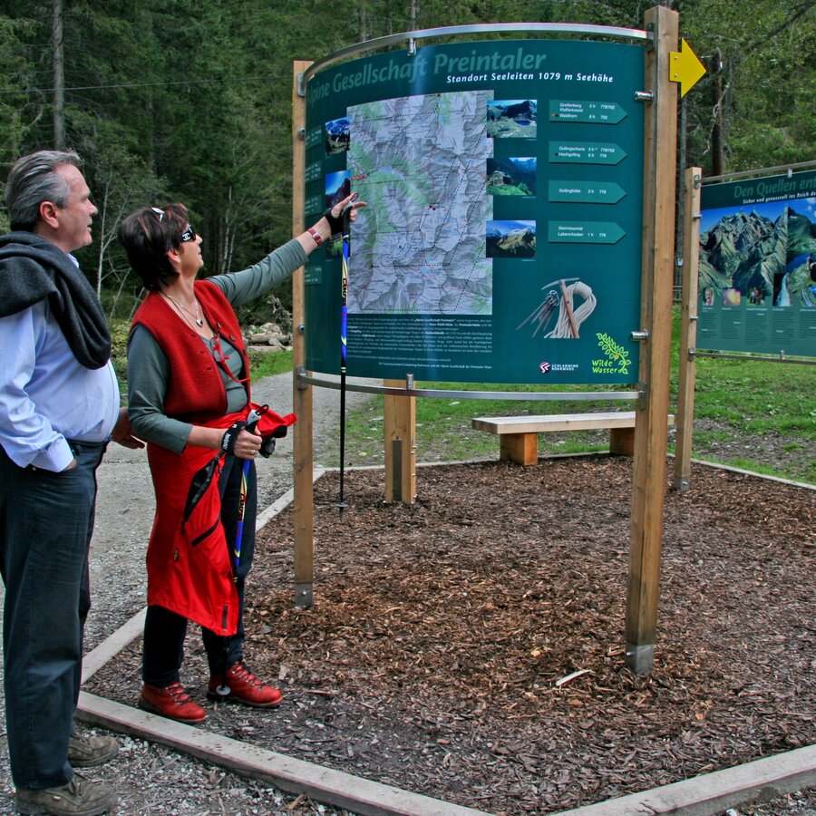
The theme trail Wild Waters starts with the Talbachklamm gorge in Schladming. The best option for parking is the parking garage at the Planai gondola (Planai stadion). From there you follow the trail signs towards Talbachklamm (passing by the white, Protestant church).
To reach the parking garage at Planai gondola you take exit "Schladming-Ost" from highway B320 at the congress center and follow the signage to the Planai gondola.
The trail runs along the Untertal valley following the creek's way out of the valley. The Planai-Hochwurzen buses run between Schladming and the Seeleiten parking area at the valley head. There are several bus stops in between so you can also just take some stages of the entire trail.
Information about bus time tables at www.planaibus.at
Changes in weather patterns, quick falls in temperature, thunderstorms, wind, fog and snow are some of the dangers that can be encountered on a hiking tour. Hosts of alpine huts and mountain refuges have a lot of experience in the mountains and can give good advice about weather and the trails. Poor equipment, overestimation of one's own capabilities, carelessness, poor personal constitution and/or wrong judgement can lead to critical situations. In case of thunderstorms: avoid summits, ridges and steel ropes.
GPS data and orienteering
Available GPS data - just like hiking maps - is only a guidance for orientation and can never depict a trail exactly with all its details. Especially at dangerous spots it is essential to judge on site how to proceed.
In an emergency please call:
- 140 - for Alpine emergencies (all over Austria)
- 112 - European GSM emergency number
Die genussvollen 14 Spazier- und Wanderkilometer direkt am Wasser tun Herz und der Seele gut. Sie sind eine wertvolle Seltenheit im gesamten Alpenraum und bei guter Kondition als Tagestour sehr geeignet. Rückfahrt mit dem Wanderbus.
Tourismusinformation: www.schladming.com
Infos über Busse: www.planaibus.at
360°-Bilder
Einen Überblick über Schladming kannst Du Dir mit Hilfe unserer 360°-Bilder verschaffen:
Blick in den Unteren Bereich der Talbachklamm: https://vonoben.schladming-dachstein.at/sommer/index.php?S=58
Blick über den Riesachsee: https://vonoben.schladming-dachstein.at/sommer/index.php?S=318
- Wanderkarte Schladming, 1:25.000, erhältlich im Tourismusverband Schladming.
- Wanderkarte Schladming-Dachstein, 1:50.000, erhältlich im Tourismusverband Schladming.
- Kostenloses Magazin "Wilde Wasser", erhältlich im Tourismusverband Schladming.
- "Wandern - Laufen - Walken" - erhältlich beim Tourismusverband Schladming.
- Wanderführer Schladming-Dachstein von Herbert Raffalt, erhältlich im Tourismusverband Schladming.


