Via the Bräualm to the Hohensee lake
easy Family hikes · Naturpark Sölktäler
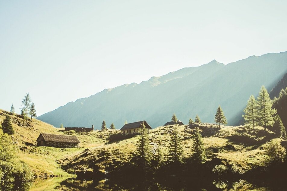
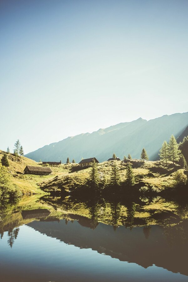
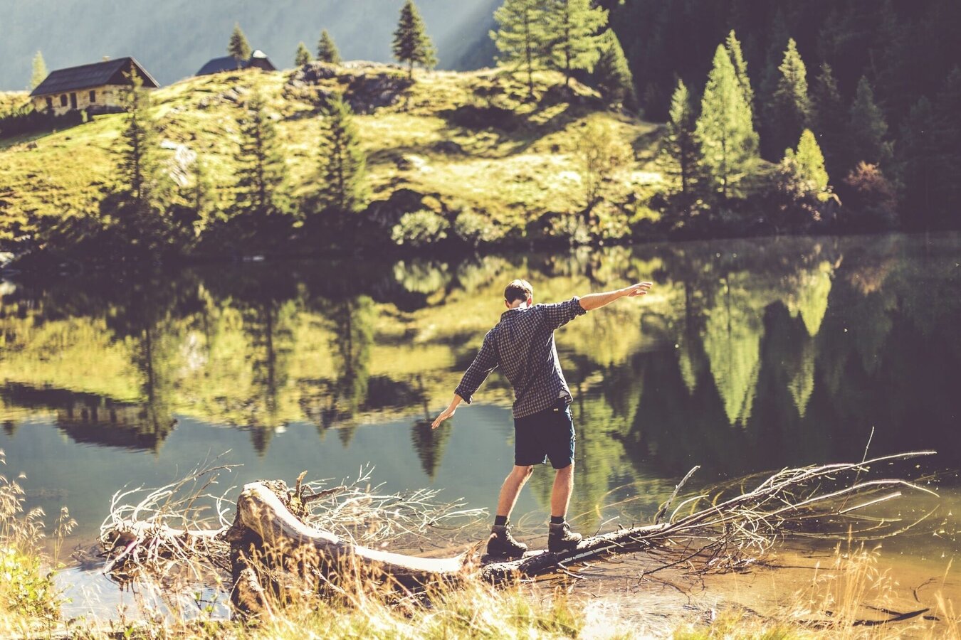
From St. Nikolai in the Großsölktal you hike along the Bräualmbach, past the Dürrmoos waterfall to the Hohensee. There, in addition to several dilapidated huts, there are two alpine pastures built of marble stones, which are, however, not managed. The lake itself is surrounded by high mountains and offers the perfect resting place for you.
Gallery


Starting point St. Nikolai im Sölktal village, again there is a large parking lot where you can leave your car. From St. Nikolai head towards Bräualm and Dürrmoos waterfall, from there continue to Hohensee. (Marking Weitwanderweg 702)
By train (train station Stein an der Enns) you arrive in the Sölktäler Nature Park. Here the valley bus (on weekdays from July 9 to September 11, 2022) will take you to the starting point of this hike. Here you can find more information and the current timetable.
Outside these times you can contact the Taxi Mayer in Fleiß. (Taxi Mayer - Tel.Nr. +43 676 54 09 858 or +43 676 60 28 107)
Weather changes, rapid drop in temperature, thunderstorms, wind, fog and snowfields are objective dangers and require the right behavior on the way. Hut keepers are experienced mountain connoisseurs, they can give good tips on the weather and the course of the trail. Lack of equipment, overestimation of one's own abilities, carelessness, poor physical condition and a wrong assessment can lead to critical situations. During thunderstorms: avoid peaks, ridges and rope belays at all costs.
GPS data and orientation aids
Available GPS data are - like hiking maps - only an orientation aid, since they can never represent an exact image or the richness of detail of a path in reality. Especially in the case of danger spots, it must therefore always be decided in the end on the basis of the conditions on the spot whether and how the further course of the path looks like.
In case of emergency, please dial the following emergency numbers:
140 - for alpine emergencies - Austria-wide
112 - Euro emergency call GSM emergency call service
Weather changes, rapid drop in temperature, thunderstorms, wind, fog and snowfields are objective dangers and require the right behavior on the way. Hut keepers are experienced mountain connoisseurs, they can give good tips on the weather and the course of the trail. Lack of equipment, overestimation of one's own abilities, carelessness, poor physical condition and a wrong assessment can lead to critical situations. During thunderstorms: avoid peaks, ridges and rope belays at all costs.
GPS data and orientation aids
Available GPS data are - like hiking maps - only an orientation aid, since they can never represent an exact image or the richness of detail of a path in reality. Especially in the case of danger spots, it must therefore always be decided in the end on the basis of the conditions on the spot whether and how the further course of the path looks like.
In case of emergency, please dial the following emergency numbers:140 - for alpine emergencies - Austria-wide112 - Euro emergency call GSM emergency call service
A good backpack is helpful and for routes in alpine terrain, hood, gloves, a good jacket and pants are part of the basic equipment. Good, waterproof shoes, sunglasses, sunscreen and enough drinks are essential. Flashlight, maps, knife and a small first aid box are also essential.
SummitLynx- Your digital summit and hut book - available worldwide and always with you!
You can get more information at the tourist office Schladming DachsteinInformation
Office Nature Park Sölktäler:
Phone: +43 3687 23310 501naturpark@soelktaeler.comStein an der Enns 1078961 Sölk


