Summit Tour to the Emblem of the Planneralm - the Schoberspitz
easy open Hiking · Grimming-Donnersbachtal
Tour characteristics
Stamina
Technique
Experience
Landscape
Tour-Infos
Distance: 8.27 km
Duration: 4.5 h
Ascent: 822 m
Descent: 822 m
Best time of year
january
february
march
april
may
juny
july
august
september
october
november
december
The tour
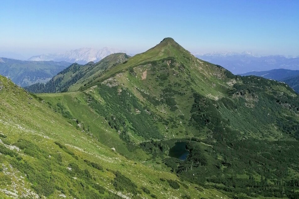
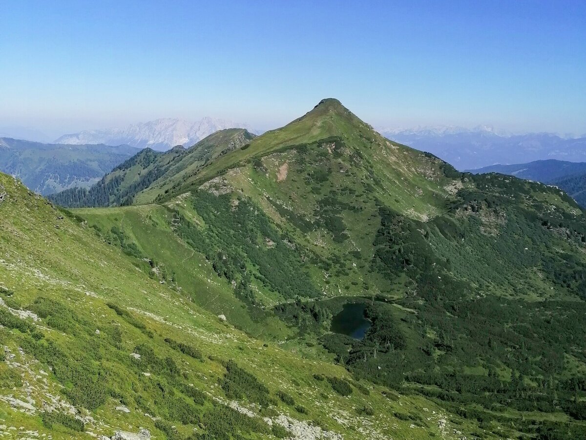
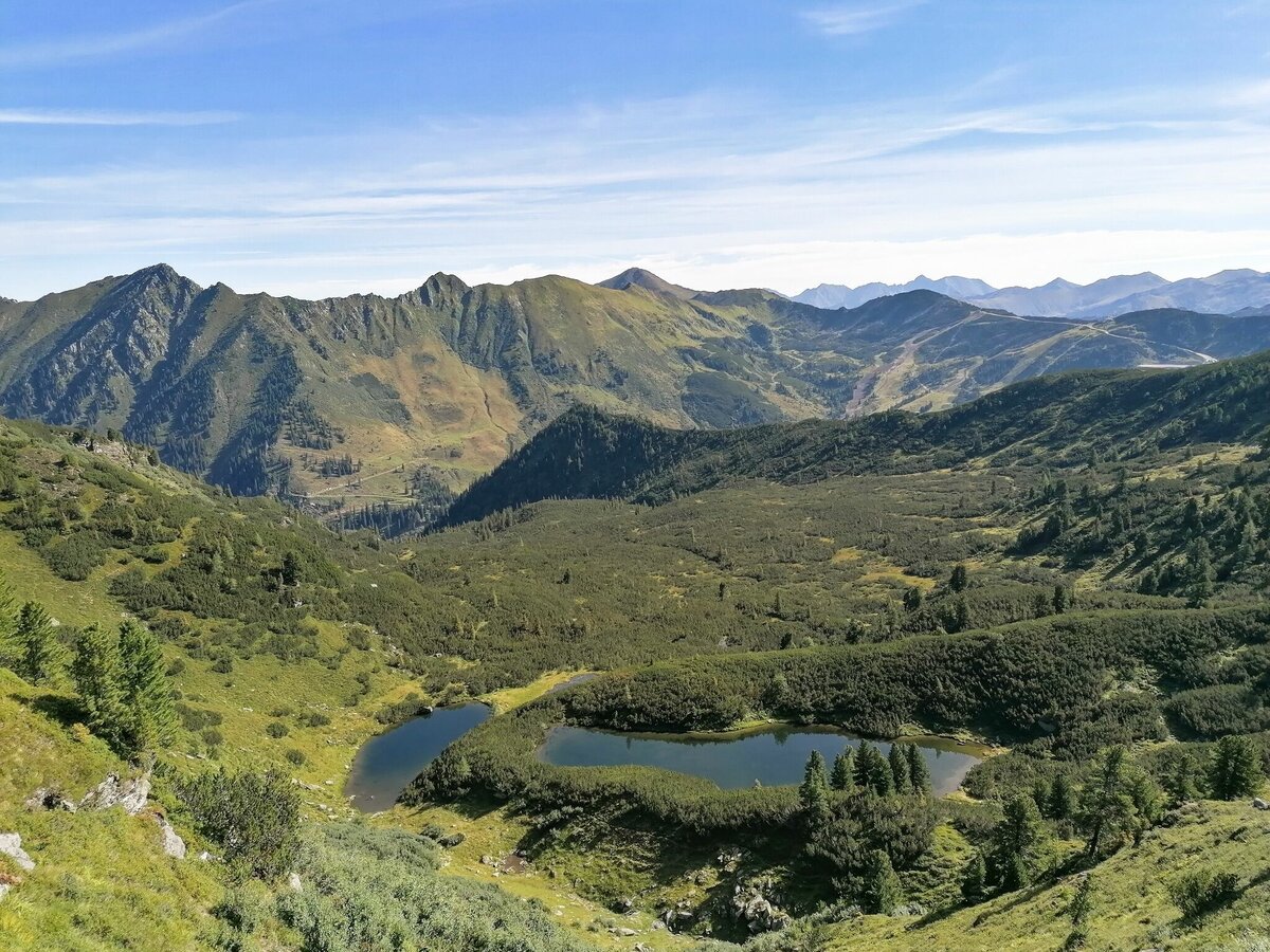
This hike leads in just under an hour through a bright but notably damp forest, to a cirque and the small Kothüttensee tarn, then becoming somewhat steeper through a grassy fields of rocks up to the ridge near the Goldbachscharte. On the ridge we follow markings for trail No. 902 to the W, enjoying an easy hike to a striking rock formation (the Hunnengrab), continuing on our leisurely hike across a grassy hillside to the trail crossing on the Karlspitze. The trail to Schoberspitze now leads gently downhill to the Karscharte, from where a short-but-steep hike (No. 925) along the wide southern ridge of the Schoberspitz leads to the summit. The view is something to rave about: the massive rock figure of the Grimming naturally attracts all the attention at first. But then we have time to observe the other surrounding peaks, the small tarns and green cirques. It is a place to enjoy! We will take the same route back.
Gallery


More information
Turn-by-turn directions
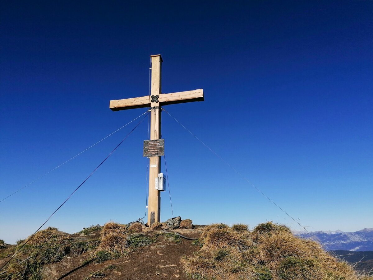
This hike leads you past the alpine inn Grimmingblick. You follow the markings, first flat, then over the steeper trail into the watery cirque on the high plateau. The striking mountain shape of the Schoberspitze is already in view. Enjoy this section before you hike along the marked path back uphill to the ridge and on to the Karlspitze. First rest. Summit book entry. Continue hiking to the Schoberspitze. On the way to the top you will be amazed by the enchanting alpine flowers and mountain lakes. Once at the top, a magnificent view of the nearby mountains of the Planneralm or those in Donnersbachwald will fill you with a feeling that makes you want to whoop. You also have a clear view of the mighty Grimming, the Schladminger Tauern and the Tote Gebirge. Rest and enjoy before you hike back to the Planneralm via the same trail.
Getting there
From the Ennstalbundesstraße (B320) turn off at the Trautenfels junction in the direction of Irdning, Donnersbach, Donnersbachwald. In the village of Donnersbach after the village center turn left towards Planneralm. 12 km long ascent via the toll-free mountain road up to the Planneralm.
In the summer there are no puplic transport.
Taxi/Cab Telephon Number: +43 660 6633666
Parking
Parking area at the wayside cross, valley station of the ski lift.
Start
Planneralm P at the trail crossing and lift terminal
Destination
Parkplace Planneralm-at the lift terminal
Security
- Plan your tour in advance and take into account walking time, route length, altitude difference, danger spots and weather forecast.
- The Alpine Club provides detailed information on "Safe Mountain Hiking". Under www.alpenverein.at you can inform comprehensively about it.
- Together is much more beautiful and at the same time safer in the mountains. Do not go alone, if possible, and adapt the tour to the ability of your group.
- Let them know where you are going and when you want to be back. Also sign hut or summit books.
- Turn back in good time if the weather deteriorates. If you get caught in a thunderstorm, do not stay on the summit or ridge and stay away from individual trees. Wait out the storm, if possible in a crouching position.
- Stay on the marked trails and remember to close pasture fences again.Getting up the trail is only half the battle.
- Stay alert, especially on the descents, to make it back to the valley safely.
- In case of emergency, keep calm and call the mountain rescue service on 140. If you have no reception, take out the sim card and dial 112.
Equipment
- Plan your tour in advance and take into account walking time, route length, altitude difference, danger spots and weather forecast.
- The Alpine Club provides detailed information on "Safe Mountain Hiking". Under www.alpenverein.at you can inform comprehensively about it.
- Together is much more beautiful and at the same time safer in the mountains. Do not go alone, if possible, and adapt the tour to the ability of your group.
- Let them know where you are going and when you want to be back. Also sign hut or summit books.
- Turn back in good time if the weather deteriorates. If you get caught in a thunderstorm, do not stay on the summit or ridge and stay away from individual trees. Wait out the storm, if possible in a crouching position.
- Stay on the marked trails and remember to close pasture fences again.Getting up the trail is only half the battle.
- Stay alert, especially on the descents, to make it back to the valley safely.
- In case of emergency, keep calm and call the mountain rescue service on 140. If you have no reception, take out the sim card and dial 112.
Author’s recommendation
After returning, treat yourself to a stop at the Planneralm or at the Schrabachhütte.
Tips, hints and links
Tourism information: www.schladming-dachstein.at
Tourism blog: www.derbergdastal.at
Tourist Office Schladming-Dachstein
Ramsauerstrasse 756
8970 Schladming
T: +43 3687 23310
info@schladming-dachstein.at
Garbage on meadows and paths can not smell mountain and valley. Please take it with you. Agriculture and forestry are important partners for Berg und Tal. They allow you to walk and drive on many of their paths. Be aware that only good cooperation will guarantee your recreational enjoyment in the future.
- GRIMMING-DONNERSBACHTAL Leisure Map (1:31.000). Available free of charge at tourist offices and lodging establishments.
- SCHLADMING-DACHSTEIN Hiking Map (1:50.000)
- KOMPASS Hiking Map 68, Ausseerland-Ennstal 1:50.000, hiking, biking, ski touring
You might also be interested in...


Weather forecast
Date
Early clouds will clear to leave the region with a dry and sunny day.
The day starts sunny, but will be partly cloudy in the afternoon.
The day starts sunny, but will be partly cloudy in the afternoon.


