Mountaineer Memorial and Dachstein Museum
Hiking · Ramsau am Dachstein
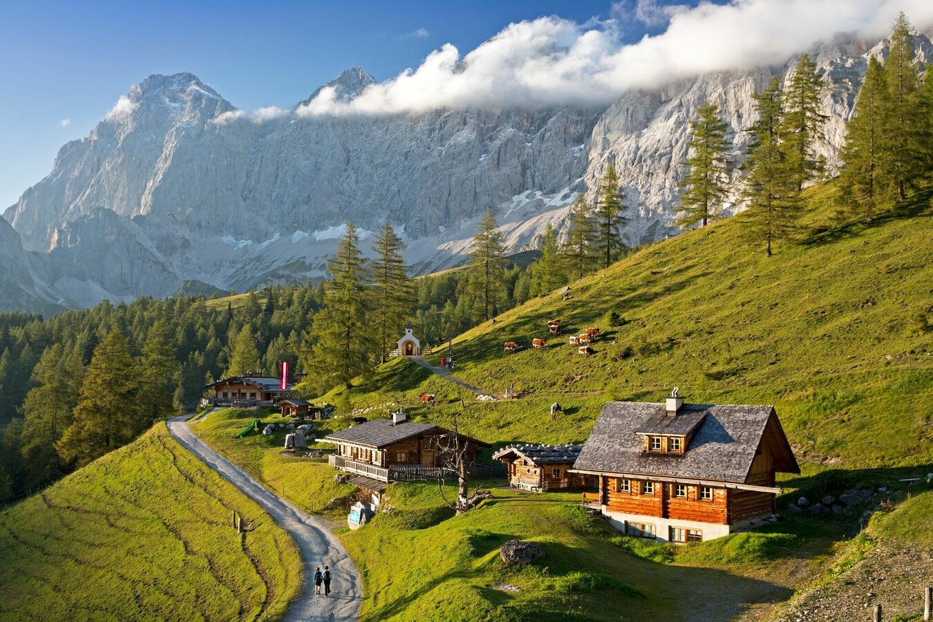
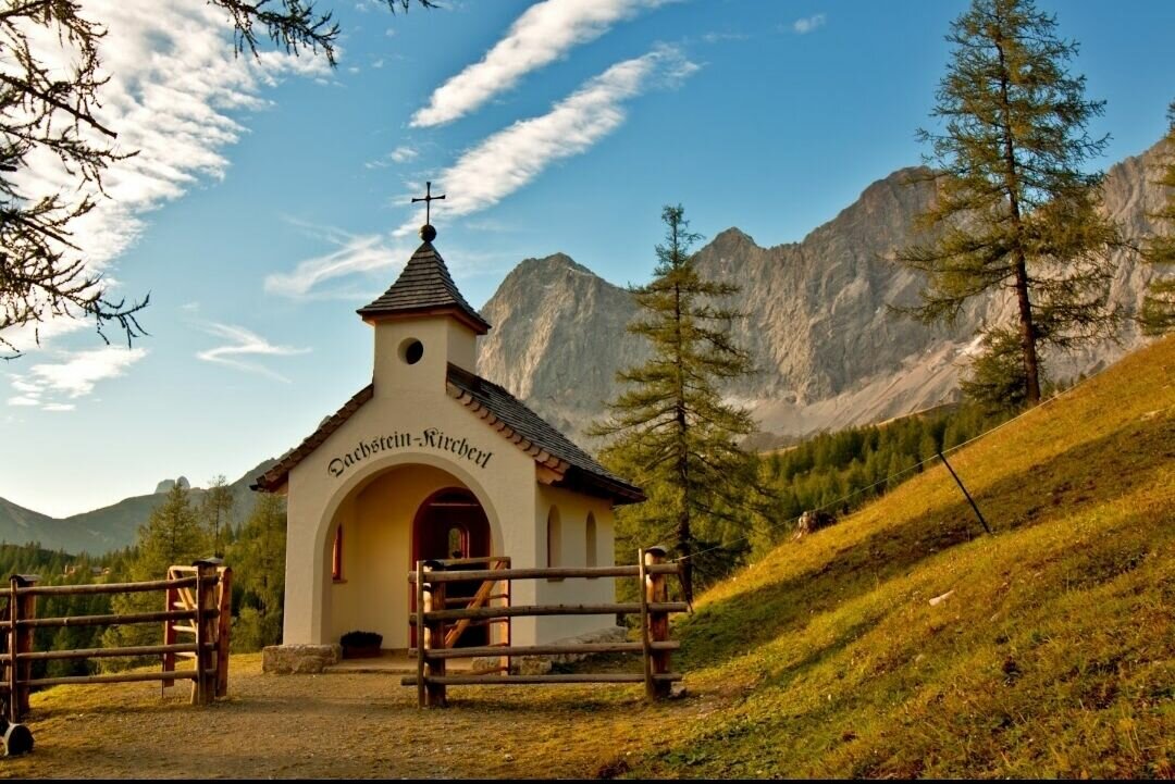
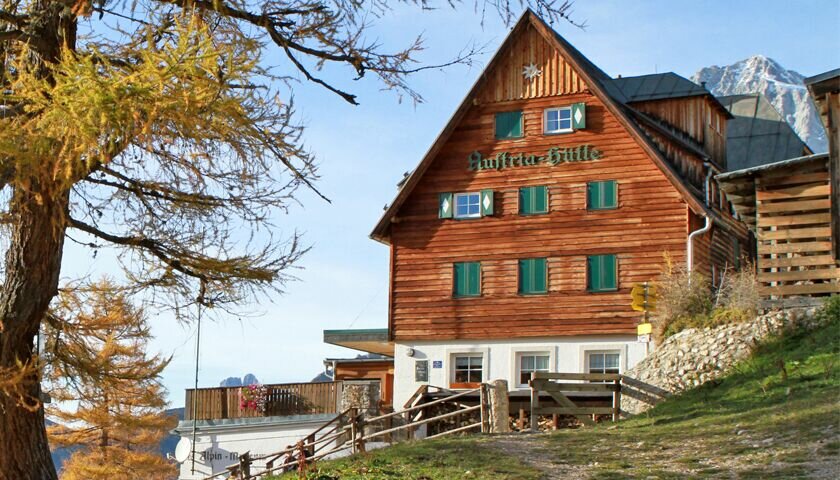
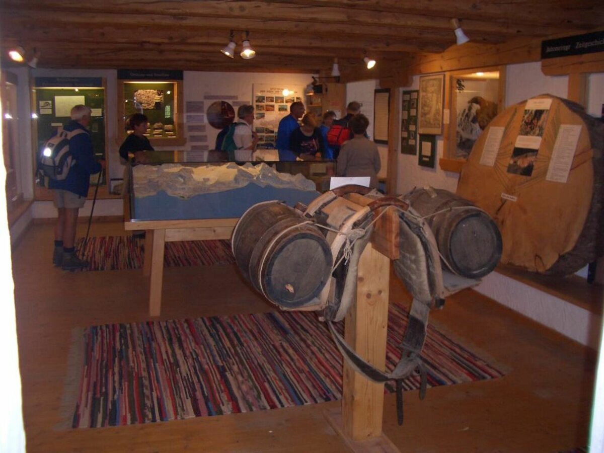
This easy and promising hike brings you closer to the history of mountaineering around the Dachstein. You will find the mountaineering memorial in the form of the small Dachstein church right next to the Brandalm. The mountaineers who have fallen in the Dachstein area since 1879 are remembered here. A short section further up you will find the Dachstein Museum in the Austriahütte, whose permanent exhibition takes a look at the diverse alpinistic relationships with the Dachstein and the region.
To round off this circular tour, a stop at the Brandalm, the Austriahütte - or on the way back into the valley - at the Dachsteinhaus or Gasthof Edelbrunn is a must.
Gallery
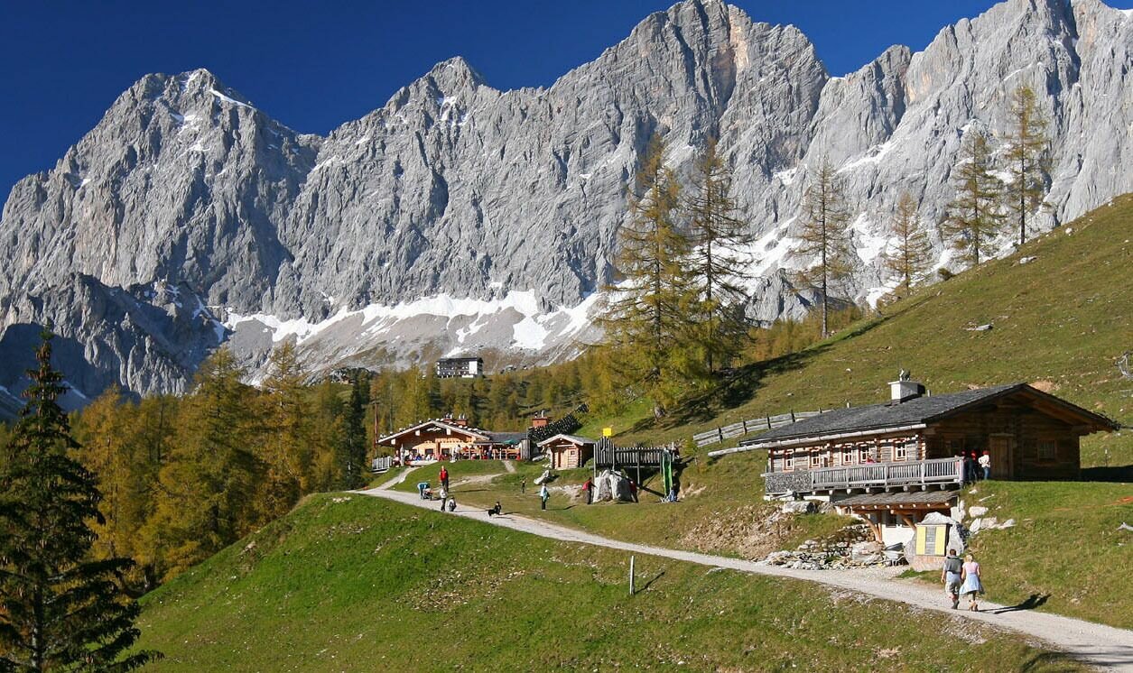
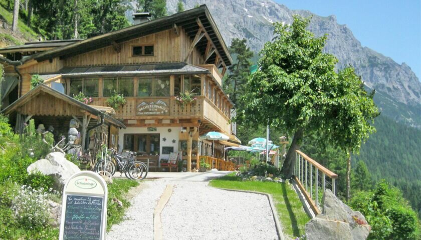


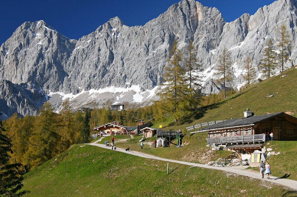
From the starting point you walk westwards, along the wide forest path in the direction of the Ramsauer Almengebiet. After a short stretch in the forest, hiking trail #615 from the Ski Willy/Rittislift bus stop (approx. 15 minutes' walk) joins the forest road. You hike moderately uphill past the Dachsteinhaus and enjoy a wonderful view over the Ramsau plateau. At the following forest path crossing, keep to the right and continue to follow path #615 in the direction of Brandalm and Austriahütte. The forest road winds with a few curves along the western flank of the Brandriedel and after about 50 minutes you will reach the Brandalm with the Dachsteinkircherl.
You follow the forest path past the Brandalm and after about 300 m you turn right at the fork and hike - slightly uphill - to an unattended alpine hut on hiking trail #11. Then follow this to the right and in a few minutes you will reach the Austriahütte with the Dachstein Museum. From there, walking trail #9 takes you back down to the Brandalm and on the well-known forest path back to the starting point at the Edelbrunn hiking portal.
From the west: Tauernautobahn A 10 to the Ennstal junction - exit in the direction of Graz/Schladming - around 20 km on the Ennstal federal road to Schladming - Ramsau junction.
From the east: Pyhrnautobahn in the direction of Liezen Ennstalbundesstraße to Schladming - Ramsau junction.
Follow the Ramsauer Landesstraße through the village and turn right at the "Lange Gasse" junction to the Edelbrunn hiking portal.
Ramsau Ski Willy/Rittis lift bus stop. From there hiking trail along hiking trail #615 to the Edelbrunn hiking portal or directly onto the route.
- Ramsau public transport company: www.rvb.at
Car parking at the hiking trail head.
Changes in weather patterns, quick falls in temperature, thunderstorms, wind, fog and snow are some of the dangers that can be encountered on a hiking tour. Hosts of alpine huts and mountain refuges have a lot of experience in the mountains and can give good advice about weather and the trails. Poor equipment, overestimation of one's own capabilities, carelessness, poor personal constitution and/or wrong judgement can lead to critical situations. In case of thunderstorms: avoid summits, ridges and steel ropes.
GPS data and orienteering
Available GPS data - just like hiking maps - is only a guidance for orientation and can never depict a trail exactly with all its details. Especially at dangerous spots it is essential to judge on site how to proceed.
In an emergency please call:
- 140 - for Alpine emergencies (all over Austria)
- 112 - European GSM emergency number
A well-packed backpack is helpful and especially when touring Alpine terrain a tuque, gloves, a windproof jacket and pants are standard equipment. Good, waterproof shoes, sun glasses, sun cream and sufficient beverages are essential too. Torch light, a map of the area, knie and a small first-aid kit should also be in the backpack.
If you take the forest road for the way back from the Austriahütte to the Brandalm, the entire tour is suitable for pushchairs.
- From the Austriahütte you can also hike further up to the valley station of the Dachstein cable car and from there take the bus back down to the valley.
- The tour is possible year-round up to Brandalm.
Schladming-Dachstein summer experience map WEST, available at the information offices.


