Fageralm Tour
Ski tour prepared · Schladming
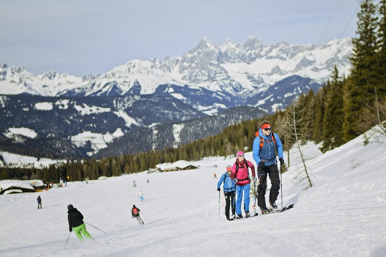
A technically simple piste ski tour for which you should, however, be a little more fit. With an vertical ascent of 900 meters and a length of around 7.5 kilometers, the tour is quite a challenge - especially for beginners in touring sports. You will be rewarded with a winter wonderland in the alpine pasture area of the Fageralm, a wonderful view of the imposing Dachstein massif and a hearty stop at one of the ski huts.
Opening hours:
As long as the snow situation permits, the slopes are open to ski tourers daily from 8.30 a.m. to 5 p.m.
Touring ticket required:
A fee has to be payed for the ascent and use of the infrastructure such as slopes, parking lot, guidance system, etc. You can find the prices here: www.schladming-dachstein.at/en/winter/Skitouring-Fageralm
This does not apply to owners of a valid season ski pass - please take this season ski pass with you and show it at the ticket station - thank you!
Gallery
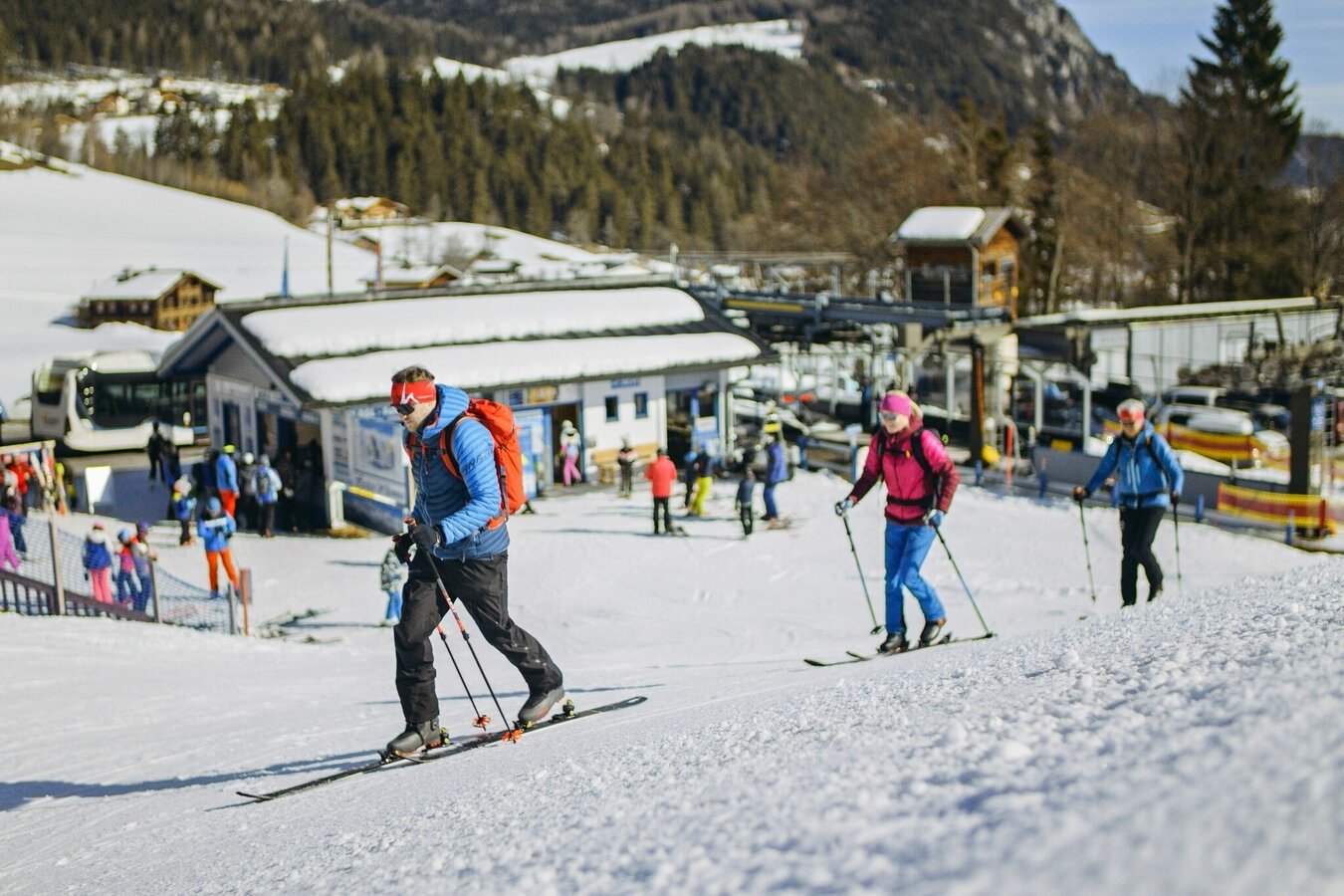
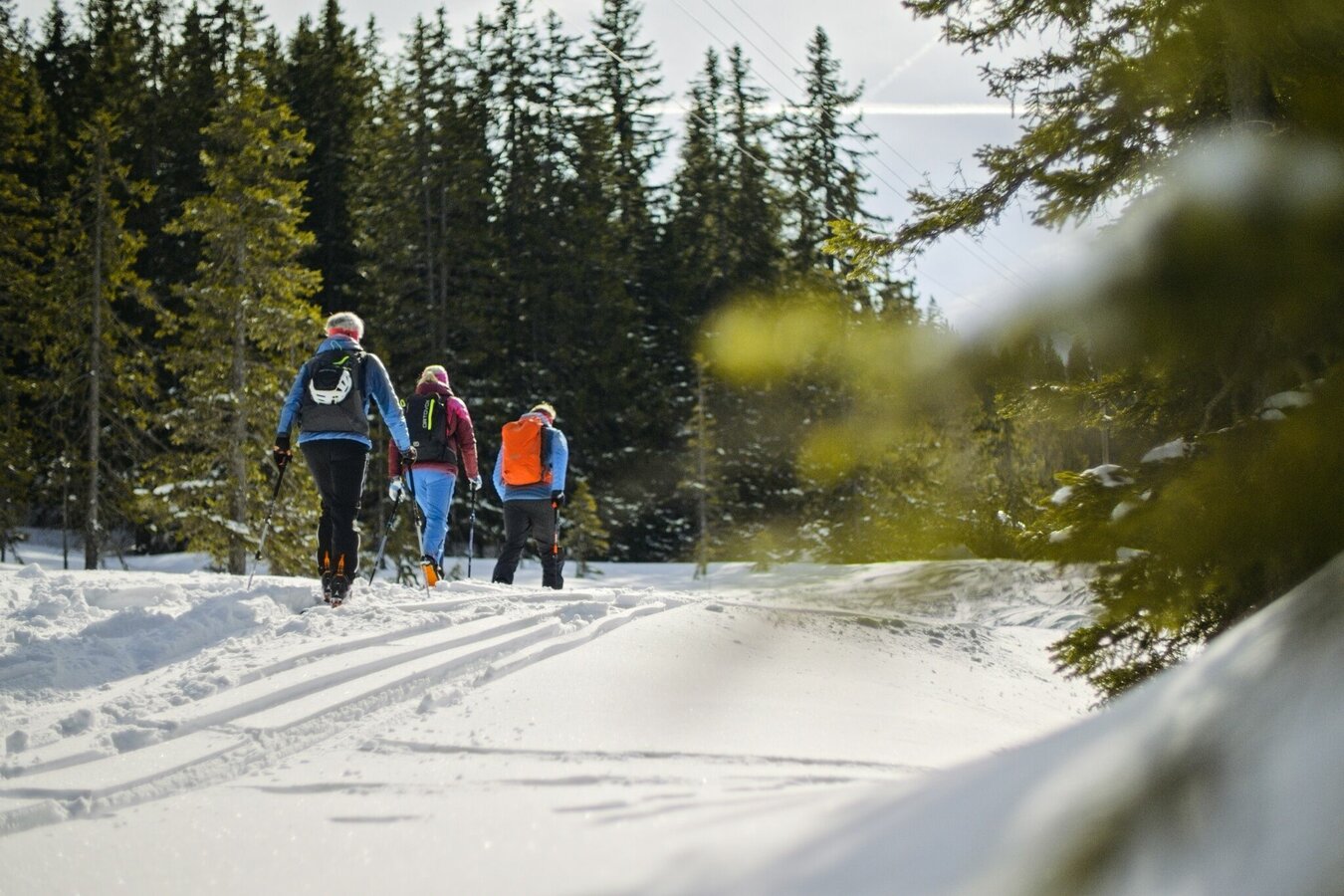


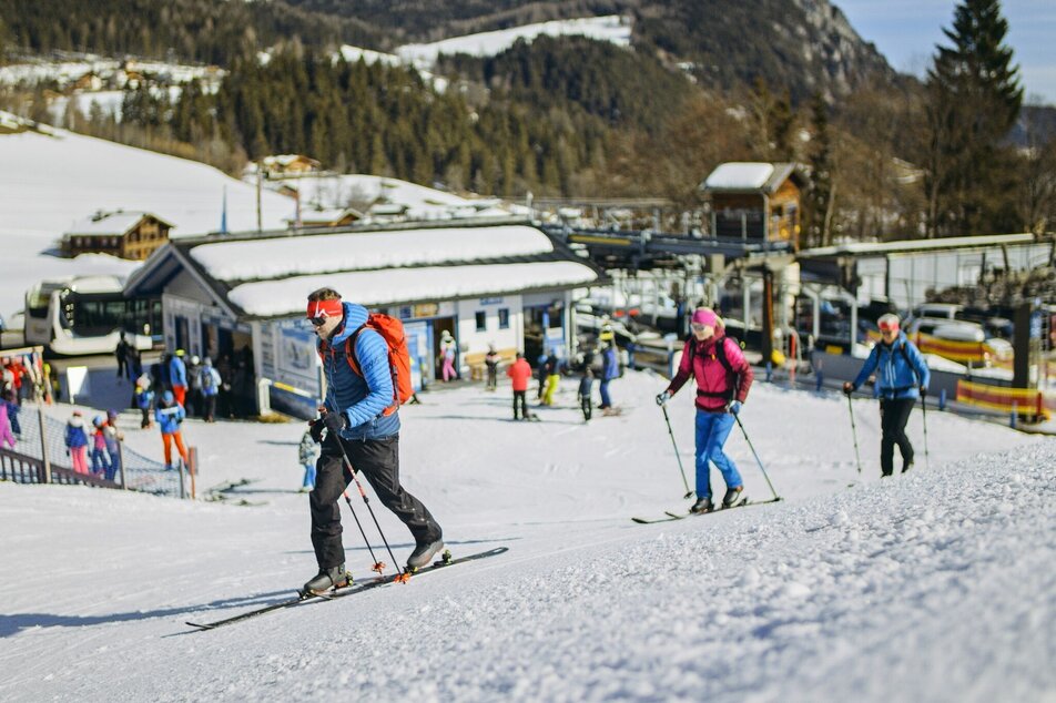
From Gasthof Unterreith at the Fageralm valley station you walk across the practice meadow to the edge of the forest and then follow the edge of the slopes of the ski path from the Fageralm. During the ascent to the mountain station of the Forstaubahn (you cross under it a few times) you also cross the valley run a few times - caution is advised!
From the Forstaubahn mountain station, follow the Jägerlift Skiweg to the right of the Jägerlift valley station and then - roughly - the summer hiking trail no.2 until you reach the extensive alpine pasture area of the Fageralm at the Unterbergalm. Past the Lechneralm and the Premhütte you continue to climb until you reach the route of the summery Fagerstraße, which you then follow to the Trinkeralm. From there it is another 100 meters and half a kilometer to the Hinterfager mountain station and the Goliath giant swing, where you have reached your destination.
The descent takes place along the ascent route or along the Forstau valley run.
From the west:
From the A10 Tauern motorway turn off at Altenmarkt and follow the B99 federal road to Radstat. You stay on this until the roundabout at the end of Radstadt and take the 3rd exit to Forstau. From here it's about 6 km past the Seitenalm family hotel and over the top of the pass to the valley station of the Forstaubahn.
From the east:
Turn off the A9 Phyrn-Autobahn at Liezen and on the B320 Ennstalbundesstraße past Schladming to Gleiming and there turn onto the L721 Gleimingstraße. Continue to Forstau (from the state border Salzburg the road is numbered L223) to the valley station of the Forstaubahn.
With the ski bus 900S from Schladming (from the train station you walk approx. 250 m to the bus stop at Planai-West ski station) to the Fageralm. The start of the tour is about 50 metres away at Gasthof Unterreith, Forstau.
HERE you can find the bus timetables.
Sufficient parking spaces are available at the Forstaubahn valley station.
GPS data and orienteering
Available GPS data - just like hiking maps - is only a guidance for orientation and can never depict a trail exactly with all its details. Especially at dangerous spots it is essential to judge on site how to proceed.
In an emergency please call:
- 140 - for Alpine emergencies (all over Austria)
- 112 - European GSM emergency number
In winter, caution is advised on even supposedly easy tours. The ground can be slightly icy in shady places, and there is a risk of avalanches on slopes. Mountain sports are therefore - all the more so in winter - subject to personal responsibility. Before every ski tour or snowshoe hike, the current avalanche report should be checked - available at www.lawine.at.
Tourism associations or avalanche warning services assume no liability for the information provided.
For detailed descriptions please contact a local Alpine school for a mountain guide: www.schladming-dachstein.at/mountainguide
- Ski touring equipment consisting of skis / splitboard, skins and sticks
- Avalanche transceiver (LVS), shovel and probe
- Camisole & hood to change
- Sunglasses for the ascent, ski goggles & helmet for the descent
- Warm gloves, possibly light gloves for the ascent
- Thermos with a warm drink, e.g. tea and granola bars
The Fageralm is a snowy alp area that offers some nice variations on the descent.


