Mölbegg
snadné Hiking · Grimming-Donnersbachtal
Vlastnosti túry
Vhodnost
Technika
Zážitek
Krajina
Informace o túře
Trasa: 6.37 km
Doba trvání: 3.75 h
Výstup: 830 m
Sestup: 824 m
Nejlepší roční období
Leden
Únor
Březen
Duben
Květen
Červen
Červenec
Srpen
Září
Říjen
Listopad
Prosinec
Túra
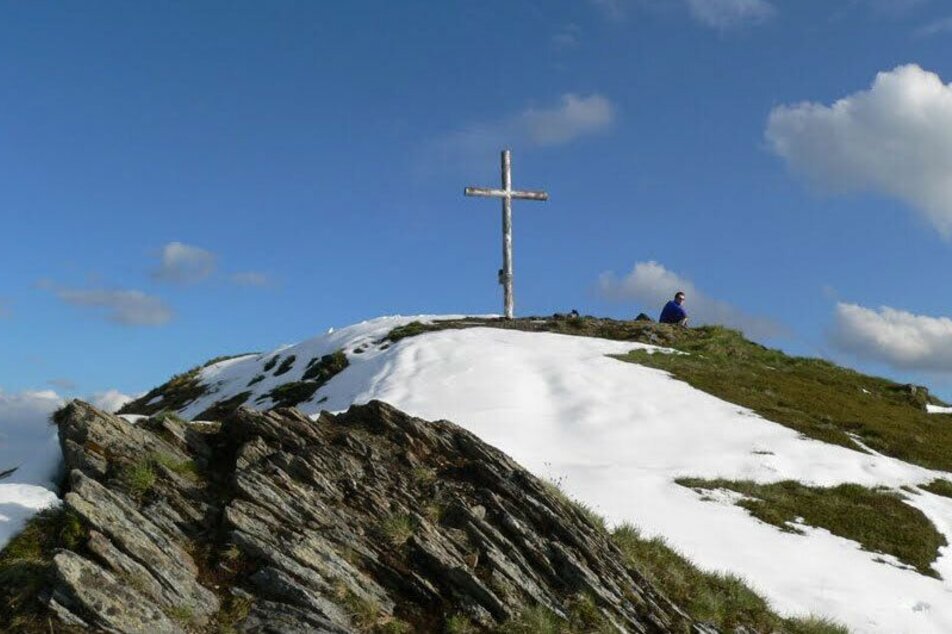
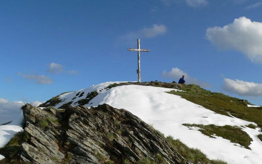
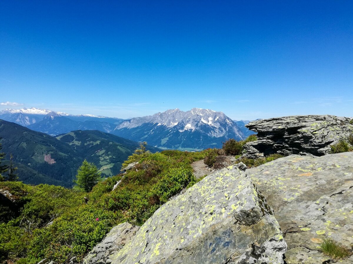
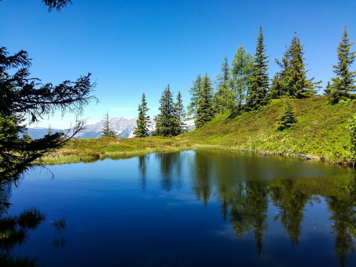
On the right side in front of the farm Hochbär, we follow the markings Mölbegg 930/Hochstein 931. The way leads us quickly uphill towards the forest. At the fork of the ways in the forest, we keep left. We hike further through the wood and reach a high ridge with a clearing and a small lake. From there we enjoy the wonderful view of the summits, Mölbegg, Edelweißspitze and Hochstein. At the branch Mölbegg Hochstein we keep slightly left towards Mölbegg. The path leads us across the side of the Mölbegg to the summit.
Fotogalerie


Více informací
Popis trasy
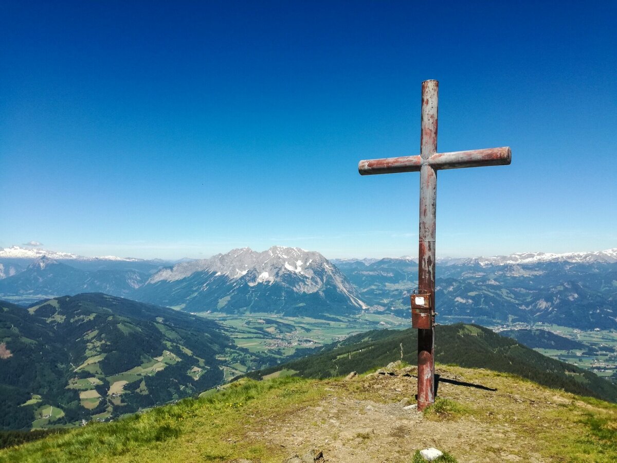
On the right before the Hochbär farmstead, follow the Mölbegg 930 or Hochstein 931 markings. The trail leads up into the forest. At the fork in the path in the forest, keep left and continue hiking up the steeper trail to the tree line. In total you cross a forest road three times. Then you will come to a high ridge with a clearing and a small lake. Take a short break to shoot a few photos, from there you can enjoy a wonderful view of the peaks Mölbegg, Edelweißspitze and Hochstein. Continue on a narrow path to the Scharte. At the junction Mölbegg/Hochstein you keep slightly left and hike up the flank to the summit. A summit with a lot of power, because it allows you a 360° panoramic view of the very best - Grimming foot-free, of course. Further hiking possibility to the Hochstein.
Příjezd
From Irdning towards Donnersbach, along the Planneralm street towards Ilgenberg, after 2 km turn left, uphill then right, stay on this narrow road until the farm Hochbär.
Parkování
At the Hochbär homestead. On nice weekends, do not park in driveways and if in doubt, ask the owner.
Začátek
Farm Hochbär
Cíl
Summit Mölbegg and back to the farm Hochbär
Zabezpečení
- Plan your tour in advance, taking into account walking time, route length, altitude difference, danger spots and weather forecast.Together is much more beautiful and at the same time safer in the mountains.
- Do not go alone, if possible, and adapt the tour to the ability of your group.
- Let them know where you are going and when you want to be back. Also sign hut or summit books.
- Turn back in good time if the weather deteriorates. If you get caught in a thunderstorm, do not stay on the summit or ridge and stay away from individual trees. Wait out the storm, if possible in a crouching position.
- Stay on the marked trails and remember to close pasture fences again.
- Getting up the trail is only half the battle. Stay alert, especially on the descents, to make it back to the valley safely.In case of emergency, keep calm and call the mountain rescue on 140. If you have no reception, take out the sim card and dial 112.
- If you encounter cows: It is best to pass above the herd with at least 50 meters distance. Stay calm, don't make any frantic movements and don't run away. Do not imitate cow sounds and do not try to pet the animals. A stick and loud shouting can often make the animals turn back in an emergency.
- If you are a dog owner: Clarify before the hike if you have to cross a pasture. Keep your dog on a leash and make sure he stays calm. If a cow attacks, let the dog off the leash immediately. Never pick him up to defend him.
- You can get detailed information on "Safe Mountain Hiking" from the Alpine Club. At www.alpenverein.at you can inform yourself comprehensively about it.
Tipy autora
If your legs are still tingling at the summit of the Mölbegg, then head for the next peak, the Hochstein.
Další informace a odkazy
Tourism information: www.schladming-dachstein.at
Tourism blog: www.derbergdastal.at
Tourist Office Schladming-Dachstein
Ramsauerstrasse 756
8970 Schladming
T: +43 3687 23310
info@schladming-dachstein.at
Garbage on meadows and paths can not smell mountain and valley. Please take it with you. Agriculture and forestry are important partners for Berg und Tal. They allow you to walk and drive on many of their paths. Be aware that only good cooperation will guarantee your recreational enjoyment in the future.
- GRIMMING-DONNERSBACHTAL Leisure Map (1:31.000). Available free of charge at tourist offices and lodging establishments.
- SCHLADMING-DACHSTEIN Hiking Map (1:50.000)
- KOMPASS Hiking Map 68, Ausseerland-Ennstal 1:50.000, hiking, biking, ski touring
Také by vás to mohlo zajímat


Předpověď počasí
Vybrat datum
Dry and partly sunny throughout the day, with cloudy periods from time to time.
Early clouds will clear to leave the region with a dry and sunny day.
Dry and bright with plenty of sunshine, clouds will be rare.


