
Roseggersteig
łatwe Hiking · Austriahütte
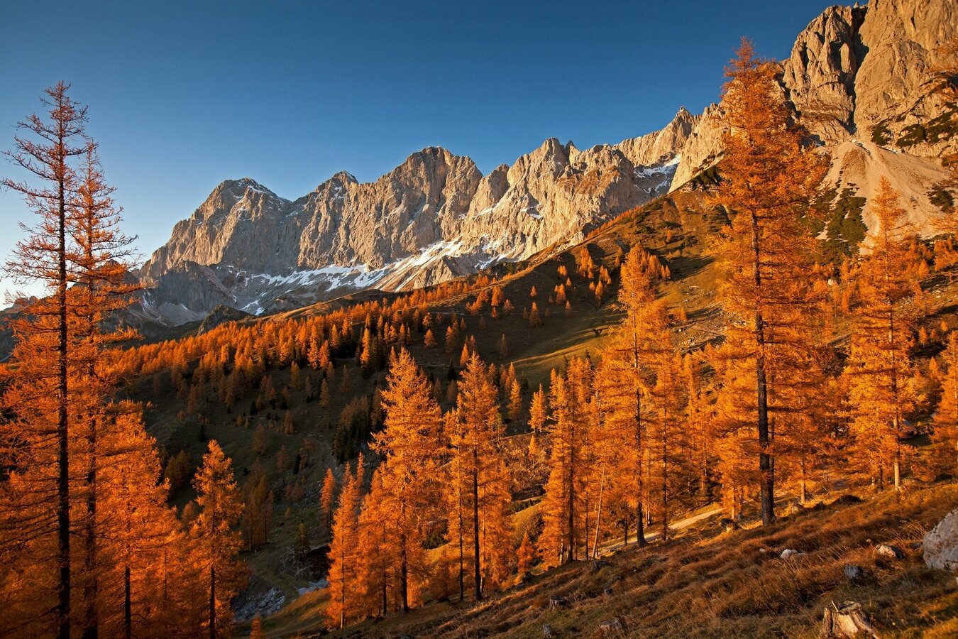
The Ramsau alpine pasture area stretches between the Brandriedel in the east and the Rötelstein in the west with a wonderful view and photo point at the Brandriedel. Magnificent view over the Ramsau Plateau and the Schladminger Tauern. The Brandriedel inspired the Viennese writer Kurt Maix for his flashback to Ramsau's past. Here he wrote, as he himself said "...lying in the alpine meadow on the Brandriedel..." the story of the mountaineering personalities under the spell of the Dachstein south face.
The special thing about this landscape is the immediate transition from the green alpine pastures into the rubble cirques of the southern walls. Light larch forests and alpine meadows are overlooked by the bright, 4 km wide and almost 1,000 meter high Dachstein south walls. Alpine huts, horses, cattle and sheep enliven this area.
Galeria obrazów
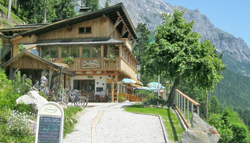


From the Edelbrunn-Roseggersteig hiking trail head, you first hike up a wide forest path to the right of the Edelbrunn inn. At the crossroads in the forest you keep left and continue to follow the path, which eventually becomes narrower and leads you through an - often dry - river bed. The path now becomes steeper and takes you through the forest up to Brandriedel. In the last few meters a steel staircase helps you up the steep slope - and the spectacular view of the Dachstein south walls opens up in front of you.
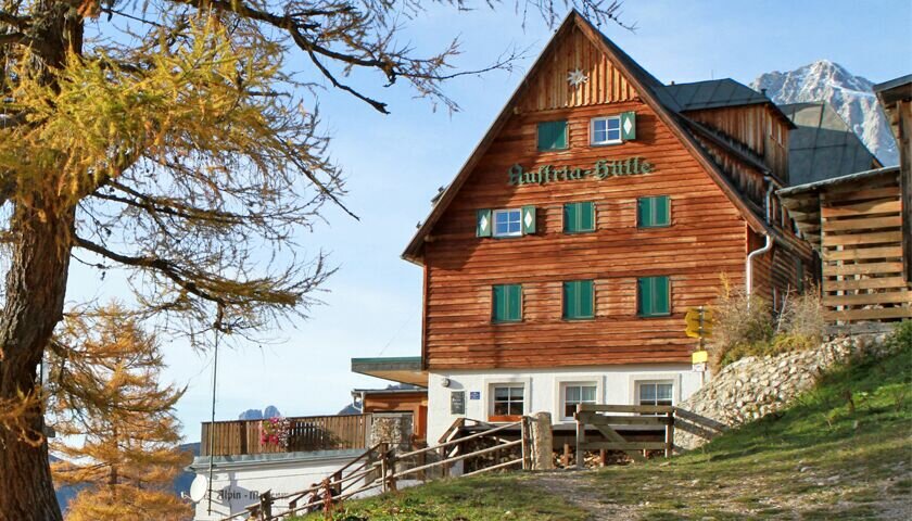
From here you hike slightly downhill through the light larch forest to the Austriahütte. There you have the choice of whether you descend back to your starting point via the Brandalm and path #615 to Dachsteinhaus and Edelbrunn, or hike further up to the Hotel Türlwand and the Gasthof Hunerkogel, from where you can take the bus back to Ramsau.
From the west: Tauern Autobahn (A 10) to Knoten Ennstal - turnoff direction Graz/Schladming - stay on the Ennstal-Bundesstraße (B320) for approx. 20 km until Schladming - take the turnoff for Ramsau.
From the north: Pyhrn Autobahn (A 9) direction Liezen - take the Ennstal-Bundesstraße (B320) to Schladming - turnoff Ramsau.
Drive up to Ramsau and through the village until you reach the turn-off "Edelbrunn" to your right-hand side. Drive up the road to the parking lot.
With the bus of "Ramsauer Verkehrsbetriebe" from Schladming train station to Ramsau. Exit at bus stop "Langegasse". From there it is a 10-minute walk up to the starting point. See the timetables HERE
Changes in weather patterns, quick falls in temperature, thunderstorms, wind, fog and snow are some of the dangers that can be encountered on a hiking tour. Hosts of alpine huts and mountain refuges have a lot of experience in the mountains and can give good advice about weather and the trails. Poor equipment, overestimation of one's own capabilities, carelessness, poor personal constitution and/or wrong judgement can lead to critical situations. In case of thunderstorms: avoid summits, ridges and steel ropes.
GPS data and orienteering
Available GPS data - just like hiking maps - is only a guidance for orientation and can never depict a trail exactly with all its details. Especially at dangerous spots it is essential to judge on site how to proceed.
In an emergency please call:
- 140 - for Alpine emergencies (all over Austria)
- 112 - European GSM emergency number
A well-packed backpack is helpful and especially when touring Alpine terrain a tuque, gloves, a windproof jacket and pants are standard equipment. Good, waterproof shoes, sun glasses, sun cream and sufficient beverages are essential too. Torch light, a map of the area, knie and a small first-aid kit should also be in the backpack.
Especially in autumn, the Brandriedel in the gold of the larches is an incomparable place.
Hiking map Schladming-Dachstein, 1:50,000, available in the information offices
Hiking guide Schladming-Dachstein by Herbert Raffalt (available only in German), available in the information offices


