Hiking and chalet experience Halserberg-Rittisberg
partially opened Hiking · Schladming
Charakterystyka wycieczki
Warunek
Technika
Przygoda
Krajobraz
Informacje o wycieczce
Trasa: 11.67 km
Okres obowiązywania: 4 h
Wejście: 454 m
Zejście: 455 m
Najlepsza pora roku
Styczeń
Luty
Marzec
Kwiecień
Maj
Czerwiec
Lipiec
Sierpień
Wrzesień
Październik
Listopad
Grudzień
Wycieczka
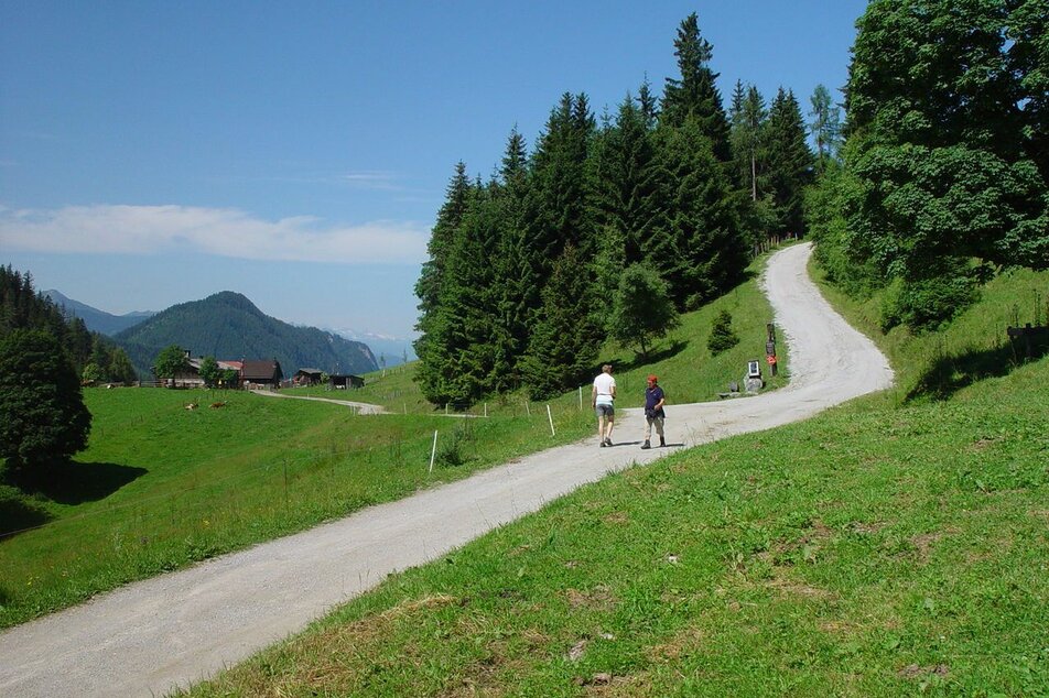
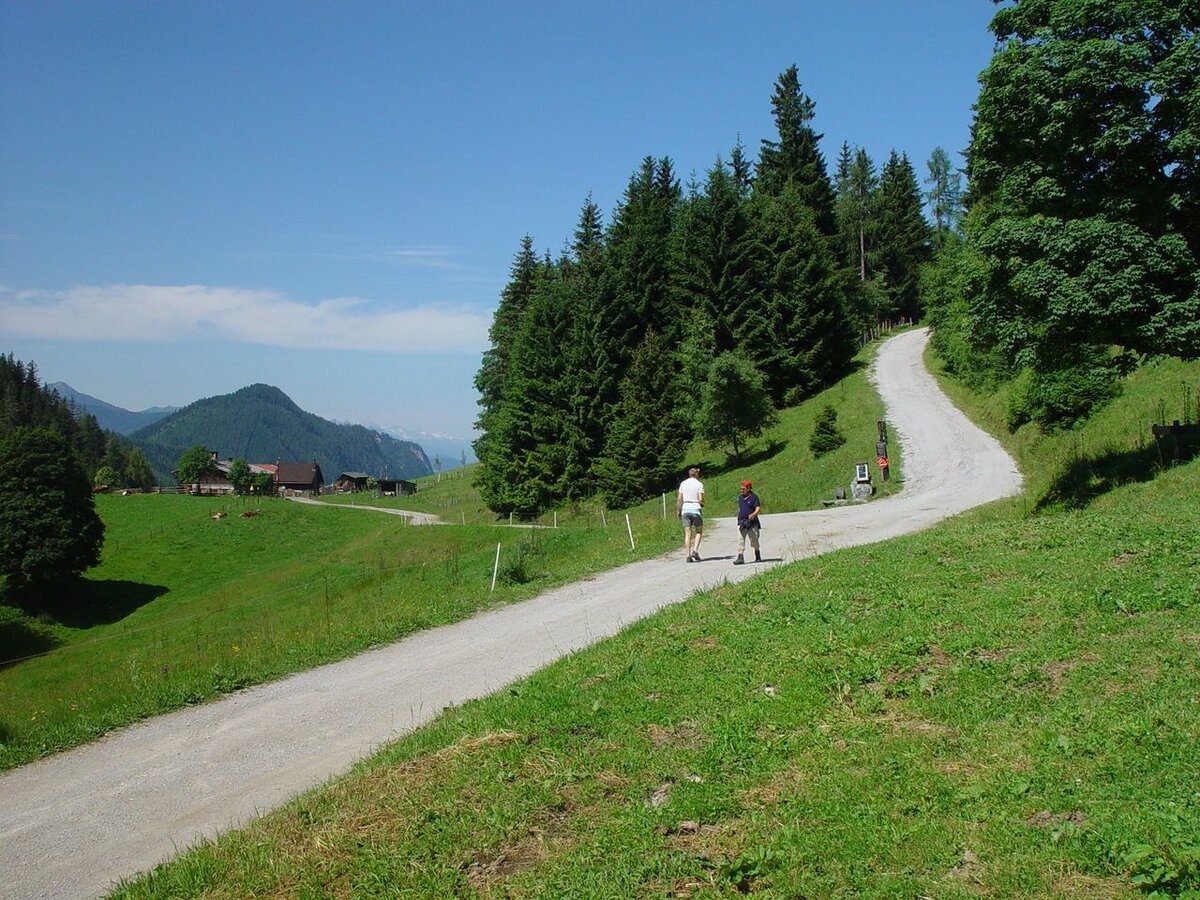
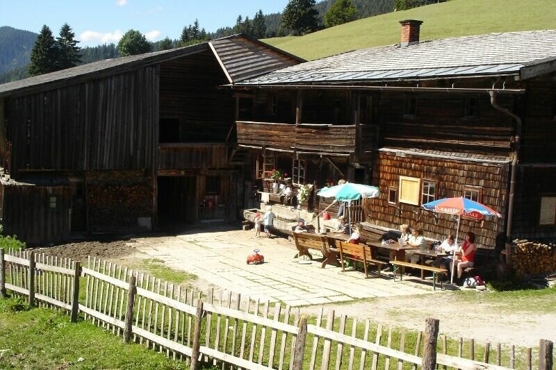
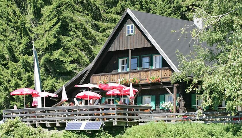
Rittisberg and Halserberg are two of the most wooded hiking areas in front of the south face of the Dachstein. The trail is also suitable for prams (the section from Sonnenalm to Ochsenalm Inn is a bit more difficult, but is also possible with pram). The comfortable huts Halseralm, Sonnenalm and Ochsenalm offer tasty delicacies of the region. The flambéed Kaiserschmarren, the free-range animals to pet, the huge children's playground, where children can climb, jump, drive with a go-kart, … and the nature hunters trail are an experience for all ages!
Galeria obrazów


Dalsze informacje
Opis drogi
From the hiking trail head Vorberg-Arnika follow the forestry road to the North. After a couple of minutes walk through the forest you reach a trail junction where you make a left towards the chalets and inns. The trail now runs along the edge of the forest to the inns. At first you reach Halseralm Inn, shortly after Sonnenalm Inn, and finally Ochsenalm Inn. Also walkable when the weather is bad.
Alternative route for the way back:
This hike can be extended at will, for example across the Höhenweg to the Rittisstadel (not suitable for prams).
Przyjazd
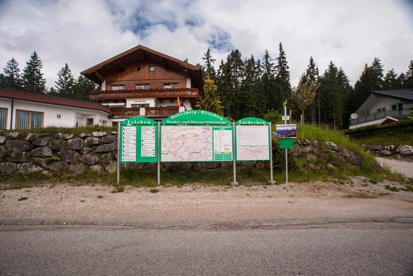
Exit from federal highway B320 at Pichl (approximately 4 kms West of Schladming) and continue towards Vorberg. Pass by Hotel Steirerhof and continue to Pension Arnika, where the hiking trail head Vorberg-Arnika is located.
Buses of Ramsauer Verkehrsbetriebe: www.rvb.at
Parkowanie
Parking is available at the hiking trail head Vorberg-Arnika.
Start
Hiking trail head Vorberg-Arnika
Cel
Halseralm, Sonnenalm or Ochsenalm
Bezpieczeństwo
Changes in weather patterns, quick falls in temperature, thunderstorms, wind, fog and snow are some of the dangers that can be encountered on a hiking tour. Hosts of alpine huts and mountain refuges have a lot of experience in the mountains and can give good advice about weather and the trails. Poor equipment, overestimation of one's own capabilities, carelessness, poor personal constitution and/or wrong judgement can lead to critical situations. In case of thunderstorms: avoid summits, ridges and steel ropes.
GPS data and orienteering
Available GPS data - just like hiking maps - is only a guidance for orientation and can never depict a trail exactly with all its details. Especially at dangerous spots it is essential to judge on site how to proceed.
In an emergency please call:
- 140 - for Alpine emergencies (all over Austria)
- 112 - European GSM emergency number
Equipment
Changes in weather patterns, quick falls in temperature, thunderstorms, wind, fog and snow are some of the dangers that can be encountered on a hiking tour. Hosts of alpine huts and mountain refuges have a lot of experience in the mountains and can give good advice about weather and the trails. Poor equipment, overestimation of one's own capabilities, carelessness, poor personal constitution and/or wrong judgement can lead to critical situations. In case of thunderstorms: avoid summits, ridges and steel ropes.
GPS data and orienteering
Available GPS data - just like hiking maps - is only a guidance for orientation and can never depict a trail exactly with all its details. Especially at dangerous spots it is essential to judge on site how to proceed.
In an emergency please call:
- 140 - for Alpine emergencies (all over Austria)
- 112 - European GSM emergency number
Wskazówki autorów
Jägersteig and Sonnenalm Panorama Trail start at Sonnenalm Inn. The nature trail invites kids to play and explore.
Dalsze informacje i linki
Tourist information: www.schladming.com
Information about bus schedules: www.rvb.at
- Hiking map Schladming, 1:25.000, available at the tourist office Schladming.
- Hiking map Schladming-Dachstein, 1:50.000, available at the tourist office Schladming.
- Tourist map "Hiking - Running - Walking", available at the tourist office Schladming.
To też może Cię zainteresować


Prognoza pogody
Wybierz datę
Early clouds will clear to leave the region with a dry and sunny day.
Dry and partly sunny throughout the day, with cloudy periods from time to time.
Fair or bright in the beginning, cloudy towards the end of the day.


