Hiking to the Lärchbodenalm
łatwe Family hikes · Ramsau am Dachstein
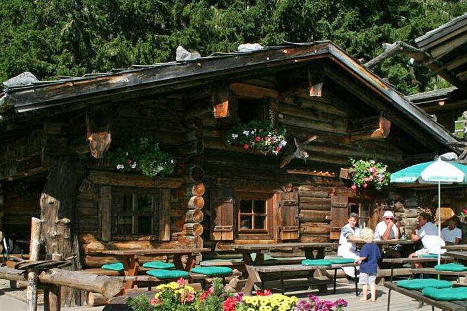
A beautiful, relatively short hike to the Lärchbodenalm at 1,440 m above sea level. At the beginning mostly through the forest, the Lärchbodenalm itself lies in the middle of a forest clearing with beautiful alpine meadows, lined with larches and mountain pines. The alpine hut offers regional delicacies and products from our own farm.
Galeria obrazów
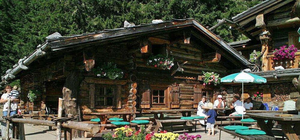


This easy hike takes you along the alpine path to the Lärchbodenalm. From the car park you go uphill in a northerly direction, past the Hotel Feistererhof and along the Feistererbach. After one kilometer you cross the Bachgraben at a (usually dry) ford. A few meters further on you keep left on the forest path and hike past the "Kalkbründl" and continue uphill. After four hairpin bends in quick succession, you will already reach the green alpine meadows on the Lärchboden. You follow the path to the upper end of the meadow and turn right there to the rustic Lärchbodenalm.
From west:
Tauernautobahn A 10 to the Ennstal junction - exit in the direction of Graz/Schladming - around 20 km on the Ennstal federal road to Schladming - Schladming Mitte exit. From here continue to Ramsau am Dachstein on the Ramsau Plateau and about 1 km after Ramsau Kulm turn right onto Rössingstraße. After a few hundred meters, turn left towards Feistererhof and follow the road to the car park.
From North and East:
Pyhrnautobahn in the direction of Liezen Ennstalbundesstraße to Schladming - exit Schladming Mitte. From here continue to Ramsau am Dachstein on the Ramsau Plateau and about 1 km after Ramsau Kulm turn right onto Rössingstraße. After a few hundred meters, turn left towards Feistererhof and follow the road to the car park.
Arrival by bus (No. 962) to the Berghof stop/Feisterer junction. The ascent to the starting point takes about 10 minutes on foot from there.
- Ramsauer Verkehrsbetriebe timetables at www.rvb.at
Feistererhof trailhead car park
Changes in weather patterns, quick falls in temperature, thunderstorms, wind, fog and snow are some of the dangers that can be encountered on a hiking tour. Hosts of alpine huts and mountain refuges have a lot of experience in the mountains and can give good advice about weather and the trails. Poor equipment, overestimation of one's own capabilities, carelessness, poor personal constitution and/or wrong judgement can lead to critical situations. In case of thunderstorms: avoid summits, ridges and steel ropes.
GPS data and orienteering
Available GPS data - just like hiking maps - is only a guidance for orientation and can never depict a trail exactly with all its details. Especially at dangerous spots it is essential to judge on site how to proceed.
In an emergency please call:
- 140 - for Alpine emergencies (all over Austria)
- 112 - European GSM emergency number
Hiking equipment, Light hiking boots
From the hut you can take a circular route to visit the mountain chapel and the so called "Place of Dimensions". From there, a forest path leads back to the starting point.
- Hiking map Schladming-Dachstein, 1:50,000, available in the information offices.
- Tourist map Schladming-Dachstein "WEST", available in the information offices.
Hiking guide Schladming-Dachstein by Herbert Raffalt (available only in German), available in the information offices.


