
Friedenskircherl at Stoderzinken
eenvoudig Hiking · Gröbminger Land
DANGER! There is already a lot of snow on the way to Friedenskircherl (No. 676a). There is a risk of slipping and therefore falling.
The railings that are present in summer are dismantled by mountain rescue in winter due to the risk of avalanches.
A tour to the Kircherl is expressly NOT recommended! There is a risk of falling and thus mortal danger!
Even the ascent on the Stoderzinken Alpenstraße is an experience. Especially in the last third, where the road hugs the rocks and leads to the starting point. During the short hike from the Rosemi Alm to the Alpengasthof Steiner, we get our first glimpse of the Dachstein Glacier high above the forest. A beautiful, narrow path leads directly along the rocks to the chapel, which sits enthroned on the summit like an eagle's nest and offers a wonderful view over the Ennstal and to Gröbming and Aich-Assach.
Fotogalerij
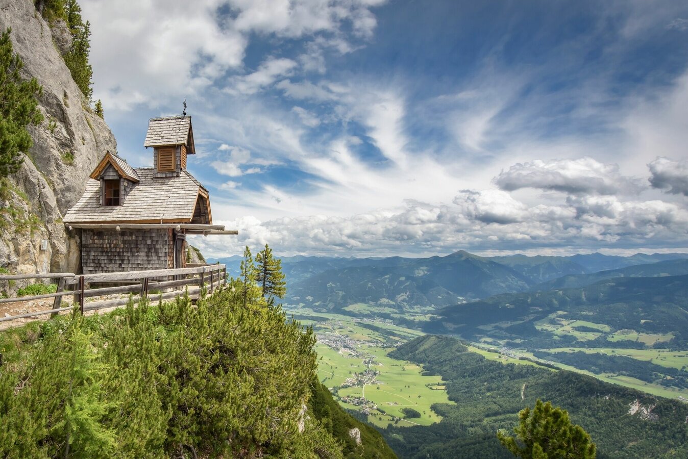
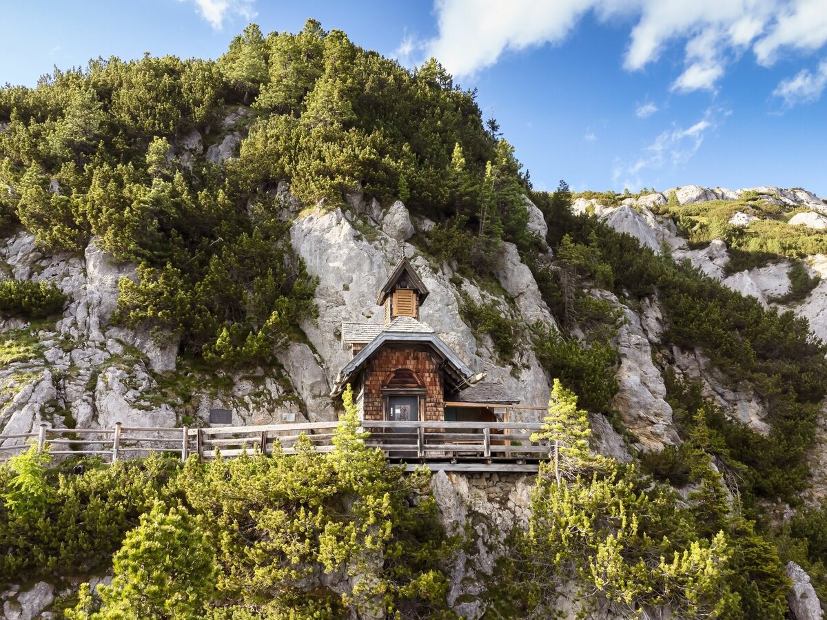
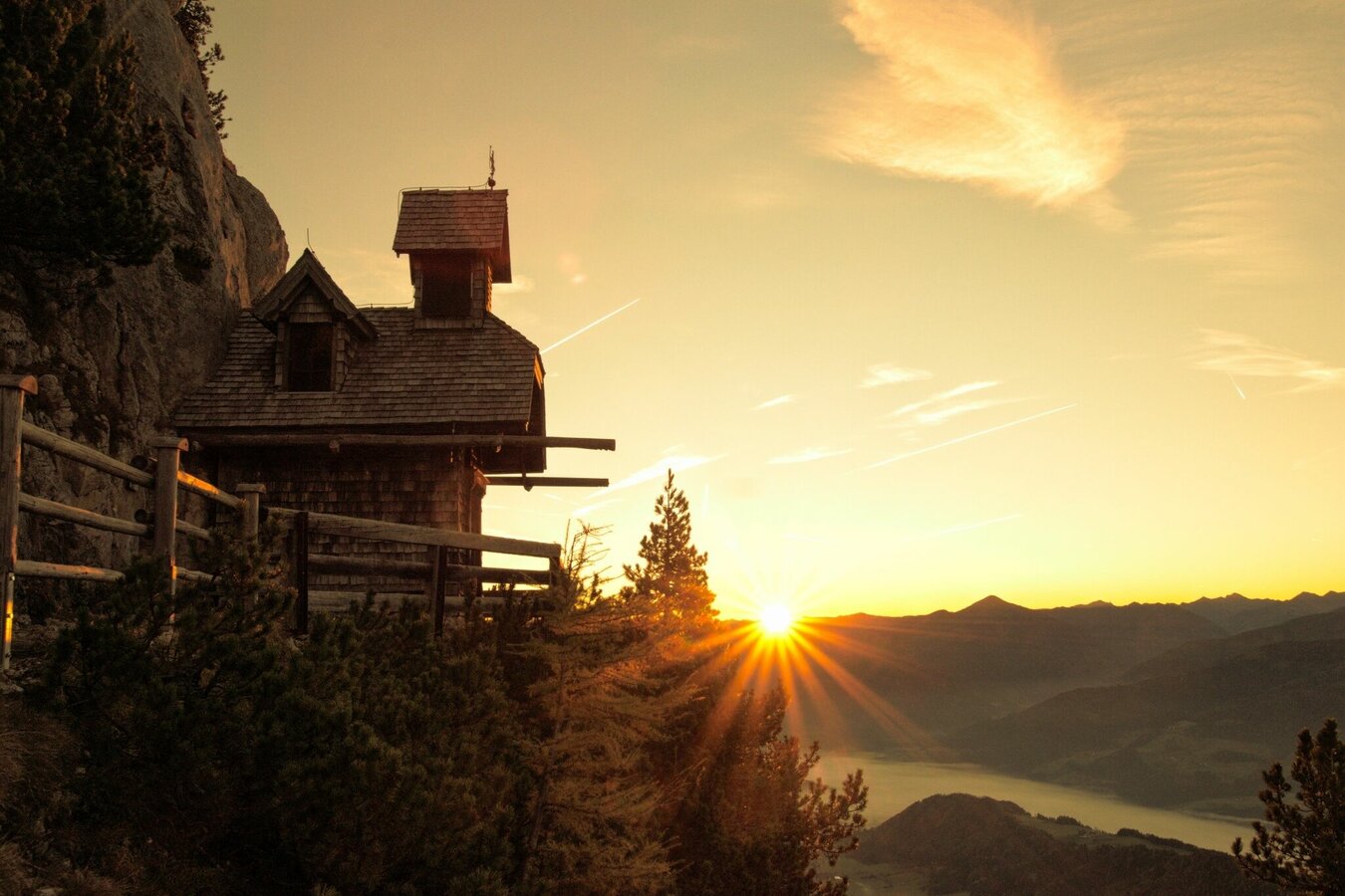


At the crossroads next to the Stoderhütte, the trail branches off to the summit and to the Friedenskirchlein, which can be reached in about 20 minutes. Narrow and close to the rock, this beautiful path leads to the little church, which hangs in the rocks like an eagle's nest and offers a magnificent view. Built in memory of the pioneer of the Stoderzinken, Emil Ritter von Horstig, it has now become a much-visited vantage point.
Exit the B320 Ennstalbundesstraße in Gröbming. Follow the signs towards the Stoderzinken Alpenstrasse. From the Adventure Park/Gröbminger Alm, the Stoderzinkenstraße is a toll road.
From July 8th to September 10th, 2023 it is possible to drive up with the Stoderzinken bus shuttle.
More information: Stoder bus shuttle | Information from A-Z | Schladming-Dachstein
Car parking of Stoderzinken toll road:
- Car park at trail head Rosemi Alm
- Car park at trail head Christophorus
The path to the Friedenskircherl leads over gravelly limestone and is somewhat exposed in parts, with railings installed at the steepest points in summer.
Changes in weather patterns, quick falls in temperature, thunderstorms, wind, fog and snow are some of the dangers that can be encountered on a hiking tour. Hosts of alpine huts and mountain refuges have a lot of experience in the mountains and can give good advice about weather and the trails. Poor equipment, overestimation of one's own capabilities, carelessness, poor personal constitution and/or wrong judgement can lead to critical situations. In case of thunderstorms: avoid summits, ridges and steel ropes.
GPS data and orienteering
Available GPS data - just like hiking maps - is only a guidance for orientation and can never depict a trail exactly with all its details. Especially at dangerous spots it is essential to judge on site how to proceed.
In an emergency please call:
- 140 - for Alpine emergencies (all over Austria)
- 112 - European GSM emergency number
- Sturdy shoes with treaded soles
- walking sticks
Tour at your own risk! No liability whatsoever is assumed with regard to any given or occurring alpine hazards (weather, etc.).
Schladming-Dachstein summer leisure card "Mitte", available in the information offices of the Schladming-Dachstein region


