---
id: 5825
title: Oberhüttenlake Tour | SW 12
path: /en/activities/tours/Oberh-C3-BCttenlake-Tour-7C-SW-12_tour_5825
url: "https://www.schladming-dachstein.at/en/activities/tours/Oberh-C3-BCttenlake-Tour-7C-SW-12_tour_5825"
language: en
generated_at: "2026-11-22T00:05:14+01:00"
type: object
class: App\Model\DataObject\Tour
---
back Oberhüttenlake Tour | SW 12
=============================
Mountainbike tour
Overview
Data:
[GPX](https://tirol.mapservices.eu/nefos_app/api/gpx/el_oD9BiM7lvDWLMtVl/en/generate/121375499)
[Elevation profile](https://tirol.mapservices.eu/nefos_app/api/altitudeprofile/el_oD9BiM7lvDWLMtVl/en/121375499/800/200)
Print
[](https://dqq9mwzzr5k9i.cloudfront.net/general-solutions/tours/Oberh%C3%BCttensee%20Tour%20-%2025/169674/image-thumb__169674__lightbox/bike_neustattalmen_025clorenz_masser_19072024-08.d4ad270f.jpg) copyright: Lorenz Masser
[](https://dqq9mwzzr5k9i.cloudfront.net/general-solutions/tours/Oberh%C3%BCttensee%20Tour%20-%2025/169675/image-thumb__169675__lightbox/image_930210985.646ffdb4.jpg)
[show gallery](https://dqq9mwzzr5k9i.cloudfront.net/general-solutions/tours/Oberh%C3%BCttensee%20Tour%20-%2025/bike_neustattalmen_025clorenz_masser_19072024-08.jpg)
Tour description
This varied tour leads through idyllic alpine landscapes up into high alpine terrain. While the first part is still quite relaxed, the final climb to the Oberhütte becomes noticeably more challenging.
At the top, the Oberhüttensee awaits – a true natural gem – along with a cozy place to stop for a break, perfect for recharging before the descent.
The tour originally comes from our colleagues in SalzburgerLand – further information can be found at the following link: Variant Oberhütte (SW 12).
The tour
moderate
Starting pointForstau
DestinationOberhütte on the lake
Tour characteristics Distance: 29.5 km
Fitness (3/6)
Skills (3/6)
InformationDistance: 29.5 km
Duration: 3:50 h
Ascent: 981 m
Descent: 978 m
highest point: 1866 m
Best seasonJan
Feb
Mar
Apr
May
Jun
Jul
Aug
Sep
Oct
Nov
Dec
Map, elevation profile & further information
--------------------------------------------------
- Tour description
- Arrival & parking
- Public transport
- Equipment
- Tips & links
Start in the center of Forstau and head south towards Forstau-Winkl. First ride about 4 km on asphalt, then switch to a gravel road and follow it steadily uphill for around 7 km to the Fallhausalm or Vögeialm.
From the alpine huts, the steep and challenging final climb begins on the mountain road to the Oberhütte and further up to the Oberhüttensee (1,860 m).
Return along the same route back to Forstau – take care on the steeper sections during the descent.
read more
**From Salzburg,** take the B150 and B160 to the A10 Tauern motorway towards Graz/Villach. Exit at 63 Altenmarkt onto the B320/E651, then continue on the B99 towards Radstadt, and from there take Forstauer Straße directly to the center of Forstau.
**From Graz**, take the B67 and A9/E57 towards Salzburg and exit onto the B320 at Selzthal. Follow the B320 via Liezen and Schladming, then continue on the L721 and further on the L223 towards Forstau. In the village, follow the final turns to reach the center of Forstau.
[Google Link](https://maps.app.goo.gl/ji1QuWF3azGVkyyb7)
read more
**From Graz**, take the Railjet (RJ) to Bruck an der Mur, then continue with the regional train R9 via Radstadt to Radstadt station. From there, walk to the nearby bus stop and take bus line 517 (towards Forstau Mehrzweckhalle) to the final stop, then it’s just a short walk to the center of Forstau.
**From Salzburg,** take the ICE 119 to Bischofshofen, then continue with the InterRegio (IR) to Radstadt station. From there, go to the bus stop and take bus line 517 towards Forstau Mehrzweckhalle to the final stop, then walk a few minutes to the center of Forstau.
[ÖBB timetable information](https://fahrplan.oebb.at/webapp/#!P%7CTP!H%7C544588)
read more
Weather in the mountains can change quickly – thunderstorms, wind, fog or sudden drops in temperature are serious risks. Plan your tour realistically and don’t underestimate these dangers. Hut hosts are happy to give you up-to-date advice.
- In case of thunderstorms: avoid summits, exposed ridges, trees and fixed cables.
**Emergency numbers:**
140 mountain rescue
112 European emergency number
- Recommended equipment: helmet, suitable clothing, sturdy shoes, weather protection and enough water.
read more
Places to stop for refreshments are available at the [Winklhütte](https://www.winklhuette.at/de/), Fallhausalm, [Vögeialm](http://www.voegeialm.at/02_home/home.html), or at the [Oberhütte](https://www.oberhuette.at/).
For further information:
**Tourismusverband Forstau**
Ort 111
A-5552 Forstau
- [+43-(0)6454-8325](tel:+4364548325)
-
- [Website](https://www.forstau.at/)
read more
[Fullscreen](https://maps.schladming-dachstein.at/v2/en/gdi_winter/2d/-1/detail/-1/-1/-1/4413/121375499)
Wheather predicition
----------------------
[Source: https://www.geosphere.at/de](https://www.geosphere.at/)
Tours nearby
--------------
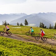 moderate
copyright: Coen Weesjes
25.8 km
3:15 h
Filzmoos-Rossbrand Tour |SW 01
Mountainbike tour
[to tour](https://www.schladming-dachstein.at/en/activities/tours/Filzmoos-Rossbrand-Tour-7CSW-01_tour_117572)
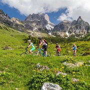 moderate
copyright: Coen Weesjes
10.1 km
Hütten-Rallye Filzmoos | SW 05
Mountainbike tour
[to tour](https://www.schladming-dachstein.at/en/activities/tours/H-C3-BCtten-Rallye-Filzmoos-7C-SW-05_tour_117633)
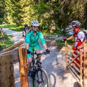 easy
copyright: Coen Weesjes
9.5 km
1:00 h
Schnitzberg Route | SW 02
Mountainbike tour
[to tour](https://www.schladming-dachstein.at/en/activities/tours/Schnitzberg-Route-7C-SW-02_tour_117625)
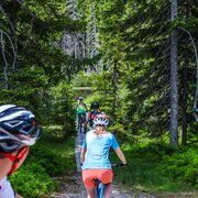 moderate
copyright: Coen Weesjes
14.5 km
1:45 h
Sattei Route | SW 04
Mountainbike tour
[to tour](https://www.schladming-dachstein.at/en/activities/tours/Sattei-Route-7C-SW-04_tour_117626)
 moderate
copyright: Lorenz Masser
26.1 km
3:40 h
Fageralm Tour | SW 15
Mountainbike tour
[to tour](https://www.schladming-dachstein.at/en/activities/tours/Fageralm-Tour-7C-SW-15_tour_117489)
 difficult
copyright: Schladming Dachstein
30.4 km
4:00 h
Radstadt-Roßbrand Tour | SW 13
Mountainbike tour
[to tour](https://www.schladming-dachstein.at/en/activities/tours/Radstadt-Ro-C3-9Fbrand-Tour-7C-SW-13_tour_5802)